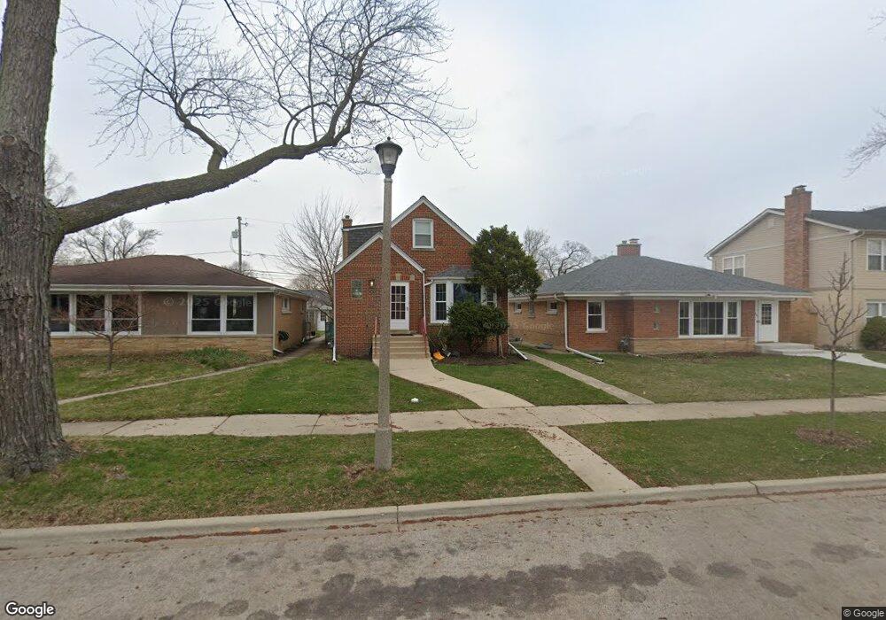
5018 Birchwood Ave Skokie, IL 60077
Southwest Skokie NeighborhoodEstimated Value: $363,000 - $487,000
4
Beds
2
Baths
1,047
Sq Ft
$408/Sq Ft
Est. Value
About This Home
This home is located at 5018 Birchwood Ave, Skokie, IL 60077 and is currently estimated at $427,143, approximately $407 per square foot. 5018 Birchwood Ave is a home located in Cook County with nearby schools including Fairview South Elementary School, Niles West High School, and Cheder Lubavitch Hebrew Day School.
Ownership History
Date
Name
Owned For
Owner Type
Purchase Details
Closed on
Oct 21, 2009
Sold by
Chicago Title Land Trust Company
Bought by
Schneider Mark and Campbell Mary Elizabeth
Current Estimated Value
Home Financials for this Owner
Home Financials are based on the most recent Mortgage that was taken out on this home.
Original Mortgage
$270,655
Outstanding Balance
$177,004
Interest Rate
5.11%
Mortgage Type
FHA
Estimated Equity
$250,139
Create a Home Valuation Report for This Property
The Home Valuation Report is an in-depth analysis detailing your home's value as well as a comparison with similar homes in the area
Home Values in the Area
Average Home Value in this Area
Purchase History
| Date | Buyer | Sale Price | Title Company |
|---|---|---|---|
| Schneider Mark | $286,000 | Chicago Title Land Trust Co |
Source: Public Records
Mortgage History
| Date | Status | Borrower | Loan Amount |
|---|---|---|---|
| Open | Schneider Mark | $270,655 |
Source: Public Records
Tax History Compared to Growth
Tax History
| Year | Tax Paid | Tax Assessment Tax Assessment Total Assessment is a certain percentage of the fair market value that is determined by local assessors to be the total taxable value of land and additions on the property. | Land | Improvement |
|---|---|---|---|---|
| 2024 | $7,102 | $28,212 | $5,524 | $22,688 |
| 2023 | $6,849 | $36,000 | $5,524 | $30,476 |
| 2022 | $6,849 | $36,000 | $5,524 | $30,476 |
| 2021 | $5,330 | $26,543 | $3,887 | $22,656 |
| 2020 | $5,808 | $26,543 | $3,887 | $22,656 |
| 2019 | $5,919 | $29,493 | $3,887 | $25,606 |
| 2018 | $5,318 | $24,480 | $3,375 | $21,105 |
| 2017 | $5,384 | $24,480 | $3,375 | $21,105 |
| 2016 | $5,324 | $24,480 | $3,375 | $21,105 |
| 2015 | $4,574 | $20,143 | $2,864 | $17,279 |
| 2014 | $4,435 | $20,143 | $2,864 | $17,279 |
| 2013 | $4,489 | $20,143 | $2,864 | $17,279 |
Source: Public Records
Map
Nearby Homes
- 5037 Fargo Ave
- 4944 Jarvis Ave
- 4838 Howard St Unit 301
- 4931 Brummel St
- 7500 Laramie Ave
- 5153 Dobson St
- 7507 Frontage Rd
- 4858 W Chase Ave
- 4757 Howard St Unit 205B
- 7748 Lincoln Ave
- 7601 Skokie Blvd Unit 511
- 4907 Hull St
- 7848 Lincoln Ave
- 4634 Jerome Ave
- 4906 Hull St
- 4817 Hull St Unit 2B
- 4856 Hull St
- 7638 Knox Ave
- 7241 N Kilpatrick Ave
- 5261 Mulford St
- 5024 Birchwood Ave
- 5010 Birchwood Ave
- 5030 Birchwood Ave
- 5030 Birchwood Ave
- 5015 Jerome Ave
- 5025 Jerome Ave
- 5013 Jerome Ave
- 7500 Lavergne Ave
- 7500 Lavergne Ave
- 5013 Jerome St N
- 5009 Jerome Ave
- 5034 Birchwood Ave
- 5017 Birchwood Ave
- 5031 Jerome Ave
- 5031 Jerome Ave
- 5021 Birchwood Ave
- 5013 Birchwood Ave
- 5027 Birchwood Ave
- 5009 Birchwood Ave
- 7524 Lavergne Ave