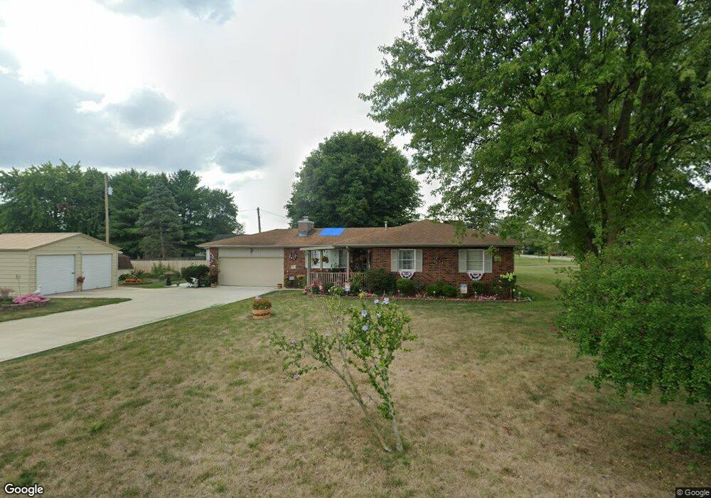
5019 N Union St N South Bloomfield, OH 43103
Estimated Value: $236,000 - $287,000
3
Beds
2
Baths
1,732
Sq Ft
$157/Sq Ft
Est. Value
About This Home
This home is located at 5019 N Union St N, South Bloomfield, OH 43103 and is currently estimated at $272,146, approximately $157 per square foot. 5019 N Union St N is a home located in Pickaway County.
Ownership History
Date
Name
Owned For
Owner Type
Purchase Details
Closed on
Aug 5, 2020
Sold by
Humble Robert S and Humble Judy K
Bought by
Humble Robert S and Humble Judy K
Current Estimated Value
Purchase Details
Closed on
Oct 28, 1996
Sold by
Carter Alton R
Bought by
Humble Robert S and Humble Judy K
Home Financials for this Owner
Home Financials are based on the most recent Mortgage that was taken out on this home.
Original Mortgage
$62,500
Interest Rate
8.32%
Mortgage Type
New Conventional
Create a Home Valuation Report for This Property
The Home Valuation Report is an in-depth analysis detailing your home's value as well as a comparison with similar homes in the area
Home Values in the Area
Average Home Value in this Area
Purchase History
| Date | Buyer | Sale Price | Title Company |
|---|---|---|---|
| Humble Robert S | -- | None Available | |
| Humble Robert S | $98,500 | -- |
Source: Public Records
Mortgage History
| Date | Status | Borrower | Loan Amount |
|---|---|---|---|
| Closed | Humble Robert S | $62,500 |
Source: Public Records
Tax History Compared to Growth
Tax History
| Year | Tax Paid | Tax Assessment Tax Assessment Total Assessment is a certain percentage of the fair market value that is determined by local assessors to be the total taxable value of land and additions on the property. | Land | Improvement |
|---|---|---|---|---|
| 2024 | -- | $77,000 | $9,710 | $67,290 |
| 2023 | $2,955 | $77,000 | $9,710 | $67,290 |
| 2022 | $2,387 | $57,300 | $8,090 | $49,210 |
| 2021 | $2,261 | $57,300 | $8,090 | $49,210 |
| 2020 | $2,267 | $57,300 | $8,090 | $49,210 |
| 2019 | $1,916 | $47,180 | $8,090 | $39,090 |
| 2018 | $1,948 | $47,180 | $8,090 | $39,090 |
| 2017 | $1,889 | $44,660 | $8,090 | $36,570 |
| 2016 | $1,830 | $43,080 | $7,990 | $35,090 |
| 2015 | $1,831 | $43,080 | $7,990 | $35,090 |
| 2014 | $1,832 | $43,080 | $7,990 | $35,090 |
| 2013 | $1,896 | $43,080 | $7,990 | $35,090 |
Source: Public Records
Map
Nearby Homes
- 0 U S 23
- 5050 S Walnut St
- The Daffodil Plan at Riverbend at Scioto Landing
- The Daisy Plan at Riverbend at Scioto Landing
- The Avalon Plan at Riverbend at Scioto Landing
- The Aster Plan at Riverbend at Scioto Landing
- 51 Henderson Ln
- 127 Boutot St
- 14337 Us Highway 23
- 14337 Us Highway 23
- Longwood Plan at Walker Pointe
- Birmingham Plan at Walker Pointe
- Sanibel Plan at Walker Pointe
- Carlisle Plan at Walker Pointe
- Somerset Plan at Walker Pointe
- Chattanooga Plan at Walker Pointe
- Rockford Plan at Walker Pointe
- Hoover Plan at Walker Pointe
- Sedona Plan at Walker Pointe
- Truman Plan at Walker Pointe
- 5019 Union St
- 5022 N Union St N
- 5016 N Union St N
- 5022 W North St
- 5046 W Main St
- 5048 W Main St
- 5021 W North St
- 5020 W North St
- 5050 W Main St
- 5024 W North St
- 5038 West St
- 5018 W North St
- 5044 W Main St
- 5025 W North St
- 5016 W Main St
- 5026A W North St Unit B
- 5026 West St
- 5016 W North St
- 5030 W North St
- 5023 W Main St