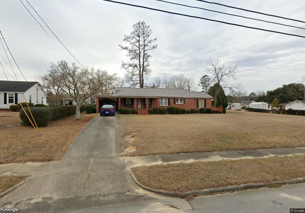
5019 W Louisiana Ave Soperton, GA 30457
Estimated Value: $99,000 - $132,000
--
Bed
2
Baths
1,504
Sq Ft
$76/Sq Ft
Est. Value
About This Home
This home is located at 5019 W Louisiana Ave, Soperton, GA 30457 and is currently estimated at $114,549, approximately $76 per square foot. 5019 W Louisiana Ave is a home located in Treutlen County with nearby schools including Treutlen Elementary School, Treutlen Middle/High School, and Faith Tabernacle Christian Academy.
Ownership History
Date
Name
Owned For
Owner Type
Purchase Details
Closed on
Sep 22, 2022
Sold by
Fowler Royce W
Bought by
Fowler Royce W and Fowler Melva M
Current Estimated Value
Purchase Details
Closed on
Jan 17, 2018
Sold by
Parramore Joy Ricks
Bought by
Fowler Royce W
Purchase Details
Closed on
May 9, 2000
Sold by
Ricks Curtis
Bought by
Parramore Joy Ricks
Purchase Details
Closed on
Jun 20, 1948
Bought by
Ricks Curtis
Create a Home Valuation Report for This Property
The Home Valuation Report is an in-depth analysis detailing your home's value as well as a comparison with similar homes in the area
Home Values in the Area
Average Home Value in this Area
Purchase History
| Date | Buyer | Sale Price | Title Company |
|---|---|---|---|
| Fowler Royce W | -- | -- | |
| Fowler Royce W | $50,000 | -- | |
| Parramore Joy Ricks | -- | -- | |
| Ricks Curtis | -- | -- |
Source: Public Records
Tax History Compared to Growth
Tax History
| Year | Tax Paid | Tax Assessment Tax Assessment Total Assessment is a certain percentage of the fair market value that is determined by local assessors to be the total taxable value of land and additions on the property. | Land | Improvement |
|---|---|---|---|---|
| 2024 | $863 | $27,800 | $2,240 | $25,560 |
| 2023 | $703 | $25,160 | $2,240 | $22,920 |
| 2022 | $626 | $23,200 | $2,240 | $20,960 |
| 2021 | $625 | $23,200 | $2,240 | $20,960 |
| 2020 | $625 | $23,200 | $2,240 | $20,960 |
| 2019 | $538 | $23,200 | $2,240 | $20,960 |
| 2018 | $682 | $23,200 | $2,240 | $20,960 |
| 2017 | $427 | $23,200 | $2,240 | $20,960 |
| 2016 | $420 | $23,200 | $2,240 | $20,960 |
| 2015 | -- | $23,200 | $2,240 | $20,960 |
| 2014 | -- | $23,200 | $2,240 | $20,960 |
| 2013 | -- | $23,200 | $2,240 | $20,960 |
Source: Public Records
Map
Nearby Homes
- 4687 W Main St
- 46 Georgia 46
- 1785 Martin Luther King jr Dr
- 7586 Eastman Rd
- 4004 E Louisiana Ave
- 0 Cedar Grove Rd
- 0 Rivoli Clay Rd
- 00 Rivoli Clay Rd
- 1936 Cedar Grove Rd
- 0 Beasley Hill Place Unit 10640367
- 0 Knox Mill Rd Unit 10640244
- 4281 Ga Highway 46
- 4281 Sr-46
- 0 County Line Rd Unit n/a 113727
- 481 Windmill Way
- 0 Muskogee Trail Unit 25917
- 0 Muskogee Trail Unit LOT 78 20128125
- 95 Railroad Ave
- 0 Lake Helen Loop Unit 10640271
- 2166 Ga Highway 199
- 5001 W Louisiana Ave
- 5051 W Louisiana Ave
- 309 Norman St
- 304 Glenn St
- 307 Norman St
- 5030 W Louisiana Ave
- 5008 W Louisiana Ave
- 4965 W Louisiana Ave
- 5081 W Louisiana Ave
- 5046 W Louisiana Ave
- 305 Glenn St
- 308 Norman St
- 302 Glenn St
- 4988 W Louisiana Ave
- 5066 W Louisiana Ave
- 303 Glenn St
- 5086 W Louisiana Ave
- 306 Norman St
- 0 Norman St Unit 7548976
- 0 Norman St