Estimated Value: $85,000 - $135,000
2
Beds
1
Bath
825
Sq Ft
$133/Sq Ft
Est. Value
About This Home
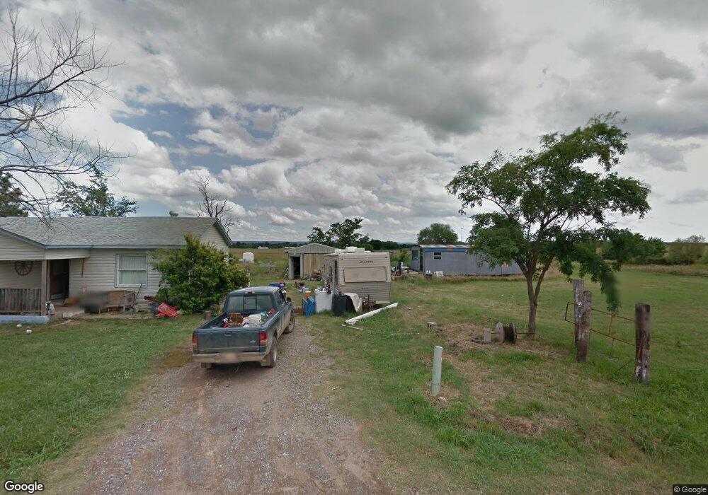
This home is located at 502 Biggers Rd, Kiowa, OK 74553 and is currently estimated at $110,000, approximately $133 per square foot. 502 Biggers Rd is a home with nearby schools including Kiowa High School.
Ownership History
Date
Name
Owned For
Owner Type
Purchase Details
Closed on
Jan 22, 2024
Sold by
Williams Terry Don and Williams Teresa Kaye
Bought by
Williams Terry Don and Williams Teresa Kaye
Current Estimated Value
Purchase Details
Closed on
Mar 11, 2008
Sold by
Greathouse James R and Greathouse Frances L
Bought by
Dibble Vern
Purchase Details
Closed on
Aug 4, 2006
Sold by
Cozad Chris and Cozad Tammy
Bought by
Dibble Vern
Purchase Details
Closed on
Mar 12, 2004
Sold by
Blankenship Anna
Bought by
Cozad Chris
Purchase Details
Closed on
Jun 3, 2003
Sold by
Sheriff'S Sale
Bought by
Blankenship Anna
Create a Home Valuation Report for This Property
The Home Valuation Report is an in-depth analysis detailing your home's value as well as a comparison with similar homes in the area
Home Values in the Area
Average Home Value in this Area
Purchase History
| Date | Buyer | Sale Price | Title Company |
|---|---|---|---|
| Williams Terry Don | -- | None Listed On Document | |
| Smith Glynda Sue | -- | None Listed On Document | |
| Smith Glynda Sue | -- | None Listed On Document | |
| Porter Brenda | -- | None Listed On Document | |
| Porter Brenda | -- | None Listed On Document | |
| Hughes Randy S | -- | None Listed On Document | |
| Hughes Randy S | -- | None Listed On Document | |
| Dibble Vern | $7,500 | None Available | |
| Dibble Vern | $15,000 | None Available | |
| Cozad Chris | $15,000 | -- | |
| Blankenship Anna | $75,000 | -- |
Source: Public Records
Tax History Compared to Growth
Tax History
| Year | Tax Paid | Tax Assessment Tax Assessment Total Assessment is a certain percentage of the fair market value that is determined by local assessors to be the total taxable value of land and additions on the property. | Land | Improvement |
|---|---|---|---|---|
| 2024 | $136 | $1,802 | $440 | $1,362 |
| 2023 | $136 | $1,135 | $440 | $695 |
| 2022 | $81 | $1,081 | $440 | $641 |
| 2021 | $1 | $1,081 | $440 | $641 |
| 2020 | $0 | $980 | $440 | $540 |
| 2019 | $0 | $980 | $440 | $540 |
| 2018 | $0 | $924 | $440 | $484 |
| 2017 | $0 | $897 | $440 | $457 |
| 2016 | -- | $871 | $440 | $431 |
| 2015 | -- | $846 | $440 | $406 |
| 2014 | -- | $846 | $440 | $406 |
Source: Public Records
Map
Nearby Homes
- 6363 S Brewer Rd
- 16379 N Highway 69
- 0 N Highway 69
- 644 S Dewey St
- 31 8th St
- 630 S Oyama St
- 803 S Jackson St
- 1032 Cherry St
- 707 W 9th St
- 18639 S Us Highway 69
- 210 4th St
- 609 First St
- 00 Adele Rd
- 0 Patton Unit 2538586
- 19118 U S 69
- 0 S Brewer Rd Unit 2503451
- 0 S Brewer Rd Unit 2503395
- 303 Chickasaw
- 189 S Brewer Rd
- 9801 N Highway 69