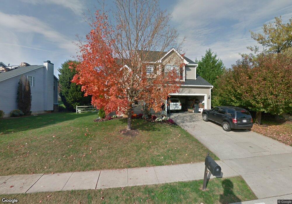
502 Country Ridge Cir Bel Air, MD 21015
Estimated Value: $594,450 - $646,000
--
Bed
3
Baths
2,080
Sq Ft
$299/Sq Ft
Est. Value
About This Home
This home is located at 502 Country Ridge Cir, Bel Air, MD 21015 and is currently estimated at $621,613, approximately $298 per square foot. 502 Country Ridge Cir is a home located in Harford County with nearby schools including Emmorton Elementary School, Bel Air Middle School, and Bel Air High School.
Ownership History
Date
Name
Owned For
Owner Type
Purchase Details
Closed on
Sep 18, 2003
Sold by
Kurumlu Hasan
Bought by
James Nicol and Nicol Lisa
Current Estimated Value
Purchase Details
Closed on
Feb 3, 1999
Sold by
Secretary Of Veterans Affairs The
Bought by
Kurumlu Hasan and Kurumlu Goksen
Purchase Details
Closed on
Oct 5, 1998
Sold by
Hector Nathan Earl
Bought by
Secretary Of Veterans Affairs The
Purchase Details
Closed on
Feb 7, 1995
Sold by
Grp Ryland
Bought by
Hector Nathan E
Home Financials for this Owner
Home Financials are based on the most recent Mortgage that was taken out on this home.
Original Mortgage
$183,498
Interest Rate
9.13%
Create a Home Valuation Report for This Property
The Home Valuation Report is an in-depth analysis detailing your home's value as well as a comparison with similar homes in the area
Home Values in the Area
Average Home Value in this Area
Purchase History
| Date | Buyer | Sale Price | Title Company |
|---|---|---|---|
| James Nicol | $290,000 | -- | |
| Kurumlu Hasan | $185,000 | -- | |
| Secretary Of Veterans Affairs The | $160,446 | -- | |
| Hector Nathan E | $179,949 | -- |
Source: Public Records
Mortgage History
| Date | Status | Borrower | Loan Amount |
|---|---|---|---|
| Previous Owner | Hector Nathan E | $183,498 | |
| Closed | Kurumlu Hasan | -- |
Source: Public Records
Tax History Compared to Growth
Tax History
| Year | Tax Paid | Tax Assessment Tax Assessment Total Assessment is a certain percentage of the fair market value that is determined by local assessors to be the total taxable value of land and additions on the property. | Land | Improvement |
|---|---|---|---|---|
| 2025 | $4,364 | $431,433 | $0 | $0 |
| 2024 | $4,364 | $400,367 | $0 | $0 |
| 2023 | $4,025 | $369,300 | $116,700 | $252,600 |
| 2022 | $3,927 | $360,267 | $0 | $0 |
| 2021 | $3,949 | $351,233 | $0 | $0 |
| 2020 | $3,949 | $342,200 | $116,700 | $225,500 |
| 2019 | $3,906 | $338,433 | $0 | $0 |
| 2018 | $3,827 | $334,667 | $0 | $0 |
| 2017 | $3,784 | $330,900 | $0 | $0 |
| 2016 | $140 | $324,600 | $0 | $0 |
| 2015 | $4,192 | $318,300 | $0 | $0 |
| 2014 | $4,192 | $312,000 | $0 | $0 |
Source: Public Records
Map
Nearby Homes
- 2300 Arthurs Woods Dr
- 402 Tall Sycamore Ct
- 407 Country Ridge Cir
- 2302 Bell's Tower Ct
- Parkland Plan at Bell's Tower - Bell's Tower
- 2310 Bell's Tower Ct Unit 5
- 0 W Wheel Rd Unit MDHR2045912
- 613 Berwick Ct
- 2332 Darby Ct
- 403 Summershade Ct
- 202 Burkwood Ct
- 201 Burkwood Ct Unit 3B
- 300 Lothian Way Unit 202
- 2007 Royal Fern Ct
- 400 Cahill Rd
- 2913 Islay Ct
- 2815 Lanarkshire Way
- 292 Maple Wreath Ct
- 285 Maple Wreath Ct
- 214 Maple Wreath Ct
- 504 Country Ridge Cir
- 2244 Deadora Dr
- 2242 Deadora Dr
- 2240 Deadora Dr
- 506 Country Ridge Cir
- 503 Country Ridge Cir
- 505 Country Ridge Cir
- 503 Spring Guide Ct
- 505 Spring Guide Ct
- 501 Country Ridge Cir
- 507 Country Ridge Cir
- 2238 Deadora Dr
- 501 Spring Guide Ct
- 509 Country Ridge Cir
- 432 Country Ridge Cir
- 2245 Deadora Dr
- 511 Country Ridge Cir
- 507 Spring Guide Ct Unit Y
- 2236 Deadora Dr
- 2243 Deadora Dr