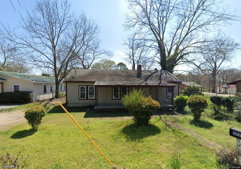
502 de Groat St Lagrange, GA 30241
Estimated Value: $86,000 - $95,000
3
Beds
1
Bath
1,050
Sq Ft
$85/Sq Ft
Est. Value
About This Home
This home is located at 502 de Groat St, Lagrange, GA 30241 and is currently estimated at $88,923, approximately $84 per square foot. 502 de Groat St is a home with nearby schools including Franklin Forest Elementary School, Hollis Hand Elementary School, and Ethel W. Kight Elementary School.
Ownership History
Date
Name
Owned For
Owner Type
Purchase Details
Closed on
May 17, 2011
Sold by
Daniel Flossie C
Bought by
Brown Bessie
Current Estimated Value
Purchase Details
Closed on
Feb 2, 1982
Sold by
Pearl Hester A and Pearl Sheppard
Bought by
Daniel Roosevelt
Purchase Details
Closed on
Jan 1, 1948
Sold by
Mrs R H Parks
Bought by
Pearl Hester A and Pearl Sheppard
Create a Home Valuation Report for This Property
The Home Valuation Report is an in-depth analysis detailing your home's value as well as a comparison with similar homes in the area
Home Values in the Area
Average Home Value in this Area
Purchase History
| Date | Buyer | Sale Price | Title Company |
|---|---|---|---|
| Brown Bessie | -- | -- | |
| Daniel Roosevelt | $15,000 | -- | |
| Pearl Hester A | -- | -- |
Source: Public Records
Tax History Compared to Growth
Tax History
| Year | Tax Paid | Tax Assessment Tax Assessment Total Assessment is a certain percentage of the fair market value that is determined by local assessors to be the total taxable value of land and additions on the property. | Land | Improvement |
|---|---|---|---|---|
| 2024 | -- | $22,440 | $2,280 | $20,160 |
| 2023 | $0 | $18,720 | $2,280 | $16,440 |
| 2022 | $497 | $17,816 | $2,280 | $15,536 |
| 2021 | $515 | $17,080 | $2,280 | $14,800 |
| 2020 | $515 | $17,080 | $2,280 | $14,800 |
| 2019 | $341 | $11,320 | $2,280 | $9,040 |
| 2018 | $0 | $11,320 | $2,280 | $9,040 |
| 2017 | $341 | $11,320 | $2,280 | $9,040 |
| 2016 | -- | $12,088 | $2,305 | $9,784 |
| 2015 | -- | $12,088 | $2,305 | $9,784 |
| 2014 | -- | $11,574 | $2,305 | $9,269 |
| 2013 | -- | $12,174 | $2,305 | $9,869 |
Source: Public Records
Map
Nearby Homes
- 121 de Groat St
- 621 Arthur St
- 131 Foch St
- 600 S Harlem Cir
- 608 S Harlem Cir
- 606 S Harlem Cir
- 616 S Harlem Cir
- 618 S Harlem Cir
- 801 Hines St
- 600,606,608,616 S Harlem
- 902 Georgia Ave
- 706 N Harlem Cir
- 906 Georgia Ave
- 803 1/2 Hines St
- 228 E Render St
- 208 Render St
- LOT 58 Belk St
- 119 Belk St
- LOT 65 Belk St
- LOT 66 Belk St
- 208 Horace King St
- 107 de Groat St
- 104 de Groat Aly
- 103 de Groat St
- 202 Strong St
- 101 de Groat St
- 508-304 304 Degroat St
- 109 de Groat St
- 102 de Groat St
- 108 de Groat St
- 106 de Groat St
- 106 de Groat St Unit 8
- 300 Horace King St
- 302 Front St
- 302 Horace King St
- 604 de Groat St
- 207 Strong St
- 303 Front St
- 211 Horace King St
- 213 Horace King St