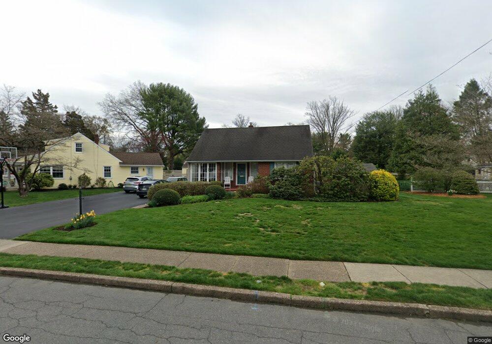
502 Devon Rd Moorestown, NJ 08057
Estimated Value: $557,000 - $662,000
4
Beds
3
Baths
1,811
Sq Ft
$327/Sq Ft
Est. Value
About This Home
This home is located at 502 Devon Rd, Moorestown, NJ 08057 and is currently estimated at $592,780, approximately $327 per square foot. 502 Devon Rd is a home located in Burlington County with nearby schools including George C. Baker Elementary School, Moorestown Upper Elementary School, and William Allen Middle School.
Ownership History
Date
Name
Owned For
Owner Type
Purchase Details
Closed on
Nov 26, 2008
Sold by
Jones Philip P
Bought by
Jones Philip P and Robertson Victoria
Current Estimated Value
Purchase Details
Closed on
Jul 10, 2008
Sold by
Todd Christopher H and Todd Leslie L
Bought by
Jones Philip P
Purchase Details
Closed on
Jul 15, 1994
Sold by
Marshall Donald E and Marshall Helen M
Bought by
Todd Christopher H and Todd Leslie L
Create a Home Valuation Report for This Property
The Home Valuation Report is an in-depth analysis detailing your home's value as well as a comparison with similar homes in the area
Home Values in the Area
Average Home Value in this Area
Purchase History
| Date | Buyer | Sale Price | Title Company |
|---|---|---|---|
| Jones Philip P | $150,000 | None Available | |
| Jones Philip P | $415,000 | Infinity Title Agency Inc | |
| Todd Christopher H | $132,500 | -- |
Source: Public Records
Tax History
| Year | Tax Paid | Tax Assessment Tax Assessment Total Assessment is a certain percentage of the fair market value that is determined by local assessors to be the total taxable value of land and additions on the property. | Land | Improvement |
|---|---|---|---|---|
| 2025 | $7,708 | $271,700 | $123,700 | $148,000 |
| 2024 | $7,474 | $271,700 | $123,700 | $148,000 |
| 2023 | $7,474 | $271,700 | $123,700 | $148,000 |
| 2022 | $7,398 | $271,700 | $123,700 | $148,000 |
| 2021 | $7,083 | $271,700 | $123,700 | $148,000 |
| 2020 | $7,254 | $271,700 | $123,700 | $148,000 |
| 2019 | $7,127 | $271,700 | $123,700 | $148,000 |
| 2018 | $6,934 | $271,700 | $123,700 | $148,000 |
| 2017 | $6,994 | $271,700 | $123,700 | $148,000 |
| 2016 | $6,969 | $271,700 | $123,700 | $148,000 |
| 2015 | $6,885 | $271,700 | $123,700 | $148,000 |
| 2014 | $6,537 | $271,700 | $123,700 | $148,000 |
Source: Public Records
Map
Nearby Homes
- 401 W 3rd St
- 307 Fairview Ave
- 15 Circle Dr
- 543 Bethel Ave
- 444 Shady Ln
- 601 Stratford Dr
- 206 E Camden Ave
- 149 Chalkboard Ct
- 93 Westbrook Dr
- 141 Chalkboard Ct Unit 141
- 15 W Close Unit 15
- 22 E Close Unit 22
- 206 Crider Ave Unit 206
- 21 N Lenola Rd
- 5 Vincent Way
- 27 Domenica Dr
- 11 Errickson Ave
- 8 S Close Unit 8
- 228 Mill St
- 700 Lippincott Ave
- 504 Devon Rd
- 500 Devon Rd
- 505 Covington Terrace
- 506 Devon Rd
- 501 Covington Terrace
- 511 Covington Terrace
- 503 Devon Rd
- 515 Covington Terrace
- 505 Devon Rd
- 501 Devon Rd
- 508 Devon Rd
- 205 Flynn Ave
- 207 Flynn Ave
- 507 Devon Rd
- 203 Flynn Ave
- 209 Flynn Ave
- 519 Covington Terrace
- 509 Devon Rd
- 201 Flynn Ave
- 510 Devon Rd
Your Personal Tour Guide
Ask me questions while you tour the home.