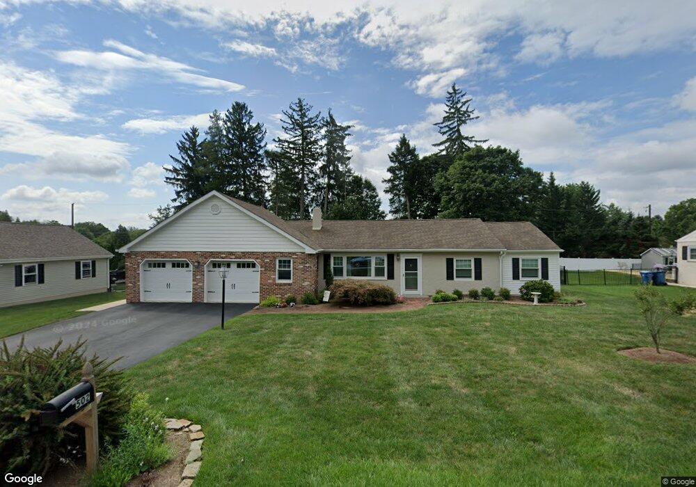
502 Howard Rd West Chester, PA 19380
Estimated Value: $592,174 - $639,000
3
Beds
2
Baths
1,996
Sq Ft
$306/Sq Ft
Est. Value
About This Home
This home is located at 502 Howard Rd, West Chester, PA 19380 and is currently estimated at $610,794, approximately $306 per square foot. 502 Howard Rd is a home located in Chester County with nearby schools including Fern Hill Elementary School, E.N. Peirce Middle School, and Henderson High School.
Ownership History
Date
Name
Owned For
Owner Type
Purchase Details
Closed on
Nov 9, 2007
Sold by
Fetzer James A and Brown Kathleen M
Bought by
Brown Kathleen M
Current Estimated Value
Home Financials for this Owner
Home Financials are based on the most recent Mortgage that was taken out on this home.
Original Mortgage
$160,000
Interest Rate
6.42%
Mortgage Type
New Conventional
Create a Home Valuation Report for This Property
The Home Valuation Report is an in-depth analysis detailing your home's value as well as a comparison with similar homes in the area
Home Values in the Area
Average Home Value in this Area
Purchase History
| Date | Buyer | Sale Price | Title Company |
|---|---|---|---|
| Brown Kathleen M | -- | Manito Title Insurance Compa |
Source: Public Records
Mortgage History
| Date | Status | Borrower | Loan Amount |
|---|---|---|---|
| Closed | Brown Kathleen M | $160,000 |
Source: Public Records
Tax History Compared to Growth
Tax History
| Year | Tax Paid | Tax Assessment Tax Assessment Total Assessment is a certain percentage of the fair market value that is determined by local assessors to be the total taxable value of land and additions on the property. | Land | Improvement |
|---|---|---|---|---|
| 2025 | $4,759 | $164,160 | $46,450 | $117,710 |
| 2024 | $4,759 | $164,160 | $46,450 | $117,710 |
| 2023 | $4,759 | $164,160 | $46,450 | $117,710 |
| 2022 | $4,697 | $164,160 | $46,450 | $117,710 |
| 2021 | $4,631 | $164,160 | $46,450 | $117,710 |
| 2020 | $4,602 | $164,160 | $46,450 | $117,710 |
| 2019 | $4,538 | $164,160 | $46,450 | $117,710 |
| 2018 | $4,441 | $164,160 | $46,450 | $117,710 |
| 2017 | $4,345 | $164,160 | $46,450 | $117,710 |
| 2016 | $3,526 | $164,160 | $46,450 | $117,710 |
| 2015 | $3,526 | $164,160 | $46,450 | $117,710 |
| 2014 | $3,526 | $164,160 | $46,450 | $117,710 |
Source: Public Records
Map
Nearby Homes
- 306 Greenhill Rd
- 1210 Ashbridge Rd
- 1405 Gorky Ln
- 1302 Ashbridge Rd
- 1614 Phillips Dr
- 1708 Frost Ln
- 300 Kirkland Ave Unit AUGUSTA
- 300 Kirkland Ave Unit HAWTHORNE
- 300 Kirkland Ave Unit SAVANNAH
- 300 Kirkland Ave Unit DEVONSHIRE
- Magnolia Plan at The Woodlands at Brandywine
- Savannah Plan at The Woodlands at Brandywine
- Nottingham Plan at The Woodlands at Brandywine
- Covington Plan at The Woodlands at Brandywine
- Hawthorne Plan at The Woodlands at Brandywine
- Kipling Plan at The Woodlands at Brandywine
- Ethan Plan at The Woodlands at Brandywine
- Devonshire Plan at The Woodlands at Brandywine
- Augusta Plan at The Woodlands at Brandywine
- Woodford Plan at The Woodlands at Brandywine