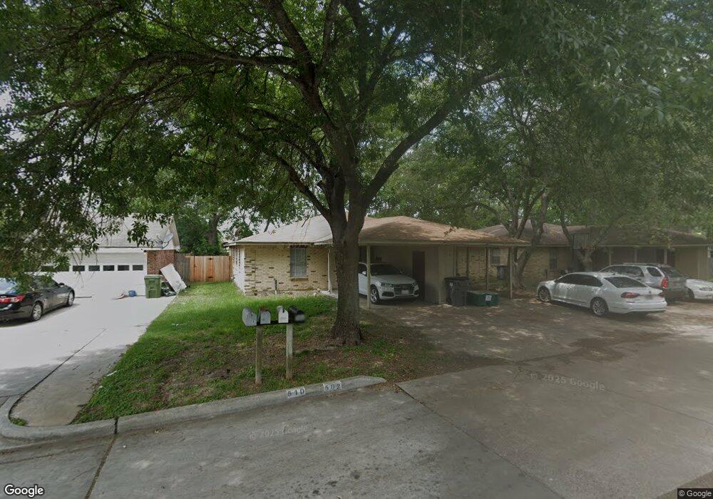
502 Kathy St Unit A Humble, TX 77338
Estimated Value: $215,928 - $301,000
3
Beds
2
Baths
930
Sq Ft
$276/Sq Ft
Est. Value
About This Home
This home is located at 502 Kathy St Unit A, Humble, TX 77338 and is currently estimated at $256,309, approximately $275 per square foot. 502 Kathy St Unit A is a home located in Harris County with nearby schools including Lakeland Elementary School, Ross Sterling Middle School, and Humble High School.
Ownership History
Date
Name
Owned For
Owner Type
Purchase Details
Closed on
Dec 21, 2006
Sold by
Cornelius Kimberly and Cornelius Kimberly D
Bought by
Cornelius Michael A
Current Estimated Value
Purchase Details
Closed on
Jun 10, 2004
Sold by
Cornelius Michael A
Bought by
Cornelius Michael A and Cornelius Kimberly D
Home Financials for this Owner
Home Financials are based on the most recent Mortgage that was taken out on this home.
Original Mortgage
$61,100
Interest Rate
6.02%
Mortgage Type
New Conventional
Purchase Details
Closed on
Sep 14, 1998
Sold by
Wong Delbert and Wong Amelia C
Bought by
Cornelius Michael A
Home Financials for this Owner
Home Financials are based on the most recent Mortgage that was taken out on this home.
Original Mortgage
$61,200
Interest Rate
6.91%
Create a Home Valuation Report for This Property
The Home Valuation Report is an in-depth analysis detailing your home's value as well as a comparison with similar homes in the area
Home Values in the Area
Average Home Value in this Area
Purchase History
| Date | Buyer | Sale Price | Title Company |
|---|---|---|---|
| Cornelius Michael A | -- | None Available | |
| Cornelius Michael A | -- | Commonwealth Land Title Co | |
| Cornelius Michael A | -- | Texas American Title Company |
Source: Public Records
Mortgage History
| Date | Status | Borrower | Loan Amount |
|---|---|---|---|
| Previous Owner | Cornelius Michael A | $61,100 | |
| Previous Owner | Cornelius Michael A | $61,200 |
Source: Public Records
Tax History Compared to Growth
Tax History
| Year | Tax Paid | Tax Assessment Tax Assessment Total Assessment is a certain percentage of the fair market value that is determined by local assessors to be the total taxable value of land and additions on the property. | Land | Improvement |
|---|---|---|---|---|
| 2025 | $4,166 | $241,844 | $75,620 | $166,224 |
| 2024 | $4,166 | $200,000 | $37,810 | $162,190 |
| 2023 | $4,166 | $198,982 | $37,810 | $161,172 |
| 2022 | $3,806 | $166,000 | $30,248 | $135,752 |
| 2021 | $2,929 | $127,558 | $30,248 | $97,310 |
| 2020 | $951 | $0 | $0 | $0 |
| 2019 | $2,436 | $97,000 | $22,686 | $74,314 |
| 2018 | $1,474 | $97,000 | $22,686 | $74,314 |
| 2017 | $2,752 | $136,180 | $22,686 | $113,494 |
| 2016 | $3,206 | $129,635 | $18,149 | $111,486 |
| 2015 | $1,596 | $129,635 | $18,149 | $111,486 |
| 2014 | $1,596 | $115,775 | $22,686 | $93,089 |
Source: Public Records
Map
Nearby Homes
- 502 Sammon Dr Unit 1-3
- 521 Windswept Dr
- 0 Carolyn Ct
- 1405 Anne Ave
- 1207 Mcdugald Rd
- 519 Sharon Dr
- 106 Eddy St Unit B
- 1211 Main St
- 89 Isaacks Ct
- 606 Granberry St
- 712 Higgins St
- 1210 Lynn Ln
- 0 South Ave E
- 1327 Brenda Ln
- 1809 Country Village Blvd
- 0 S Avenue D
- 1907 Country Village Blvd Unit B
- 510 E Main St
- 1941 Country Village Blvd Unit A
- 424 S Avenue D
- 502 Kathy St
- 510 Kathy St
- 514 Kathy St
- 535 Ferguson St
- 535 Ferguson St Unit A
- 541 Ferguson St
- 511 Kathy St
- 518 Kathy St
- 517 Kathy St
- 533 Ferguson St
- 1311 Ken St
- 1311 Ken St Unit A
- 1311 Ken St Unit B
- 514 Sammon Dr
- 519 Kathy St
- 539 Ferguson St
- 525 Ferguson St Unit D3
- 525 Ferguson St Unit BLD C
- 525 Ferguson St Unit D4
- 607 Sammon Dr