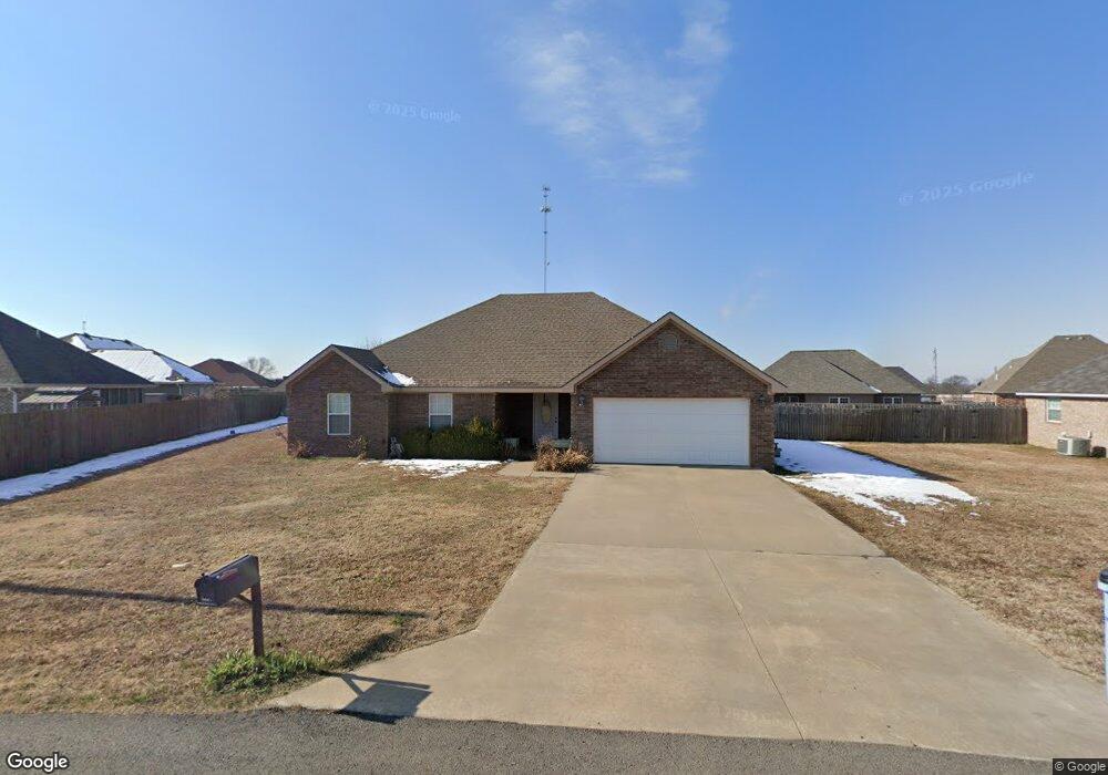
502 Kimberly Dr Checotah, OK 74426
Estimated Value: $265,000 - $324,000
3
Beds
2
Baths
1,912
Sq Ft
$153/Sq Ft
Est. Value
About This Home
This home is located at 502 Kimberly Dr, Checotah, OK 74426 and is currently estimated at $293,052, approximately $153 per square foot. 502 Kimberly Dr is a home with nearby schools including Marshall Elementary School, Checotah Intermediate Elementary School, and Checotah Middle School.
Ownership History
Date
Name
Owned For
Owner Type
Purchase Details
Closed on
Apr 12, 2013
Sold by
Mann Harold and Mann Patsy
Bought by
Robison Magen and Robison Christopher
Current Estimated Value
Home Financials for this Owner
Home Financials are based on the most recent Mortgage that was taken out on this home.
Original Mortgage
$153,060
Outstanding Balance
$108,108
Interest Rate
3.56%
Mortgage Type
New Conventional
Estimated Equity
$184,944
Create a Home Valuation Report for This Property
The Home Valuation Report is an in-depth analysis detailing your home's value as well as a comparison with similar homes in the area
Home Values in the Area
Average Home Value in this Area
Purchase History
| Date | Buyer | Sale Price | Title Company |
|---|---|---|---|
| Robison Magen | $150,000 | None Available |
Source: Public Records
Mortgage History
| Date | Status | Borrower | Loan Amount |
|---|---|---|---|
| Open | Robison Magen | $153,060 |
Source: Public Records
Tax History
| Year | Tax Paid | Tax Assessment Tax Assessment Total Assessment is a certain percentage of the fair market value that is determined by local assessors to be the total taxable value of land and additions on the property. | Land | Improvement |
|---|---|---|---|---|
| 2025 | $1,970 | $23,292 | $1,237 | $22,055 |
| 2024 | $1,862 | $23,292 | $1,404 | $21,888 |
| 2023 | $1,862 | $21,955 | $1,004 | $20,951 |
| 2022 | $1,749 | $21,315 | $859 | $20,456 |
| 2021 | $1,868 | $21,315 | $660 | $20,655 |
| 2020 | $1,836 | $20,092 | $1,980 | $18,112 |
| 2019 | $1,823 | $20,092 | $1,980 | $18,112 |
| 2018 | $1,812 | $20,092 | $1,980 | $18,112 |
| 2017 | $1,789 | $19,996 | $1,980 | $18,016 |
| 2016 | $1,775 | $19,413 | $1,980 | $17,433 |
| 2015 | $1,722 | $18,848 | $1,980 | $16,868 |
| 2014 | $1,665 | $18,299 | $1,980 | $16,319 |
Source: Public Records
Map
Nearby Homes
- 1045 W Mcintosh Ave
- 911 W Mcintosh Ave
- 0 W Gentry Ave
- 110 NW 3rd St
- 514 SE Main St
- 219 SE 1st St
- 000 W N
- 220 E Audd Ave
- 112580 New Texanna Rd
- 310 E Audd Ave
- 502 N Broadway St
- 737 NW 4th St
- 825 NW 8th St
- 613 N Wineblood St
- 604 N Oak St
- 424398 Texanna Rd
- 820 E Okmulgee Ave
- 5 S 4190 Rd
- 309 E North Ave
- 0 Old Hwy 69 Hwy Unit 2551033
- 506 Kimberly Dr
- 1036 W Mcintosh Ave
- 1133 Elizabeth Dr
- 1129 Elizabeth Dr
- 1038 W Mcintosh Ave
- 1139 Elizabeth Dr
- 1032 W Mcintosh Ave
- 1125 Elizabeth Dr
- 1121 Elizabeth Dr
- 1040 W Mcintosh Ave
- 1037 W Mcintosh Ave
- 1030 W Mcintosh Ave
- 514 Kimberly Dr
- 1156 Elizabeth Dr
- 1152 Elizabeth Dr
- 1160 Elizabeth Dr
- 1043 W Mcintosh Ave
- 507 Kimberly Dr
- 1164 Elizabeth Dr
- 1044 W Mcintosh Ave