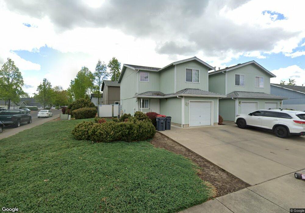
502 Mountain View Dr Central Point, OR 97502
Estimated Value: $561,000 - $667,000
9
Beds
5
Baths
3,483
Sq Ft
$179/Sq Ft
Est. Value
About This Home
This home is located at 502 Mountain View Dr, Central Point, OR 97502 and is currently estimated at $623,978, approximately $179 per square foot. 502 Mountain View Dr is a home located in Jackson County with nearby schools including Central Point Elementary School, Scenic Middle School, and Crater High School.
Ownership History
Date
Name
Owned For
Owner Type
Purchase Details
Closed on
Jan 4, 2016
Sold by
Vanmoppes Mark S and Vanmoppes Peggy Jean
Bought by
Mark S Vanmoppes & Peggy J Vanmoppes Tru
Current Estimated Value
Purchase Details
Closed on
Aug 14, 2013
Sold by
Barrett Patricia Lynn and Angelopoulos Pamela Susan
Bought by
Vanmoppes Peggy Jean and Van Moppes Mark S
Create a Home Valuation Report for This Property
The Home Valuation Report is an in-depth analysis detailing your home's value as well as a comparison with similar homes in the area
Purchase History
| Date | Buyer | Sale Price | Title Company |
|---|---|---|---|
| Mark S Vanmoppes & Peggy J Vanmoppes Tru | -- | None Available | |
| Vanmoppes Peggy Jean | $290,000 | None Available |
Source: Public Records
Tax History
| Year | Tax Paid | Tax Assessment Tax Assessment Total Assessment is a certain percentage of the fair market value that is determined by local assessors to be the total taxable value of land and additions on the property. | Land | Improvement |
|---|---|---|---|---|
| 2026 | $6,609 | $379,710 | $148,000 | $231,710 |
| 2025 | $6,446 | $387,720 | $82,360 | $305,360 |
| 2024 | $6,446 | $376,430 | $79,960 | $296,470 |
| 2023 | $6,239 | $365,470 | $77,630 | $287,840 |
| 2022 | $6,093 | $365,470 | $77,630 | $287,840 |
| 2021 | $5,919 | $354,830 | $75,370 | $279,460 |
| 2020 | $5,746 | $344,500 | $73,180 | $271,320 |
| 2019 | $5,605 | $324,730 | $68,980 | $255,750 |
| 2018 | $5,434 | $315,280 | $66,970 | $248,310 |
| 2017 | $5,297 | $315,280 | $66,970 | $248,310 |
| 2016 | $5,143 | $297,190 | $63,130 | $234,060 |
| 2015 | $4,927 | $297,190 | $63,130 | $234,060 |
| 2014 | $4,802 | $280,140 | $59,510 | $220,630 |
Source: Public Records
Map
Nearby Homes
- 533 Brittni Ln
- 512 Village Dr Unit B5
- 906 Brandi Way
- 943 Hopkins Rd
- 934 Pittview Ave
- 1025 Fairfield Ave
- 301 Freeman Rd Unit 30
- 301 Freeman Rd Unit 92
- 301 Freeman Rd Unit 91
- 301 Freeman Rd Unit 90
- 230 Peninger Rd
- 1204 Heather Ln
- 3364 Bursell Rd
- 555 Freeman Rd Unit 73
- 555 Freeman Rd Unit 254
- 555 Freeman Rd Unit 105
- 555 Freeman Rd Unit 209
- 850 Forest Glen Dr
- 647 Shadow Way
- 1258 Joshua Ct
- 500 Mountain View Dr
- 512 Mountain View Dr
- 507 Village Dr
- 313 Columbine Way
- 309 Columbine Way
- 76365 Columbine Way
- 727 Columbine Way
- 0 Columbine Way
- 514 Mountain View Dr
- 515 Village Dr
- 503 Mountain View Dr
- 511 Mountain View Dr
- 501 Mountain View Dr
- 511 Mountain View 513 Dr
- 839 Columbine Way
- 843 Columbine Way
- 837 Columbine Way
- 845 Columbine Way
- 521 Mountain View Dr
- 522 Mountain View Dr
Your Personal Tour Guide
Ask me questions while you tour the home.