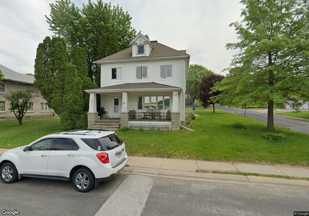
502 N Main St Port Byron, IL 61275
Estimated Value: $192,000 - $223,049
--
Bed
--
Bath
2,202
Sq Ft
$96/Sq Ft
Est. Value
About This Home
This home is located at 502 N Main St, Port Byron, IL 61275 and is currently estimated at $212,262, approximately $96 per square foot. 502 N Main St is a home located in Rock Island County with nearby schools including Riverdale Elementary School, Riverdale Middle School, and Riverdale Senior High School.
Create a Home Valuation Report for This Property
The Home Valuation Report is an in-depth analysis detailing your home's value as well as a comparison with similar homes in the area
Home Values in the Area
Average Home Value in this Area
Tax History Compared to Growth
Tax History
| Year | Tax Paid | Tax Assessment Tax Assessment Total Assessment is a certain percentage of the fair market value that is determined by local assessors to be the total taxable value of land and additions on the property. | Land | Improvement |
|---|---|---|---|---|
| 2024 | $3,843 | $61,666 | $12,237 | $49,429 |
| 2023 | $3,843 | $56,575 | $11,227 | $45,348 |
| 2022 | $2,790 | $46,445 | $10,708 | $35,737 |
| 2021 | $2,682 | $44,024 | $10,150 | $33,874 |
| 2020 | $2,628 | $43,373 | $10,000 | $33,373 |
| 2019 | $2,632 | $43,373 | $10,000 | $33,373 |
| 2018 | $2,632 | $43,881 | $9,973 | $33,908 |
| 2017 | $2,592 | $43,881 | $9,973 | $33,908 |
| 2016 | $2,557 | $43,275 | $9,835 | $33,440 |
| 2015 | $2,664 | $44,312 | $10,071 | $34,241 |
| 2014 | $631 | $44,312 | $10,071 | $34,241 |
| 2013 | $631 | $44,312 | $10,071 | $34,241 |
Source: Public Records
Map
Nearby Homes
- 613 N High St
- LOT 201 James St
- 401 Oak Blvd
- 1204 N Cody Rd
- 1128 N Cody Rd
- 817 N 2nd St
- 127 Walnut St
- Lot A B C D N Cody Rd
- 338 Benton St
- 320 N 2nd St
- 223 N 2nd St
- 401 N 8th St
- Lot 01 8th St
- Lot 004 8th St
- 21780 Great River Rd
- 1914 Ridgefield Dr
- 1008 S High St
- 903 Wild West Dr
- 902 Wild Dr W
- 217 N 8th St