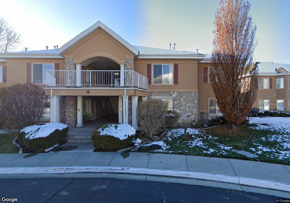
502 S 1040 E Unit 143 American Fork, UT 84003
Estimated Value: $264,000 - $283,000
2
Beds
1
Bath
1,046
Sq Ft
$261/Sq Ft
Est. Value
About This Home
This home is located at 502 S 1040 E Unit 143, American Fork, UT 84003 and is currently estimated at $273,092, approximately $261 per square foot. 502 S 1040 E Unit 143 is a home located in Utah County with nearby schools including Barratt Elementary School, American Fork Junior High School, and American Fork High School.
Ownership History
Date
Name
Owned For
Owner Type
Purchase Details
Closed on
Aug 29, 2024
Sold by
Bloom Neal T
Bought by
Walsh Ronald A and Walsh Marilyn A
Current Estimated Value
Purchase Details
Closed on
Apr 26, 2016
Sold by
Boyer Lee Ann
Bought by
Bloom Neal T
Home Financials for this Owner
Home Financials are based on the most recent Mortgage that was taken out on this home.
Original Mortgage
$99,900
Interest Rate
3.71%
Mortgage Type
New Conventional
Purchase Details
Closed on
Aug 6, 2007
Sold by
Mira Condominiums Development Llc
Bought by
Boyer Lee Ann
Home Financials for this Owner
Home Financials are based on the most recent Mortgage that was taken out on this home.
Original Mortgage
$70,000
Interest Rate
6.66%
Mortgage Type
Purchase Money Mortgage
Create a Home Valuation Report for This Property
The Home Valuation Report is an in-depth analysis detailing your home's value as well as a comparison with similar homes in the area
Home Values in the Area
Average Home Value in this Area
Purchase History
| Date | Buyer | Sale Price | Title Company |
|---|---|---|---|
| Walsh Ronald A | -- | Eagle Gate Title Insurance Age | |
| Bloom Neal T | -- | Vanguard Title Insurance Age | |
| Boyer Lee Ann | -- | Old Republic Title Company |
Source: Public Records
Mortgage History
| Date | Status | Borrower | Loan Amount |
|---|---|---|---|
| Previous Owner | Bloom Neal T | $99,900 | |
| Previous Owner | Boyer Lee Ann | $70,000 |
Source: Public Records
Tax History Compared to Growth
Tax History
| Year | Tax Paid | Tax Assessment Tax Assessment Total Assessment is a certain percentage of the fair market value that is determined by local assessors to be the total taxable value of land and additions on the property. | Land | Improvement |
|---|---|---|---|---|
| 2025 | $1,286 | $146,245 | $29,500 | $236,400 |
| 2024 | $1,286 | $142,890 | $0 | $0 |
| 2023 | $1,185 | $139,535 | $0 | $0 |
| 2022 | $1,112 | $129,305 | $0 | $0 |
| 2021 | $1,070 | $194,300 | $23,300 | $171,000 |
| 2020 | $982 | $173,000 | $20,800 | $152,200 |
| 2019 | $904 | $164,700 | $19,600 | $145,100 |
| 2018 | $815 | $142,000 | $17,000 | $125,000 |
| 2017 | $726 | $68,200 | $0 | $0 |
| 2016 | $781 | $68,200 | $0 | $0 |
| 2015 | $823 | $68,200 | $0 | $0 |
| 2014 | $723 | $59,125 | $0 | $0 |
Source: Public Records
Map
Nearby Homes
- 502 S 1040 E Unit 252
- 502 S 1040 E Unit 137
- 502 S 1040 E Unit 243
- 502 S 1040 E Unit 226
- 502 S 1040 E Unit 238
- 1088 E 390 S
- 477 S 850 E
- 796 E 500 S
- 782 E 500 S
- 29 S 2000 W
- 407 S 740 St E
- 368 S 780 E
- 293 N 1630 W
- 152 S 930 E
- 1598 W 220 N
- 759 W 930 N Unit 502
- 708 W 930 N Unit 505
- 734 W 930 N Unit 506
- 1584 W 110 N
- 1795 W 120 S Unit 52
- 502 S 1040 E
- 502 S 1040 E Unit 251
- 502 S 1040 E Unit 250
- 502 S 1040 E Unit 249
- 502 S 1040 E
- 502 S 1040 E Unit 247
- 502 S 1040 E
- 502 S 1040 E
- 502 S 1040 E
- 502 S 1040 E
- 502 S 1040 E
- 502 S 1040 E
- 502 S 1040 E
- 502 S 1040 E
- 502 S 1040 E
- 502 S 1040 E
- 502 S 1040 E Unit 149
- 502 S 1040 E Unit 148
- 502 S 1040 E
- 502 S 1040 E