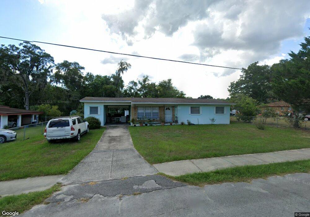
502 S Elsasser St Deland, FL 32720
Estimated Value: $196,000 - $218,000
3
Beds
1
Bath
1,020
Sq Ft
$205/Sq Ft
Est. Value
About This Home
This home is located at 502 S Elsasser St, Deland, FL 32720 and is currently estimated at $208,795, approximately $204 per square foot. 502 S Elsasser St is a home located in Volusia County with nearby schools including Edith I. Starke Elementary School, Deland High School, and Southwestern Middle School.
Ownership History
Date
Name
Owned For
Owner Type
Purchase Details
Closed on
Jul 8, 2019
Sold by
Smith Catherine Susan
Bought by
Smith Catherine Susan
Current Estimated Value
Purchase Details
Closed on
Sep 12, 2002
Sold by
Smith Fannie Hall
Bought by
Fannie Hall Smith Rev Living Tr
Purchase Details
Closed on
Jul 10, 2002
Sold by
Smith Fannie Hall
Bought by
Smith Fannie Hall
Purchase Details
Closed on
Aug 15, 1972
Bought by
Smith Fannie Hall Life Estate
Create a Home Valuation Report for This Property
The Home Valuation Report is an in-depth analysis detailing your home's value as well as a comparison with similar homes in the area
Home Values in the Area
Average Home Value in this Area
Purchase History
| Date | Buyer | Sale Price | Title Company |
|---|---|---|---|
| Smith Catherine Susan | $26,487 | Esquire Title Services Inc | |
| Smith Catherine Susan | -- | Esquire Title Services Inc | |
| Fannie Hall Smith Rev Living Tr | -- | -- | |
| Smith Fannie Hall | -- | -- | |
| Smith Fannie Hall Life Estate | $18,000 | -- |
Source: Public Records
Tax History Compared to Growth
Tax History
| Year | Tax Paid | Tax Assessment Tax Assessment Total Assessment is a certain percentage of the fair market value that is determined by local assessors to be the total taxable value of land and additions on the property. | Land | Improvement |
|---|---|---|---|---|
| 2025 | $2,454 | $156,366 | $34,527 | $121,839 |
| 2024 | $2,454 | $157,419 | $34,527 | $122,892 |
| 2023 | $2,454 | $143,275 | $23,018 | $120,257 |
| 2022 | $2,261 | $128,529 | $23,018 | $105,511 |
| 2021 | $2,136 | $103,986 | $17,263 | $86,723 |
| 2020 | $2,074 | $100,640 | $12,659 | $87,981 |
| 2019 | $1,902 | $88,090 | $11,509 | $76,581 |
| 2018 | $304 | $38,989 | $0 | $0 |
| 2017 | $296 | $38,187 | $0 | $0 |
| 2016 | $273 | $37,402 | $0 | $0 |
| 2015 | $276 | $37,142 | $0 | $0 |
| 2014 | $276 | $36,847 | $0 | $0 |
Source: Public Records
Map
Nearby Homes
- 817 W Euclid Ave
- 536 W Hubbard Ave
- 800 W Hubbard Ave
- 632 W Hubbard Ave
- 816 W Franklin Ave
- 624 W Euclid Ave
- 736 S Stone St
- 305 S Stone St
- 706 W Franklin Ave
- 247 S Marydell Ave
- 241 S Marydell Ave
- 526 W Hubbard Ave
- 1141 W Euclid Ave
- 534 S Adelle Ave
- 128 S Montgomery Ave
- 705 W Beresford Ave
- 921 Valleydale Ave
- 131 S Stone St
- 933 Longview Ave
- W SR 44, New York Ave W
- 504 S Elsasser St
- 818 W Euclid Ave
- 820 W Euclid Ave
- 501 S Boundary Ave
- 503 S Boundary Ave
- 506 S Elsasser St
- 501 S Elsasser St
- 822 W Euclid Ave
- 503 S Elsasser St
- 816 W Euclid Ave
- 505 S Boundary Ave
- 508 S Elsasser St
- 505 S Elsasser St
- 507 S Boundary Ave
- 425 S Kingsbury Blvd
- 507 S Elsasser St
- 815 W Euclid Ave
- 510 S Elsasser St
- 502 S High St
- 813 W Euclid Ave