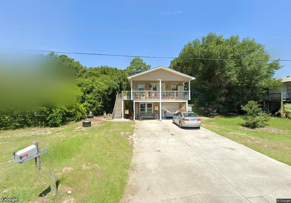
502 W Airstrip Rd Kill Devil Hills, NC 27948
Estimated Value: $450,000 - $572,000
5
Beds
4
Baths
1,824
Sq Ft
$289/Sq Ft
Est. Value
About This Home
This home is located at 502 W Airstrip Rd, Kill Devil Hills, NC 27948 and is currently estimated at $527,389, approximately $289 per square foot. 502 W Airstrip Rd is a home located in Dare County with nearby schools including First Flight Elementary School, First Flight Middle School, and First Flight High School.
Ownership History
Date
Name
Owned For
Owner Type
Purchase Details
Closed on
Oct 29, 2018
Sold by
Caggese Vincenxe A
Bought by
Culb Patricia A and Shepley Karen E
Current Estimated Value
Purchase Details
Closed on
Oct 28, 2009
Sold by
Estate Of Jon Scott Eriksen
Bought by
Mckee Investments Llc
Home Financials for this Owner
Home Financials are based on the most recent Mortgage that was taken out on this home.
Original Mortgage
$195,000
Interest Rate
5.04%
Mortgage Type
Purchase Money Mortgage
Create a Home Valuation Report for This Property
The Home Valuation Report is an in-depth analysis detailing your home's value as well as a comparison with similar homes in the area
Home Values in the Area
Average Home Value in this Area
Purchase History
| Date | Buyer | Sale Price | Title Company |
|---|---|---|---|
| Culb Patricia A | $200,000 | -- | |
| Mckee Investments Llc | $135,000 | None Available |
Source: Public Records
Mortgage History
| Date | Status | Borrower | Loan Amount |
|---|---|---|---|
| Previous Owner | Mckee Investments Llc | $195,000 |
Source: Public Records
Tax History
| Year | Tax Paid | Tax Assessment Tax Assessment Total Assessment is a certain percentage of the fair market value that is determined by local assessors to be the total taxable value of land and additions on the property. | Land | Improvement |
|---|---|---|---|---|
| 2025 | $2,594 | $477,600 | $179,400 | $298,200 |
| 2024 | $2,162 | $286,200 | $87,100 | $199,100 |
| 2023 | $2,162 | $286,200 | $87,100 | $199,100 |
| 2022 | $2,062 | $286,200 | $87,100 | $199,100 |
| 2021 | $2,062 | $286,200 | $87,100 | $199,100 |
| 2020 | $1,986 | $275,600 | $87,100 | $188,500 |
| 2019 | $1,608 | $184,800 | $68,200 | $116,600 |
| 2018 | $1,572 | $184,800 | $68,200 | $116,600 |
| 2017 | $1,572 | $184,800 | $68,200 | $116,600 |
| 2016 | $1,499 | $184,800 | $68,200 | $116,600 |
| 2014 | $144 | $184,800 | $68,200 | $116,600 |
Source: Public Records
Map
Nearby Homes
- 0 W Martin St
- 302 W Clark St Unit Lot 6
- 809 9th Ave Unit 809-B
- 1208 -2 Swan St Unit 2
- 1208 -1 Swan St Unit 1
- 1208 Swan St Unit 4
- 1208 Swan St Unit 2
- 1208 Swan St Unit 5
- 1208 Swan St Unit 1
- 900 Fox St
- 704 Swan St Unit 2
- 0 10th Ave Unit Lot 2R 130569
- 1308 Theodore St Unit 5
- 0 W Boundary St Unit Lot 1-R 130568
- 205 W Atlantic St Unit Lot 3
- 1209 Wrightsville Blvd Unit Lot 26
- 305 E Martin St Unit Lot 25
- 1014 S Virginia Dare Trail Unit 301
- 902 S Virginia Dare Trail Unit 503
- 902 S Virginia Dare Trail Unit 403
- 500 W Airstrip Rd
- 504 W Airstrip Rd
- 1003 6th Ave Unit 8
- 1003 6th Ave
- 506 W Airstrip Rd Unit 7
- 506 W Airstrip Rd
- 1004 Swan St
- 501 W Airstrip Rd
- 406 W Airstrip Rd
- 1005 6th Ave Unit 9
- 1005 6th Ave
- 1002 Swan St
- 407 W Airstrip Rd
- 505 W Airstrip Rd Unit 6
- 505 W Airstrip Rd
- 600 W Airstrip Rd
- 1001 6th Ave
- 404 W Airstrip Rd
- 405 W Airstrip Rd
- 1002 6th Ave
Your Personal Tour Guide
Ask me questions while you tour the home.