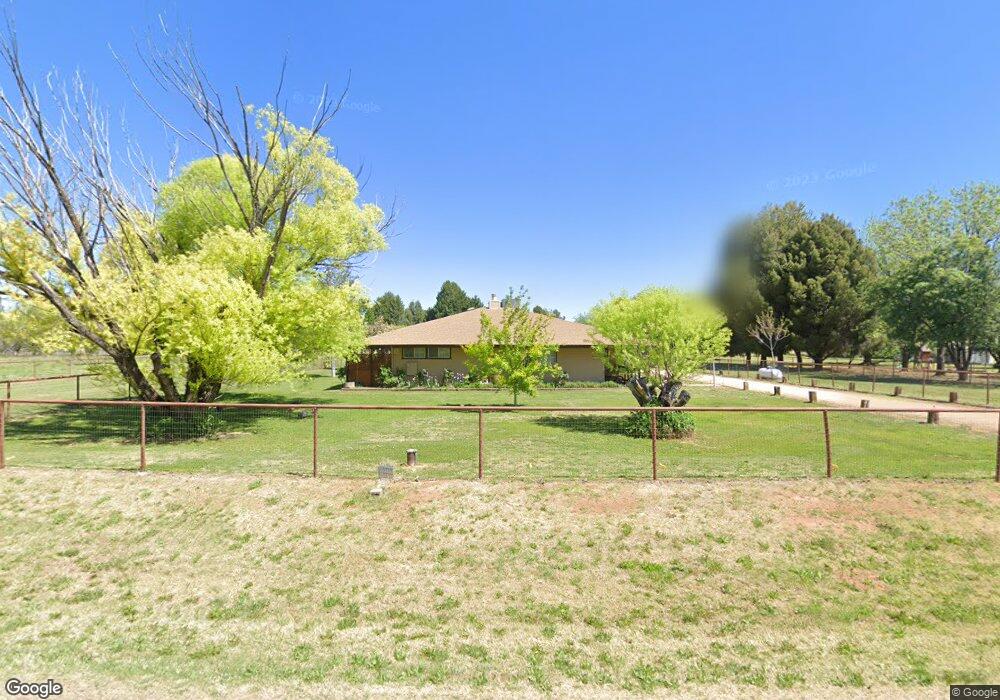
502 W Pheasant Run Cir Camp Verde, AZ 86322
Estimated Value: $565,086 - $939,000
--
Bed
--
Bath
1,802
Sq Ft
$399/Sq Ft
Est. Value
About This Home
This home is located at 502 W Pheasant Run Cir, Camp Verde, AZ 86322 and is currently estimated at $718,272, approximately $398 per square foot. 502 W Pheasant Run Cir is a home located in Yavapai County with nearby schools including Camp Verde Elementary School, Camp Verde Middle School, and Camp Verde High School.
Ownership History
Date
Name
Owned For
Owner Type
Purchase Details
Closed on
Jul 14, 2003
Sold by
Jacobson Michael Alan
Bought by
Jacobson Michael Alan and Jacobson Alana Lynn
Current Estimated Value
Purchase Details
Closed on
Mar 27, 2003
Sold by
Murray Susan and Summers Susan
Bought by
Jacobson Michael Alan
Purchase Details
Closed on
Jan 10, 2001
Sold by
Carroll Robert M and Carroll Rosalie L
Bought by
Summers Susan J
Home Financials for this Owner
Home Financials are based on the most recent Mortgage that was taken out on this home.
Original Mortgage
$243,000
Interest Rate
7.54%
Mortgage Type
New Conventional
Purchase Details
Closed on
Sep 23, 1999
Sold by
Carroll Robert M and Carroll Rosalie L
Bought by
Carroll Robert M and Carroll Rosalie L
Create a Home Valuation Report for This Property
The Home Valuation Report is an in-depth analysis detailing your home's value as well as a comparison with similar homes in the area
Home Values in the Area
Average Home Value in this Area
Purchase History
| Date | Buyer | Sale Price | Title Company |
|---|---|---|---|
| Jacobson Michael Alan | -- | Chicago Title Insurance Co | |
| Jacobson Michael Alan | $280,000 | Chicago Title Insurance Co | |
| Summers Susan J | $270,000 | Capital Title Agency Inc | |
| Carroll Robert M | -- | -- |
Source: Public Records
Mortgage History
| Date | Status | Borrower | Loan Amount |
|---|---|---|---|
| Previous Owner | Summers Susan J | $243,000 |
Source: Public Records
Tax History Compared to Growth
Tax History
| Year | Tax Paid | Tax Assessment Tax Assessment Total Assessment is a certain percentage of the fair market value that is determined by local assessors to be the total taxable value of land and additions on the property. | Land | Improvement |
|---|---|---|---|---|
| 2026 | $2,232 | $45,647 | -- | -- |
| 2024 | $2,158 | $45,287 | -- | -- |
| 2023 | $2,158 | $36,482 | $7,263 | $29,219 |
| 2022 | $2,034 | $29,655 | $4,945 | $24,710 |
| 2021 | $2,114 | $28,451 | $5,806 | $22,645 |
| 2020 | $2,040 | $0 | $0 | $0 |
| 2019 | $1,996 | $0 | $0 | $0 |
| 2018 | $1,928 | $0 | $0 | $0 |
| 2017 | $1,827 | $0 | $0 | $0 |
| 2016 | $1,757 | $0 | $0 | $0 |
| 2015 | $1,731 | $0 | $0 | $0 |
| 2014 | -- | $0 | $0 | $0 |
Source: Public Records
Map
Nearby Homes
- 2095 S Hillcrest Dr
- 1785 S Fort Apache Rd
- 2050 S Hillcrest Dr
- 2045 S Hillcrest Dr
- 1844 S Quarterhorse Ln
- 1993 S Salt Mine Rd
- 1846 S Dodge Rd
- 955 W Copperhead Rd
- 452 E Cole Blvd Unit 17
- 452 E Cole Blvd
- 1616 S Reeves Arena Rd
- 451 W Salt Mine Rd
- 2400 S Kynlee Dr Unit 3
- 2400 S Kynlee Dr
- 469 E Cole Blvd Unit 6
- 356 E Cole Blvd Unit 15
- 328 E Cole Blvd Unit 14
- 405 E Cole Blvd Unit 8
- 437 E Cole Blvd Unit 7
- 270 E Cole Blvd Unit 13
- 462 W Pheasant Run Cir Unit 2
- 552 W Pheasant Run Cir
- 2035 S Pearl Dr
- 469 W Spruce St
- 442 W Pheasant Run Cir
- 557 W Pheasant Run Cir
- 602 W Pheasant Run Cir
- 467 W Pheasant Run Cir
- 507 W Pheasant Run Cir
- 489 W Spruce St
- 452 W Spruce St
- 2058 S Pearl Dr
- 462 W Spruce St
- 402 W Pheasant Run Cir
- 447 W Pheasant Run Cir Unit 2
- 607 W Pheasant Run Cir
- 2038 S Pearl Dr
- 600 W Fir St
- 407 W Pheasant Run Cir
- 2148 S Pearl Dr