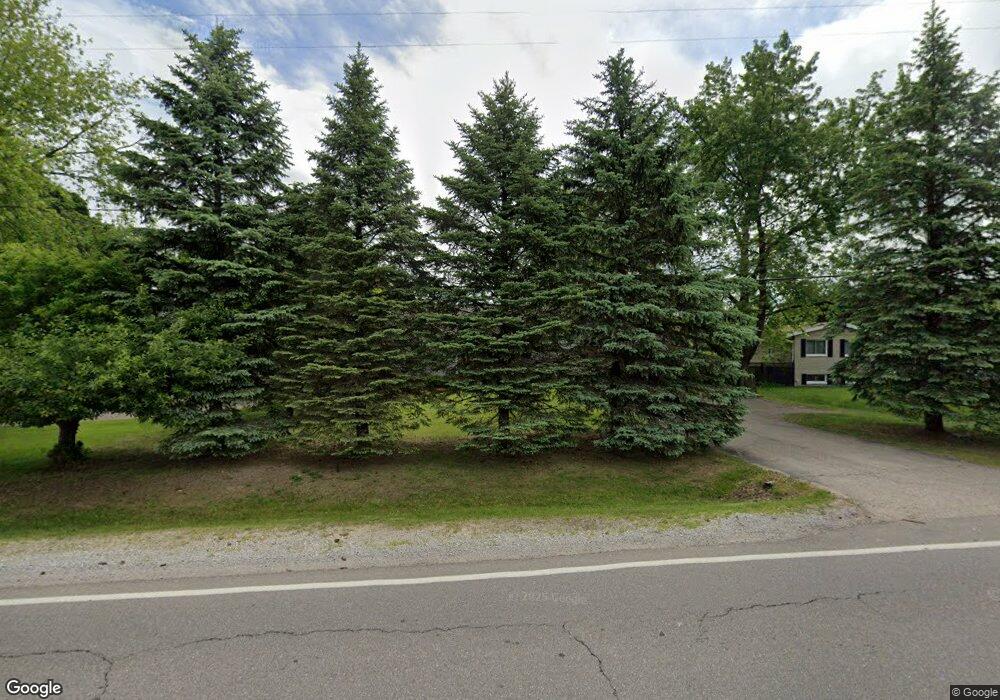
5020 Deland Rd Flushing, MI 48433
Estimated Value: $226,000 - $318,000
3
Beds
2
Baths
1,550
Sq Ft
$176/Sq Ft
Est. Value
About This Home
This home is located at 5020 Deland Rd, Flushing, MI 48433 and is currently estimated at $272,333, approximately $175 per square foot. 5020 Deland Rd is a home located in Genesee County with nearby schools including Springview Elementary School, Flushing Middle School, and Flushing High School.
Ownership History
Date
Name
Owned For
Owner Type
Purchase Details
Closed on
Jul 12, 2023
Sold by
Maroun Maroun Said Said
Bought by
Maroun S Maroun Trust and Maroun
Current Estimated Value
Purchase Details
Closed on
May 21, 2010
Sold by
Kondel Joseph and Kondel Christina
Bought by
Maroun Maroun Said Said
Purchase Details
Closed on
Aug 29, 2002
Sold by
Johnson Jason R and Johnson Ryan D
Bought by
Kondel Joseph and Kondel Christina
Purchase Details
Closed on
Jan 15, 2002
Sold by
Szukhent Jeffrey A and Szukhent Janelle M
Bought by
Johnson Jason R and Johnson Ryan D
Create a Home Valuation Report for This Property
The Home Valuation Report is an in-depth analysis detailing your home's value as well as a comparison with similar homes in the area
Home Values in the Area
Average Home Value in this Area
Purchase History
| Date | Buyer | Sale Price | Title Company |
|---|---|---|---|
| Maroun S Maroun Trust | -- | None Listed On Document | |
| Maroun Maroun Said Said | $116,500 | First American Title Ins Co | |
| Kondel Joseph | $147,000 | Cislo Title Company | |
| Johnson Jason R | $22,000 | Cislo Title Company |
Source: Public Records
Tax History Compared to Growth
Tax History
| Year | Tax Paid | Tax Assessment Tax Assessment Total Assessment is a certain percentage of the fair market value that is determined by local assessors to be the total taxable value of land and additions on the property. | Land | Improvement |
|---|---|---|---|---|
| 2025 | $2,650 | $109,100 | $0 | $0 |
| 2024 | $1,447 | $105,800 | $0 | $0 |
| 2023 | $1,303 | $97,700 | $0 | $0 |
| 2022 | $2,290 | $86,000 | $0 | $0 |
| 2021 | $2,265 | $80,900 | $0 | $0 |
| 2020 | $1,213 | $76,300 | $0 | $0 |
| 2019 | $2,947 | $70,400 | $0 | $0 |
| 2018 | $3,998 | $63,600 | $0 | $0 |
| 2017 | $2,466 | $63,600 | $0 | $0 |
| 2016 | $3,550 | $61,100 | $0 | $0 |
| 2015 | $2,819 | $60,200 | $0 | $0 |
| 2014 | $1,045 | $57,200 | $0 | $0 |
| 2012 | -- | $56,200 | $56,200 | $0 |
Source: Public Records
Map
Nearby Homes
- 5016 Deland Rd
- 0 Double Tree Estates
- 507 Dale St
- 515 Chestnut St
- 530 Coutant St
- 8520 Apple Blossom Ln
- 120 Boman St
- 8474 Wesley Dr
- 1209 Clearview Dr
- 1216 Pleasantview Dr
- 315 N Maple St
- 113 N Mckinley Rd
- 428 Sunnyside Dr
- 433 Crestview St
- 1252 Beatrice St
- 5315 Chickasaw Trail
- Lot 1 across from 74 E River Rd
- 227 Emily St
- 516 Sunnyslope Dr
- 6289 W River Rd
- 5022 Deland Rd
- 640 Deland Rd
- 5030 Deland Rd
- 640 Carpenter Rd
- 5044 Deland Rd
- 5065 Prestonwood Ln
- 636 Deland Rd
- 5061 Prestonwood Ln
- 634 Carpenter Rd
- 629 Ashwood Dr
- 639 Deland Rd
- 5056 Deland Rd
- 5069 Prestonwood Ln
- 5057 Prestonwood Ln
- 634 Northwood Dr
- 625 Ashwood Dr
- 723 Birchwood Dr
- 632 Northwood Dr
- 5073 Prestonwood Ln
- 628 Northwood Dr
