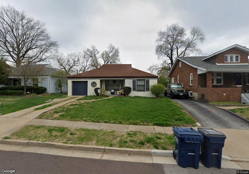
5020 Deville Ave Saint Louis, MO 63119
Estimated Value: $267,023 - $331,000
3
Beds
1
Bath
1,380
Sq Ft
$219/Sq Ft
Est. Value
About This Home
This home is located at 5020 Deville Ave, Saint Louis, MO 63119 and is currently estimated at $302,756, approximately $219 per square foot. 5020 Deville Ave is a home located in St. Louis County with nearby schools including Mesnier Primary School, Gotsch Intermediate School, and Rogers Middle School.
Ownership History
Date
Name
Owned For
Owner Type
Purchase Details
Closed on
Sep 24, 2015
Sold by
Russo Patrice
Bought by
Russo Patrice and Russo Joseph
Current Estimated Value
Purchase Details
Closed on
Dec 14, 2010
Sold by
Russo Patrice
Bought by
Stasia M Petill Supplemental Needs Trust
Purchase Details
Closed on
Nov 30, 2010
Sold by
Petill Stasia M and Russo Patrice
Bought by
Russo Patrice
Purchase Details
Closed on
Jun 3, 2010
Sold by
Petill Stasia M
Bought by
Russo Patrice and Stasia M Petill Revocable Trust
Create a Home Valuation Report for This Property
The Home Valuation Report is an in-depth analysis detailing your home's value as well as a comparison with similar homes in the area
Home Values in the Area
Average Home Value in this Area
Purchase History
| Date | Buyer | Sale Price | Title Company |
|---|---|---|---|
| Russo Patrice | -- | None Available | |
| Stasia M Petill Supplemental Needs Trust | -- | None Available | |
| Russo Patrice | $135,000 | None Available | |
| Russo Patrice | -- | None Available |
Source: Public Records
Tax History
| Year | Tax Paid | Tax Assessment Tax Assessment Total Assessment is a certain percentage of the fair market value that is determined by local assessors to be the total taxable value of land and additions on the property. | Land | Improvement |
|---|---|---|---|---|
| 2025 | $2,904 | $49,700 | $22,420 | $27,280 |
| 2024 | $2,904 | $37,010 | $14,000 | $23,010 |
| 2023 | $2,904 | $37,010 | $14,000 | $23,010 |
| 2022 | $2,722 | $32,430 | $14,000 | $18,430 |
| 2021 | $2,483 | $32,430 | $14,000 | $18,430 |
| 2020 | $2,628 | $31,660 | $12,620 | $19,040 |
| 2019 | $2,702 | $31,660 | $12,620 | $19,040 |
| 2018 | $2,399 | $25,240 | $12,430 | $12,810 |
| 2017 | $2,392 | $25,240 | $12,430 | $12,810 |
| 2016 | $2,256 | $24,550 | $10,530 | $14,020 |
| 2015 | $2,263 | $24,550 | $10,530 | $14,020 |
| 2014 | $2,332 | $25,100 | $7,240 | $17,860 |
Source: Public Records
Map
Nearby Homes
- 5028 Shrewsbury Ave
- 7324 Weil Ave
- 4900 Deville Ave
- 7310 Weil Ave
- 7400 Whitehall Colonial Ln Unit 421
- 7507 Triwoods Dr Unit H
- 25 Saint Charles Place
- 7415 Triwoods Dr Unit D
- 7611 Triwoods Dr Unit J
- 7729 Murdoch Ave
- 7819 Kenridge Ln
- 4581 Wabash Ave
- 5201 Kingwood Dr
- 7048 Lansdowne Ave
- 7062 Sutherland Ave
- 7266 Mackenzie Rd
- 7132 Lindenwood Place
- 6963 Chippewa St
- 6957 Chippewa St
- 6931 Greenholly Dr
- 5022 Deville Ave
- 5016 Deville Ave
- 5024 Deville Ave
- 5014 Deville Ave
- 5100 Deville Ave
- 5019 Danbury Ave
- 5017 Danbury Ave
- 5021 Danbury Ave
- 5023 Danbury Ave
- 5015 Danbury Ave
- 5102 Deville Ave
- 5021 Deville Ave
- 5010 Deville Ave
- 5019 Deville Ave
- 5025 Danbury Ave
- 5023 Deville Ave
- 5017 Deville Ave
- 5015 Deville Ave
- 5025 Deville Ave
Your Personal Tour Guide
Ask me questions while you tour the home.