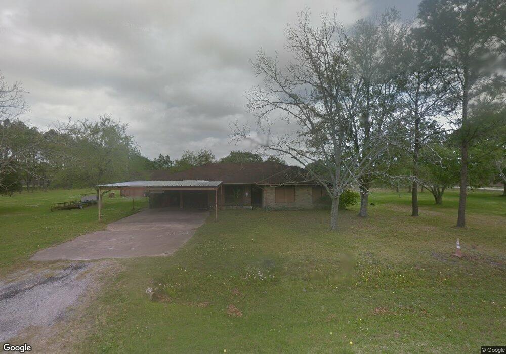
5021 Confederate Dr Pearland, TX 77584
Estimated Value: $392,000 - $509,000
3
Beds
2
Baths
2,020
Sq Ft
$229/Sq Ft
Est. Value
About This Home
This home is located at 5021 Confederate Dr, Pearland, TX 77584 and is currently estimated at $461,911, approximately $228 per square foot. 5021 Confederate Dr is a home located in Brazoria County with nearby schools including Magnolia Elementary School, Pearland Junior High School South, and Sam Jamison Middle School.
Ownership History
Date
Name
Owned For
Owner Type
Purchase Details
Closed on
Dec 9, 2016
Sold by
Best Promotional Gifts Llc
Bought by
Blanco Jose M and Blanco Dora
Current Estimated Value
Home Financials for this Owner
Home Financials are based on the most recent Mortgage that was taken out on this home.
Original Mortgage
$171,000
Outstanding Balance
$138,292
Interest Rate
3.57%
Mortgage Type
New Conventional
Estimated Equity
$323,619
Purchase Details
Closed on
Oct 21, 2015
Sold by
Barnhart Joshua and Barnhart Stephanie
Bought by
Best Promotional Gifts Llc
Purchase Details
Closed on
Mar 22, 2007
Sold by
Rogers Richard E and Steinsiek Margaret Ann
Bought by
Rogers Richard E and Steinsiek Margaret Ann
Create a Home Valuation Report for This Property
The Home Valuation Report is an in-depth analysis detailing your home's value as well as a comparison with similar homes in the area
Home Values in the Area
Average Home Value in this Area
Purchase History
| Date | Buyer | Sale Price | Title Company |
|---|---|---|---|
| Blanco Jose M | -- | Capital Title | |
| Best Promotional Gifts Llc | -- | None Available | |
| Rogers Richard E | -- | None Available |
Source: Public Records
Mortgage History
| Date | Status | Borrower | Loan Amount |
|---|---|---|---|
| Open | Blanco Jose M | $171,000 |
Source: Public Records
Tax History Compared to Growth
Tax History
| Year | Tax Paid | Tax Assessment Tax Assessment Total Assessment is a certain percentage of the fair market value that is determined by local assessors to be the total taxable value of land and additions on the property. | Land | Improvement |
|---|---|---|---|---|
| 2025 | $10,814 | $454,920 | $157,000 | $297,920 |
| 2023 | $10,814 | $498,020 | $183,170 | $314,850 |
| 2022 | $6,617 | $275,050 | $84,510 | $190,540 |
| 2021 | $6,830 | $265,080 | $84,510 | $180,570 |
| 2020 | $6,194 | $229,580 | $72,440 | $157,140 |
| 2019 | $5,402 | $200,180 | $66,400 | $133,780 |
| 2018 | $5,829 | $216,960 | $72,440 | $144,520 |
| 2017 | $6,436 | $238,360 | $78,470 | $159,890 |
| 2016 | $3,699 | $137,000 | $54,480 | $82,520 |
| 2015 | $1,908 | $167,530 | $54,480 | $113,050 |
| 2014 | $1,908 | $166,890 | $59,920 | $106,970 |
Source: Public Records
Map
Nearby Homes
- 3911 Spring Garden Dr
- 3910 Greenwood Dr
- 4806 Chaperel Dr
- 4013 Ivywood Dr
- 5205 Spring Branch Dr
- 3602 Lindhaven Dr
- 3307 Norma Ln
- 5101 Big Spring Dr
- 4015 Cedarwood Dr
- 4967 Millican Dr
- 3730 Aubrell Rd
- 3804 Parry Fields Ct
- 16622 Mclean Rd
- 5301 Ryan Acres Dr
- 3834 Aubrell Rd
- 3703 Canterbury Park Dr
- 3806 Canterbury Park Dr
- 3705 Canterbury Park Dr
- 16719 Mclean Rd
- 3115 Centennial Village Dr
- 5033 Confederate Dr
- 5034 Colonial Dr
- 3608 Mclean Rd
- 3616 Shasta Ct
- 5022 Confederate Dr
- 3614 Shasta Ct
- 3612 Shasta Ct
- 3610 Shasta Ct
- 5106 Confederate Dr
- 5109 Confederate Dr
- 3618 Shasta Ct
- 3608 Shasta Ct
- 4913 Mahejan Ct
- 5114 Colonial Dr
- 4915 Mahejan Ct
- 3604 Shasta Ct
- 3617 Shasta Ct
- 4914 Mahejan Ct
- 5003 Spring Circle Dr
- 4911 Mahejan Ct