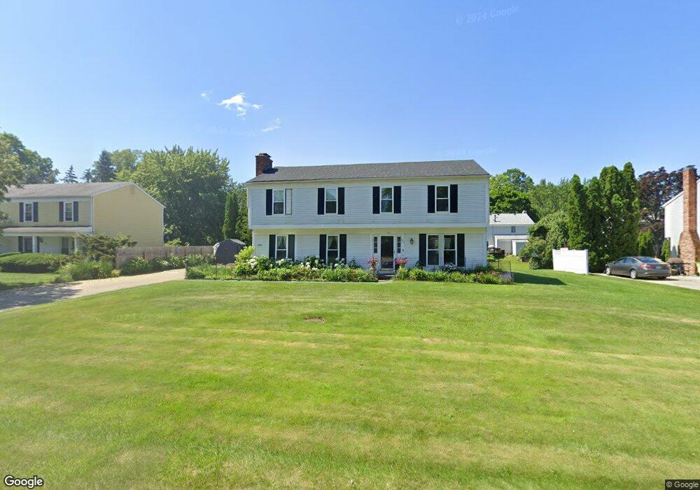
5021 Patrick Rd West Bloomfield, MI 48322
Estimated Value: $366,000 - $443,000
4
Beds
3
Baths
2,046
Sq Ft
$194/Sq Ft
Est. Value
About This Home
This home is located at 5021 Patrick Rd, West Bloomfield, MI 48322 and is currently estimated at $396,652, approximately $193 per square foot. 5021 Patrick Rd is a home located in Oakland County with nearby schools including Sheiko Elementary School, West Bloomfield Middle School, and Brookfield Academy - West Bloomfield.
Ownership History
Date
Name
Owned For
Owner Type
Purchase Details
Closed on
Aug 23, 2004
Sold by
Cohen Leslie B
Bought by
Hermez Latif A and Odish Ibtesam J
Current Estimated Value
Home Financials for this Owner
Home Financials are based on the most recent Mortgage that was taken out on this home.
Original Mortgage
$214,400
Outstanding Balance
$91,848
Interest Rate
3.98%
Mortgage Type
Purchase Money Mortgage
Estimated Equity
$304,804
Purchase Details
Closed on
Dec 2, 2002
Sold by
Chudnow Evan D
Bought by
Cohen Leslie B
Create a Home Valuation Report for This Property
The Home Valuation Report is an in-depth analysis detailing your home's value as well as a comparison with similar homes in the area
Home Values in the Area
Average Home Value in this Area
Purchase History
| Date | Buyer | Sale Price | Title Company |
|---|---|---|---|
| Hermez Latif A | $268,000 | Metropolitan Title Company | |
| Cohen Leslie B | -- | -- |
Source: Public Records
Mortgage History
| Date | Status | Borrower | Loan Amount |
|---|---|---|---|
| Open | Hermez Latif A | $214,400 |
Source: Public Records
Tax History Compared to Growth
Tax History
| Year | Tax Paid | Tax Assessment Tax Assessment Total Assessment is a certain percentage of the fair market value that is determined by local assessors to be the total taxable value of land and additions on the property. | Land | Improvement |
|---|---|---|---|---|
| 2024 | $2,455 | $165,540 | $0 | $0 |
| 2022 | $2,351 | $142,280 | $45,000 | $97,280 |
| 2021 | $1,738 | $44,730 | $0 | $0 |
| 2020 | $2,241 | $129,090 | $40,550 | $88,540 |
| 2018 | $3,289 | $113,420 | $28,700 | $84,720 |
| 2015 | -- | $94,150 | $0 | $0 |
| 2014 | -- | $85,630 | $0 | $0 |
| 2011 | -- | $75,610 | $0 | $0 |
Source: Public Records
Map
Nearby Homes
- 5016 Patrick Rd
- 5023 Meadowbrook Dr
- 6067 Charles Dr
- 5015 Langlewood Dr
- 5120 Langlewood Ct
- 4800 Faircourt Dr
- 6323 Potomac Cir Unit 22
- 5720 Beauchamp
- 4516 Kevin Ct
- 5710 Hobnail Cir
- 5106 Rock Run
- 5216 Brett Ct Unit 53
- 5353 Wright Way W
- 5353 W Bloomfield Lake Rd
- 5428 Hammersmith Dr
- 5946 Cherry Crest Dr
- 4185 Pinehurst Ct
- 5130 Lake Bluff Rd
- 6121 Westbrooke Dr Unit 7
- 6607 Westbrooke Ct
- 5031 Patrick Rd
- 5007 Patrick Rd
- 5018 Meadowbrook Dr
- 5006 Meadowbrook Dr
- 5043 Patrick Rd
- 5028 Patrick Rd
- 5030 Meadowbrook Dr
- 5004 Patrick Rd
- 5040 Patrick Rd
- 5055 Patrick Rd
- 5042 Meadowbrook Dr
- 5878 Shilo Ct
- 5921 Shillingham Dr
- 5009 Meadowbrook Dr
- 5884 Shilo Ct
- 4955 Patrick Rd
- 5945 Farmington Rd
- 5907 Shillingham Dr
- 4996 Meadowbrook Dr
- 5870 Shilo Ct