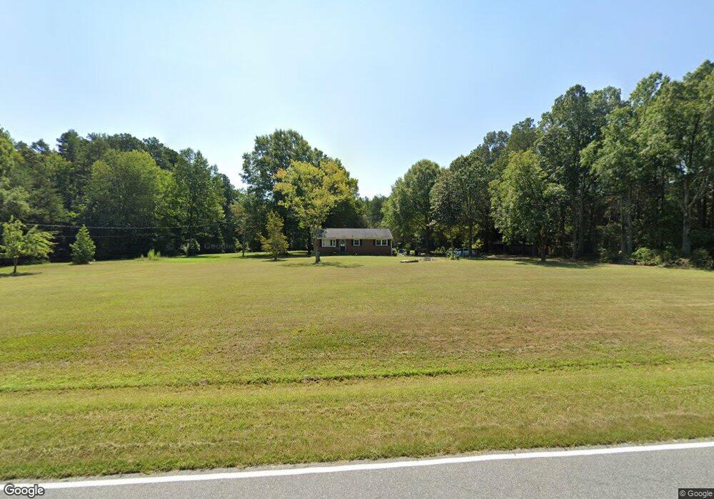
5022 Mcconnell Rd Whitsett, NC 27377
Estimated Value: $250,809 - $315,000
3
Beds
2
Baths
1,345
Sq Ft
$206/Sq Ft
Est. Value
About This Home
This home is located at 5022 Mcconnell Rd, Whitsett, NC 27377 and is currently estimated at $277,702, approximately $206 per square foot. 5022 Mcconnell Rd is a home located in Guilford County with nearby schools including Sedalia Elementary School, Eastern Guilford Middle School, and Eastern Guilford High School.
Ownership History
Date
Name
Owned For
Owner Type
Purchase Details
Closed on
Dec 17, 2024
Sold by
Riverside Homes Llc
Bought by
Smith Alijah Alejandro Ad
Current Estimated Value
Purchase Details
Closed on
May 26, 2023
Sold by
Baruch Cleaning & Investments Llc
Bought by
Riverside Homes Llc
Purchase Details
Closed on
May 4, 2023
Sold by
Brown Veronica B
Bought by
Baruch Cleaning & Investments Llc
Purchase Details
Closed on
Aug 19, 2021
Sold by
Brown Vernon K and Labrown Kendra La
Bought by
Brown Veronica B
Purchase Details
Closed on
Feb 29, 1996
Bought by
Brown Vernon K
Create a Home Valuation Report for This Property
The Home Valuation Report is an in-depth analysis detailing your home's value as well as a comparison with similar homes in the area
Home Values in the Area
Average Home Value in this Area
Purchase History
| Date | Buyer | Sale Price | Title Company |
|---|---|---|---|
| Smith Alijah Alejandro Ad | -- | None Listed On Document | |
| Smith Alijah Alejandro Ad | -- | None Listed On Document | |
| Smith Alijah Alejandro Ad | -- | None Listed On Document | |
| Riverside Homes Llc | -- | None Listed On Document | |
| Riverside Homes Llc | -- | None Listed On Document | |
| Baruch Cleaning & Investments Llc | $89,000 | None Listed On Document | |
| Brown Veronica B | -- | None Available | |
| Brown Vernon K | $89,000 | -- |
Source: Public Records
Tax History Compared to Growth
Tax History
| Year | Tax Paid | Tax Assessment Tax Assessment Total Assessment is a certain percentage of the fair market value that is determined by local assessors to be the total taxable value of land and additions on the property. | Land | Improvement |
|---|---|---|---|---|
| 2025 | $1,528 | $188,500 | $72,800 | $115,700 |
| 2024 | $1,528 | $157,400 | $72,800 | $84,600 |
| 2023 | $1,528 | $157,400 | $72,800 | $84,600 |
| 2022 | $1,276 | $157,400 | $72,800 | $84,600 |
| 2021 | $939 | $115,800 | $43,700 | $72,100 |
| 2020 | $939 | $115,800 | $43,700 | $72,100 |
| 2019 | $939 | $115,800 | $0 | $0 |
| 2018 | $934 | $115,800 | $0 | $0 |
| 2017 | $939 | $115,800 | $0 | $0 |
| 2016 | $887 | $106,200 | $0 | $0 |
| 2015 | $892 | $106,200 | $0 | $0 |
| 2014 | $903 | $106,200 | $0 | $0 |
Source: Public Records
Map
Nearby Homes
- 4539 Dillon Mill Dr
- 1810 Andrews Farm Rd
- 5100 Zante Rd
- 5100 and 5100 ZZ Zante Rd
- 4600 Mcconnell Rd
- 2402 Idol Mill Dr
- Meadowlark Plan at McConnell Ridge
- Sparrow Plan at McConnell Ridge
- 3419 Dr
- 4537 Dillon Mill Dr
- 4541 Dillon Mill Dr
- 2403 Idol Mill Dr
- 4555 Dillon Mill Dr
- 4416 Mcconnell Rd
- 5403 Laggan Dr
- 1519 Bowmore Place
- 1043 Bloomfield Rd
- 3375 Old Julian Rd
- 5438 Wild Turkey Rd
- 6506 Donahue Dr
- 5019 Mcconnell Rd
- 5032 Mcconnell Rd
- 5012 Mcconnell Rd
- 5003 Mcconnell Rd
- 5004 Mcconnell Rd
- 5002 Mcconnell Rd
- 2009 Mount Hope Church Rd
- 5038 Mcconnell Rd
- 2001 Mount Hope Church Rd
- 1993 Mount Hope Chu Rd
- 5042 Mcconnell Rd
- 2005 Mount Hope Church Rd
- 2007 Mount Hope Church Rd
- 1991 Mount Hope Chu Rd
- 2011 Mount Hope Church Rd
- 4938 Mcconnell Rd
- 5048 Mcconnell Rd
- 1989 Mount Hope Chu Rd
- 2008 Mount Hope Church Rd
- 2006 Mount Hope Church Rd