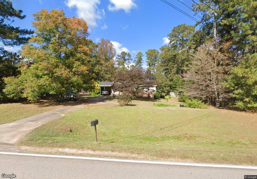
5022 Old West Point Rd Lagrange, GA 30240
Estimated Value: $187,000 - $202,000
3
Beds
2
Baths
1,104
Sq Ft
$177/Sq Ft
Est. Value
About This Home
This home is located at 5022 Old West Point Rd, Lagrange, GA 30240 and is currently estimated at $195,845, approximately $177 per square foot. 5022 Old West Point Rd is a home located in Troup County with nearby schools including Long Cane Elementary School, Berta Weathersbee Elementary School, and Whitesville Road Elementary School.
Ownership History
Date
Name
Owned For
Owner Type
Purchase Details
Closed on
Jun 26, 2019
Sold by
Chumley Carol D
Bought by
Chumley Linda Carol
Current Estimated Value
Purchase Details
Closed on
Apr 5, 1982
Bought by
Chumley Carol D
Purchase Details
Closed on
Jun 20, 1977
Purchase Details
Closed on
Mar 16, 1977
Purchase Details
Closed on
May 30, 1975
Purchase Details
Closed on
Jan 1, 1954
Create a Home Valuation Report for This Property
The Home Valuation Report is an in-depth analysis detailing your home's value as well as a comparison with similar homes in the area
Home Values in the Area
Average Home Value in this Area
Purchase History
| Date | Buyer | Sale Price | Title Company |
|---|---|---|---|
| Chumley Linda Carol | -- | -- | |
| Chumley Carol D | -- | -- | |
| -- | $29,300 | -- | |
| -- | -- | -- | |
| -- | -- | -- | |
| -- | -- | -- |
Source: Public Records
Tax History Compared to Growth
Tax History
| Year | Tax Paid | Tax Assessment Tax Assessment Total Assessment is a certain percentage of the fair market value that is determined by local assessors to be the total taxable value of land and additions on the property. | Land | Improvement |
|---|---|---|---|---|
| 2024 | $1,303 | $55,596 | $14,000 | $41,596 |
| 2023 | $810 | $55,424 | $14,000 | $41,424 |
| 2022 | $1,149 | $48,904 | $10,000 | $38,904 |
| 2021 | $1,073 | $43,316 | $10,000 | $33,316 |
| 2020 | $952 | $39,316 | $6,000 | $33,316 |
| 2019 | $878 | $36,848 | $6,000 | $30,848 |
| 2018 | $637 | $28,888 | $6,000 | $22,888 |
| 2017 | $638 | $28,888 | $6,000 | $22,888 |
| 2016 | $560 | $26,324 | $6,000 | $20,324 |
| 2015 | $559 | $26,268 | $6,000 | $20,268 |
| 2014 | $552 | $25,202 | $6,000 | $19,202 |
| 2013 | -- | $26,162 | $6,000 | $20,162 |
Source: Public Records
Map
Nearby Homes
- 0 Hanson Dr Unit 10641272
- 275 Hanson Dr
- 22 Freeman Rd
- 288 Bradfield Dr
- 266 Glass Bridge Rd
- 103 Hawthorne Cir
- 808 S Fling Rd
- 114 Westgate Dr
- 1248 Cannonville Rd
- 110 Hawthorne Cir
- 0 Bradfield Dr Unit 10568803
- 610 Ginger Cir
- 509 Connie Dr
- 102 Foxdale Dr
- 0 Robert Hayes Rd Unit 10611067
- 190 Hill Rd
- 102 Franklin Place
- 124 Foxdale Dr
- 243 Oak Dr
- 119 Plymouth Dr
- 5020 Old West Point Rd
- 5024 Old West Point Rd
- 5026 Old West Point Rd
- 5018 Old West Point Rd
- 131 Rob Roy Rd
- 5021 Old West Point Rd
- 5013 Old West Point Rd
- 5014 Old West Point Rd
- 5028 Old West Point Rd
- 5017 Old West Point Rd
- 133 Rob Roy Rd
- 5027 Old West Point Rd
- 5030 Old West Point Rd
- 130 Rob Roy Rd
- 135 Rob Roy Rd
- 5029 Old West Point Rd
- 137 Rob Roy Rd
- 5012 Old West Point Rd
- 132 Rob Roy Rd
- 5032 Old West Point Rd