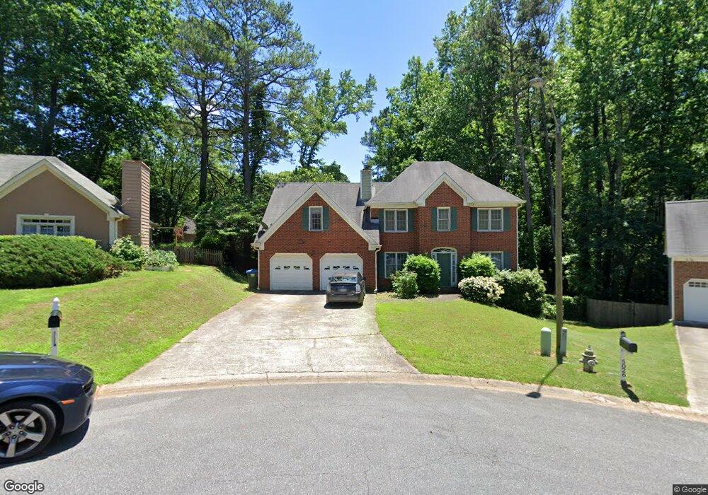
5027 Jamie Ct NE Unit 2A Woodstock, GA 30188
Sandy Plains NeighborhoodEstimated Value: $396,380 - $415,000
3
Beds
3
Baths
1,993
Sq Ft
$204/Sq Ft
Est. Value
About This Home
This home is located at 5027 Jamie Ct NE Unit 2A, Woodstock, GA 30188 and is currently estimated at $407,095, approximately $204 per square foot. 5027 Jamie Ct NE Unit 2A is a home located in Cobb County with nearby schools including Nicholson Elementary School, McCleskey Middle School, and Kell High School.
Ownership History
Date
Name
Owned For
Owner Type
Purchase Details
Closed on
May 27, 2003
Sold by
Price Robert S and Price Camille L
Bought by
Swinford Patrick H and Swinford Janice
Current Estimated Value
Home Financials for this Owner
Home Financials are based on the most recent Mortgage that was taken out on this home.
Original Mortgage
$165,600
Outstanding Balance
$72,593
Interest Rate
5.79%
Mortgage Type
New Conventional
Estimated Equity
$334,502
Purchase Details
Closed on
Apr 12, 1996
Sold by
Mustafa Muayyad M Niveen
Bought by
Price Robert S Camill
Purchase Details
Closed on
Jun 27, 1995
Sold by
Cobb Camelia Kenneth
Bought by
Mustafa Muayyad M Niveen
Create a Home Valuation Report for This Property
The Home Valuation Report is an in-depth analysis detailing your home's value as well as a comparison with similar homes in the area
Home Values in the Area
Average Home Value in this Area
Purchase History
| Date | Buyer | Sale Price | Title Company |
|---|---|---|---|
| Swinford Patrick H | $207,000 | -- | |
| Price Robert S Camill | $137,800 | -- | |
| Mustafa Muayyad M Niveen | $134,900 | -- |
Source: Public Records
Mortgage History
| Date | Status | Borrower | Loan Amount |
|---|---|---|---|
| Open | Swinford Patrick H | $165,600 | |
| Closed | Price Robert S Camill | $0 |
Source: Public Records
Tax History Compared to Growth
Tax History
| Year | Tax Paid | Tax Assessment Tax Assessment Total Assessment is a certain percentage of the fair market value that is determined by local assessors to be the total taxable value of land and additions on the property. | Land | Improvement |
|---|---|---|---|---|
| 2024 | $3,945 | $166,388 | $32,000 | $134,388 |
| 2023 | $2,573 | $128,140 | $28,000 | $100,140 |
| 2022 | $3,139 | $128,140 | $28,000 | $100,140 |
| 2021 | $2,659 | $106,188 | $22,000 | $84,188 |
| 2020 | $2,423 | $95,432 | $18,000 | $77,432 |
| 2019 | $2,237 | $86,924 | $18,000 | $68,924 |
| 2018 | $1,979 | $75,144 | $14,000 | $61,144 |
| 2017 | $1,882 | $75,144 | $14,000 | $61,144 |
| 2016 | $1,656 | $66,480 | $14,000 | $52,480 |
| 2015 | $1,698 | $66,480 | $14,000 | $52,480 |
| 2014 | $1,354 | $54,400 | $0 | $0 |
Source: Public Records
Map
Nearby Homes
- 5142 Farm Place Dr NE
- The Gavin E Plan at The Village at Shallowford - Signature Series
- The Marion A Plan at The Village at Shallowford - Classic Series
- The Cary A Plan at The Village at Shallowford - Classic Series
- 639 Tigers Eye Terrace
- 4669 Blue Topaz Trail
- 4704 Lincoln Dr NE
- 162 Ridgewood Dr
- 4793 Moonstone Trace
- 4785 Moonstone Trace
- 707 Smokey Quartz Way
- 710 Smokey Quartz Way
- 694 Smokey Quartz Way
- 4785 Moonstone NE
- 703 Smokey Quartz Way
- 706 Smokey Quartz Way
- 702 Smokey Quartz Way
- 5029 Jamie Ct NE Unit N/a
- 5029 Jamie Ct NE Unit 95
- 5029 Jamie Ct NE
- 5026 Jamie Ct NE
- 5011 Helga Ct NE
- 5009 Helga Ct NE
- 5013 Helga Ct NE Unit 2A
- 729 Jamie Way NE
- 737 Jamie Way NE Unit 2A
- 0 Helga Ct NE Unit 7224513
- 0 Helga Ct NE Unit 7161128
- 0 Helga Ct NE Unit 3206399
- 0 Helga Ct NE Unit 3168885
- 0 Helga Ct NE Unit 8743017
- 0 Helga Ct NE Unit 8293793
- 0 Helga Ct NE Unit 8284082
- 0 Helga Ct NE Unit 8156946
- 0 Helga Ct NE Unit 8061751
- 0 Helga Ct NE Unit 7630179
- 0 Helga Ct NE Unit 7013720