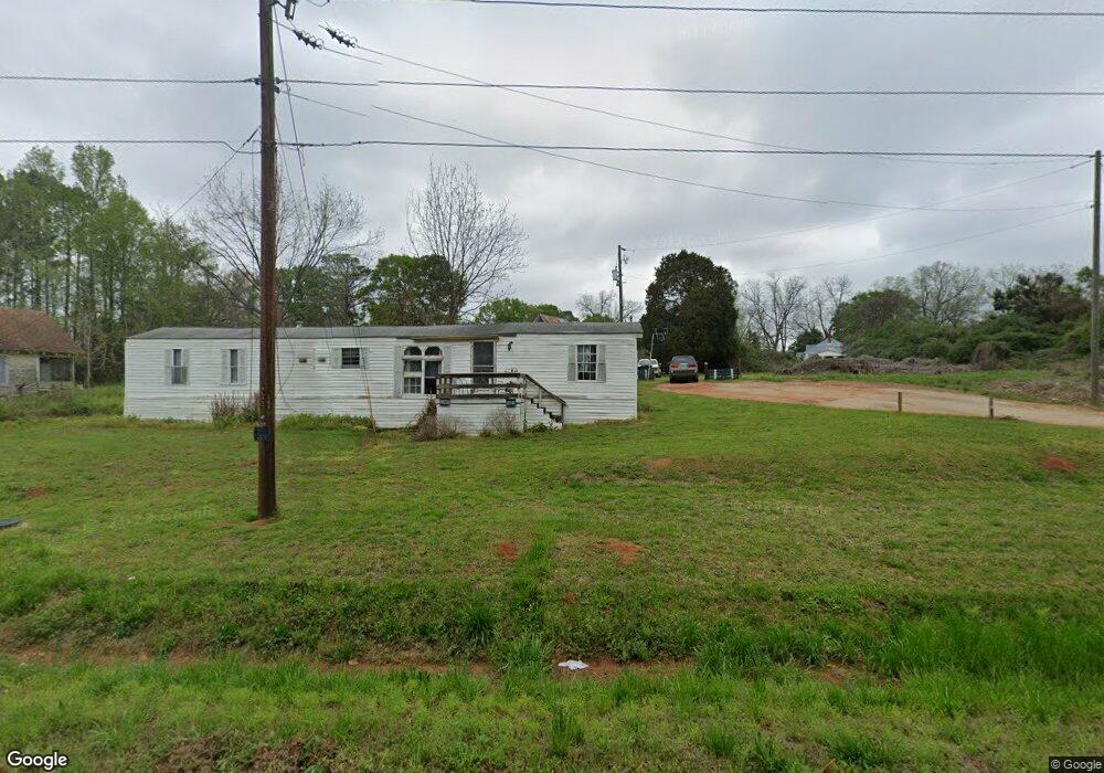
5028 Lamb Ave Union Point, GA 30669
Estimated Value: $55,089 - $136,000
2
Beds
1
Bath
865
Sq Ft
$109/Sq Ft
Est. Value
About This Home
This home is located at 5028 Lamb Ave, Union Point, GA 30669 and is currently estimated at $94,272, approximately $108 per square foot. 5028 Lamb Ave is a home with nearby schools including Greene County High School.
Ownership History
Date
Name
Owned For
Owner Type
Purchase Details
Closed on
Dec 4, 2012
Sold by
Gibson George A
Bought by
George A Lola A and George Gibson L
Current Estimated Value
Purchase Details
Closed on
Mar 2, 2010
Sold by
White Cotton Properties Llc
Bought by
Gibson George and Gibson Lola
Purchase Details
Closed on
Feb 27, 2007
Sold by
Rhodes Ralph L
Bought by
White Cotton Properties Llc
Purchase Details
Closed on
May 25, 2006
Sold by
Stewart William Joseph
Bought by
Rhodes Ralph L
Purchase Details
Closed on
Nov 19, 2003
Sold by
Ogeechee Properties--Multi Par
Bought by
Stewart William Joseph
Purchase Details
Closed on
Jan 30, 2001
Sold by
White Cotton Properties Llc
Bought by
Ogeechee Properties--Multi Par
Purchase Details
Closed on
Sep 4, 1998
Sold by
Meadows Mary Meeks
Bought by
White Cotton Properties Llc
Purchase Details
Closed on
Jun 4, 1992
Sold by
Meadows Harold
Bought by
Meadows Mary Meeks
Purchase Details
Closed on
Jan 1, 1967
Sold by
Lord David W
Bought by
Meadows Harold
Purchase Details
Closed on
Jan 1, 1966
Bought by
Lord David W
Create a Home Valuation Report for This Property
The Home Valuation Report is an in-depth analysis detailing your home's value as well as a comparison with similar homes in the area
Purchase History
| Date | Buyer | Sale Price | Title Company |
|---|---|---|---|
| George A Lola A | -- | -- | |
| Gibson George | $8,000 | -- | |
| White Cotton Properties Llc | -- | -- | |
| Rhodes Ralph L | -- | -- | |
| Stewart William Joseph | -- | -- | |
| Ogeechee Properties--Multi Par | -- | -- | |
| White Cotton Properties Llc | $23,000 | -- | |
| Meadows Mary Meeks | -- | -- | |
| Meadows Harold | -- | -- | |
| Lord David W | -- | -- |
Source: Public Records
Tax History
| Year | Tax Paid | Tax Assessment Tax Assessment Total Assessment is a certain percentage of the fair market value that is determined by local assessors to be the total taxable value of land and additions on the property. | Land | Improvement |
|---|---|---|---|---|
| 2025 | $380 | $5,440 | $3,320 | $2,120 |
| 2024 | $368 | $5,320 | $3,320 | $2,000 |
| 2023 | $320 | $5,160 | $3,320 | $1,840 |
| 2022 | $269 | $5,240 | $3,320 | $1,920 |
| 2021 | $262 | $5,000 | $3,320 | $1,680 |
| 2020 | $215 | $2,400 | $1,320 | $1,080 |
| 2019 | $216 | $2,400 | $1,320 | $1,080 |
| 2018 | $77 | $2,400 | $1,320 | $1,080 |
| 2017 | $190 | $2,456 | $1,350 | $1,106 |
| 2016 | $191 | $2,456 | $1,350 | $1,106 |
| 2015 | $164 | $2,456 | $1,350 | $1,106 |
| 2014 | $167 | $2,550 | $1,350 | $1,200 |
Source: Public Records
Map
Nearby Homes
- 509 Carlton Ave
- 202 Veazey St
- 405 Crawfordville Rd
- 1160 Moody St
- 0 Woodland Ct Unit 10543600
- 1241 Old Siloam Rd
- 324 N Rhodes St
- 215 Hunter St
- 5401 Union Point Hwy
- 1201 Buffalo Lick Rd
- 0 Buffalo Lick Rd Unit 10551234
- 0 Buffalo Lick Rd Unit 10551325
- 1071 Alexander St
- 1581 Highway 77 S
- 1581 Highway 77 S Hwy
- 000 Washington Hwy
- 0 Washington Hwy Unit 10686255
- 1251 Brick House Rd
- 1251 Brickhouse Rd
- 1251 Adams Rd
- 5020 Lamb Ave
- 100 Hendry St
- 101 Hendry St
- 4990 Lamb Ave
- 103 Carlton Ave
- 93 Carlton Ave
- 103 Hendry St
- 105 Underwood St
- 104 Hendry St
- 102 Acree St
- 33 ac Union Point Hwy
- 5081 Lamb Ave
- 202 Powers St
- 105 Hendry St
- 205 Carlton Ave
- 4970 Lamb Ave
- 42.35 ACRES Penfield Rd Rd
- 104 Dennis St
- 101 Acree St
- 4960 Lamb Ave
Your Personal Tour Guide
Ask me questions while you tour the home.