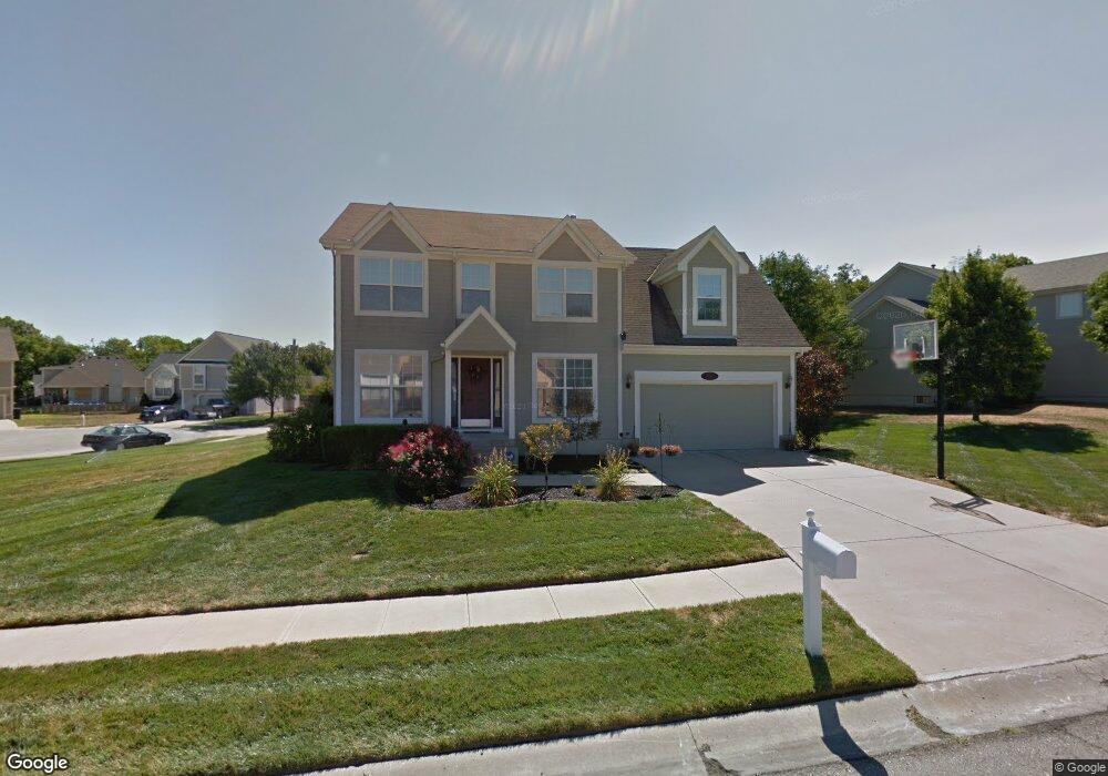
5029 S Powell Ave Blue Springs, MO 64015
Highland Manor NeighborhoodEstimated Value: $336,091 - $368,000
4
Beds
4
Baths
2,056
Sq Ft
$173/Sq Ft
Est. Value
About This Home
This home is located at 5029 S Powell Ave, Blue Springs, MO 64015 and is currently estimated at $354,773, approximately $172 per square foot. 5029 S Powell Ave is a home located in Jackson County with nearby schools including John Nowlin Elementary School, Paul Kinder Middle School, and Blue Springs High School.
Ownership History
Date
Name
Owned For
Owner Type
Purchase Details
Closed on
Nov 25, 1996
Sold by
Bell Development Inc
Bought by
Phillips Homes Llc
Current Estimated Value
Home Financials for this Owner
Home Financials are based on the most recent Mortgage that was taken out on this home.
Original Mortgage
$107,600
Interest Rate
7.54%
Mortgage Type
Purchase Money Mortgage
Create a Home Valuation Report for This Property
The Home Valuation Report is an in-depth analysis detailing your home's value as well as a comparison with similar homes in the area
Home Values in the Area
Average Home Value in this Area
Purchase History
| Date | Buyer | Sale Price | Title Company |
|---|---|---|---|
| Phillips Homes Llc | -- | Security Land Title Company |
Source: Public Records
Mortgage History
| Date | Status | Borrower | Loan Amount |
|---|---|---|---|
| Previous Owner | Phillips Homes Llc | $107,600 |
Source: Public Records
Tax History Compared to Growth
Tax History
| Year | Tax Paid | Tax Assessment Tax Assessment Total Assessment is a certain percentage of the fair market value that is determined by local assessors to be the total taxable value of land and additions on the property. | Land | Improvement |
|---|---|---|---|---|
| 2025 | $3,303 | $55,380 | $7,439 | $47,941 |
| 2024 | $3,235 | $48,157 | $6,452 | $41,705 |
| 2023 | $3,235 | $48,158 | $6,295 | $41,863 |
| 2022 | $3,516 | $45,790 | $4,982 | $40,808 |
| 2021 | $3,514 | $45,790 | $4,982 | $40,808 |
| 2020 | $3,106 | $39,878 | $4,982 | $34,896 |
| 2019 | $3,003 | $39,878 | $4,982 | $34,896 |
| 2018 | $891,111 | $34,707 | $4,336 | $30,371 |
| 2017 | $2,693 | $34,707 | $4,336 | $30,371 |
| 2016 | $2,393 | $30,970 | $5,415 | $25,555 |
| 2014 | $2,233 | $28,745 | $5,414 | $23,331 |
Source: Public Records
Map
Nearby Homes
- 20912 E 50th Street Ct S
- 405 Bellemere Rd
- 1228 NW Hidden Ridge Cir
- 0 No Address Assigned By County N A Unit HMS2492165
- 1401 NW Birdseye Ct
- 1515 NW Primrose Ln
- 1449 NW Yankee Dr
- 1490 NW Foxboro Rd
- 4705 NW Creek Side Ln
- 4902 NW Nantucket Dr
- 4301 NW Briarwood Dr
- 4513 NW Wallingford Dr
- 20301-20401 U S 40
- 6224 NE Quince Dr
- 4075 SW M 7 Hwy
- 6201 NE Upper Wood Rd
- 704 NW 39th St
- 6122 NE Upper Wood Rd
- 148 Beach Dr
- 3605 NW Dogwood Dr
- 5025 S Powell Ave
- 5020 S Powell Ave
- 5024 S Powell Ave
- 21304 E 51st St S
- 5016 S Powell Ave
- 5037 S Powell Ave
- 5013 S Powell Ave
- 21308 E 51st St S
- 5021 S Powell Ave
- 5012 S Powell Ave
- 5017 S Powell Ave
- 5028 S Powell Ave
- 21312 E 51st St S
- 5032 S Powell Ave
- 21117 E 50th Terrace Dr S
- 5007 S Powell Ave
- 5101 S Powell Ave
- 21316 E 51st St S
- 5008 S Powell Ave
- 5100 S Powell Ave