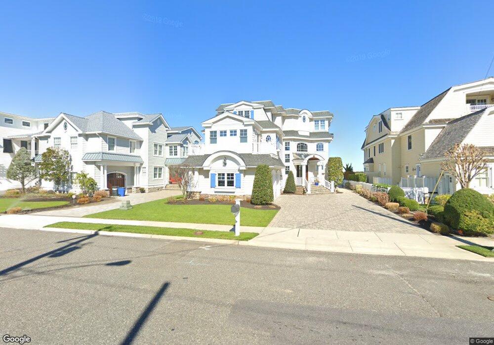
503 42nd St Avalon, NJ 08202
Estimated Value: $6,312,000 - $6,663,000
--
Bed
--
Bath
5,164
Sq Ft
$1,266/Sq Ft
Est. Value
About This Home
This home is located at 503 42nd St, Avalon, NJ 08202 and is currently estimated at $6,539,013, approximately $1,266 per square foot. 503 42nd St is a home located in Cape May County with nearby schools including Avalon Elementary School.
Ownership History
Date
Name
Owned For
Owner Type
Purchase Details
Closed on
May 30, 2008
Sold by
Zephyr Enterprises Llc
Bought by
Mccolgan Michael J and Mccolgan Angela T
Current Estimated Value
Purchase Details
Closed on
Oct 20, 2005
Sold by
Leonard Vincent and Leonard Lorraine
Bought by
Zephyr Enterprises Llc
Home Financials for this Owner
Home Financials are based on the most recent Mortgage that was taken out on this home.
Original Mortgage
$2,000,000
Interest Rate
5.62%
Mortgage Type
Fannie Mae Freddie Mac
Purchase Details
Closed on
May 15, 1991
Sold by
Nj Dep
Bought by
Leonard Vincent and Leonard Lorraine
Create a Home Valuation Report for This Property
The Home Valuation Report is an in-depth analysis detailing your home's value as well as a comparison with similar homes in the area
Home Values in the Area
Average Home Value in this Area
Purchase History
| Date | Buyer | Sale Price | Title Company |
|---|---|---|---|
| Mccolgan Michael J | $2,425,000 | None Available | |
| Zephyr Enterprises Llc | $2,495,000 | Seaboard Title Agency | |
| Leonard Vincent | $99,500 | -- |
Source: Public Records
Mortgage History
| Date | Status | Borrower | Loan Amount |
|---|---|---|---|
| Previous Owner | Zephyr Enterprises Llc | $2,000,000 |
Source: Public Records
Tax History Compared to Growth
Tax History
| Year | Tax Paid | Tax Assessment Tax Assessment Total Assessment is a certain percentage of the fair market value that is determined by local assessors to be the total taxable value of land and additions on the property. | Land | Improvement |
|---|---|---|---|---|
| 2025 | $21,304 | $3,469,700 | $2,000,000 | $1,469,700 |
| 2024 | $21,304 | $3,469,700 | $2,000,000 | $1,469,700 |
| 2023 | $21,130 | $3,469,700 | $2,000,000 | $1,469,700 |
| 2022 | $19,708 | $3,469,700 | $2,000,000 | $1,469,700 |
| 2021 | $18,979 | $3,469,700 | $2,000,000 | $1,469,700 |
| 2020 | $18,251 | $3,469,700 | $2,000,000 | $1,469,700 |
| 2019 | $17,695 | $3,469,700 | $2,000,000 | $1,469,700 |
| 2018 | $16,932 | $3,469,700 | $2,000,000 | $1,469,700 |
| 2017 | $17,926 | $3,224,100 | $1,900,000 | $1,324,100 |
| 2016 | $17,733 | $3,224,100 | $1,900,000 | $1,324,100 |
| 2015 | $17,442 | $3,224,100 | $1,900,000 | $1,324,100 |
| 2014 | $17,249 | $3,224,100 | $1,900,000 | $1,324,100 |
Source: Public Records
Map
Nearby Homes