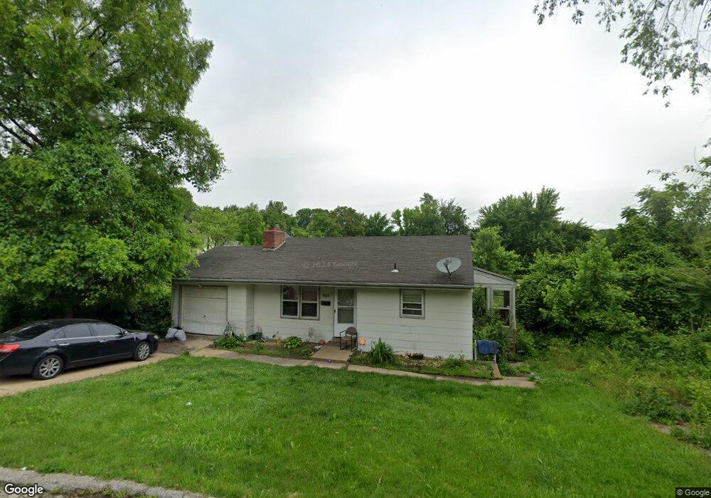
503 Abston St Ferguson, MO 63135
Estimated Value: $76,000 - $107,000
3
Beds
2
Baths
808
Sq Ft
$112/Sq Ft
Est. Value
About This Home
This home is located at 503 Abston St, Ferguson, MO 63135 and is currently estimated at $90,268, approximately $111 per square foot. 503 Abston St is a home located in St. Louis County with nearby schools including Ferguson Middle School, Johnson Wabash Elementary School, and McCluer High School.
Ownership History
Date
Name
Owned For
Owner Type
Purchase Details
Closed on
Nov 13, 2020
Sold by
Phillips Ariane
Bought by
Tamar Dohel Llc
Current Estimated Value
Purchase Details
Closed on
Dec 18, 2017
Sold by
Hla Enterprises
Bought by
Phillips Ariane
Home Financials for this Owner
Home Financials are based on the most recent Mortgage that was taken out on this home.
Original Mortgage
$14,347
Interest Rate
3.95%
Mortgage Type
New Conventional
Purchase Details
Closed on
Jun 3, 2006
Sold by
Allen Lillie
Bought by
Hla Enterprises Llc
Purchase Details
Closed on
Jan 23, 2004
Sold by
Neal Emma
Bought by
Allen Lillie
Purchase Details
Closed on
Nov 6, 2003
Sold by
Robinson Investments Co Inc
Bought by
Neal Emma
Home Financials for this Owner
Home Financials are based on the most recent Mortgage that was taken out on this home.
Original Mortgage
$60,000
Interest Rate
5.81%
Mortgage Type
Purchase Money Mortgage
Purchase Details
Closed on
Oct 23, 2003
Sold by
Saaman Corp
Bought by
Robinson Investments Inc
Home Financials for this Owner
Home Financials are based on the most recent Mortgage that was taken out on this home.
Original Mortgage
$60,000
Interest Rate
5.81%
Mortgage Type
Purchase Money Mortgage
Purchase Details
Closed on
Sep 5, 2003
Sold by
Matrix Financial Services
Bought by
Saaman Corp
Home Financials for this Owner
Home Financials are based on the most recent Mortgage that was taken out on this home.
Original Mortgage
$34,900
Interest Rate
6.1%
Mortgage Type
Purchase Money Mortgage
Purchase Details
Closed on
Apr 17, 2003
Sold by
Randle Kiesha L
Bought by
Countrywide Home Loans
Purchase Details
Closed on
Aug 26, 2002
Sold by
Kipperand Michael W and Kipper Tracy J
Bought by
Randle Kiesha L
Home Financials for this Owner
Home Financials are based on the most recent Mortgage that was taken out on this home.
Original Mortgage
$56,611
Interest Rate
6.33%
Mortgage Type
FHA
Create a Home Valuation Report for This Property
The Home Valuation Report is an in-depth analysis detailing your home's value as well as a comparison with similar homes in the area
Home Values in the Area
Average Home Value in this Area
Purchase History
| Date | Buyer | Sale Price | Title Company |
|---|---|---|---|
| Tamar Dohel Llc | -- | None Listed On Document | |
| Phillips Ariane | $20,495 | Us Title Hampton | |
| Hla Enterprises Llc | -- | None Available | |
| Allen Lillie | -- | Capital Title Co Inc | |
| Neal Emma | $60,000 | Capital Title Co Inc | |
| Robinson Investments Inc | $36,900 | -- | |
| Saaman Corp | $29,911 | -- | |
| Countrywide Home Loans | $50,400 | -- | |
| Randle Kiesha L | $56,611 | Nations Title Agency Inc |
Source: Public Records
Mortgage History
| Date | Status | Borrower | Loan Amount |
|---|---|---|---|
| Previous Owner | Phillips Ariane | $14,347 | |
| Previous Owner | Neal Emma | $60,000 | |
| Previous Owner | Robinson Investments Inc | $34,900 | |
| Previous Owner | Saaman Corp | $29,911 | |
| Previous Owner | Randle Kiesha L | $56,611 | |
| Closed | Countrywide Home Loans | -- |
Source: Public Records
Tax History Compared to Growth
Tax History
| Year | Tax Paid | Tax Assessment Tax Assessment Total Assessment is a certain percentage of the fair market value that is determined by local assessors to be the total taxable value of land and additions on the property. | Land | Improvement |
|---|---|---|---|---|
| 2025 | $1,095 | $16,730 | $1,240 | $15,490 |
| 2024 | $1,095 | $14,970 | $1,630 | $13,340 |
| 2023 | $1,095 | $14,970 | $1,630 | $13,340 |
| 2022 | $769 | $9,110 | $1,240 | $7,870 |
| 2021 | $744 | $9,110 | $1,240 | $7,870 |
| 2020 | $824 | $9,100 | $1,290 | $7,810 |
| 2019 | $809 | $9,100 | $1,290 | $7,810 |
| 2018 | $763 | $7,640 | $1,370 | $6,270 |
| 2017 | $748 | $7,640 | $1,370 | $6,270 |
| 2016 | $1,060 | $10,780 | $1,750 | $9,030 |
| 2015 | $1,067 | $10,780 | $1,750 | $9,030 |
| 2014 | $981 | $9,770 | $1,960 | $7,810 |
Source: Public Records
Map
Nearby Homes
- 218 N Marguerite Ave
- 138 N Marguerite Ave
- 415 Warford Ave
- 439 Warford Ave
- 806 Rolwes Ave
- 28 N Harvey Ave
- 53 N Dade Ave
- 810 Airport Rd
- 614 January Ave
- 213 Henquin Dr
- 116 Henquin Dr
- 215 Carson Rd
- 324 Newell Dr
- 111 Royal Ave
- 415 Wesley Ave
- 6130 Wulff Dr
- 127 Thoroughman Ave
- 601 Chanslor Ave
- 6016 Shillington Dr
- 206 Thoroughman Ave
- 503 Abston Ave
- 208 N Harvey Ave
- 501 Abston Ave
- 146 N Harvey Ave
- 145 Wabash Ave
- 214 N Harvey Ave
- 425 Abston Ave
- 427 Abston Ave
- 142 N Harvey Ave
- 601 Abston Ave
- 216 N Harvey Ave
- 424 Abston Ave
- 417 Abston Ave
- 420 Abston Ave
- 149 N Harvey Ave
- 211 N Harvey Ave
- 138 N Harvey Ave
- 413 Abston Ave
- 414 Abston Ave
- 217 N Harvey Ave