Estimated Value: $544,000 - $677,000
3
Beds
2
Baths
1,808
Sq Ft
$333/Sq Ft
Est. Value
About This Home
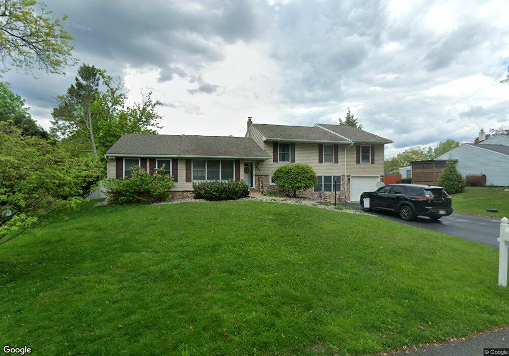
This home is located at 503 Briar Rd, Exton, PA 19341 and is currently estimated at $601,598, approximately $332 per square foot. 503 Briar Rd is a home located in Chester County with nearby schools including Exton Elementary School, J.R. Fugett Middle School, and West Chester East High School.
Ownership History
Date
Name
Owned For
Owner Type
Purchase Details
Closed on
Nov 19, 2009
Sold by
Cartus Corporation
Bought by
Mcguire Michael
Current Estimated Value
Home Financials for this Owner
Home Financials are based on the most recent Mortgage that was taken out on this home.
Original Mortgage
$232,000
Interest Rate
4.92%
Mortgage Type
New Conventional
Purchase Details
Closed on
Nov 18, 2009
Sold by
Waugh Andrew and Waugh Cheryl
Bought by
Cartus Corporation
Home Financials for this Owner
Home Financials are based on the most recent Mortgage that was taken out on this home.
Original Mortgage
$232,000
Interest Rate
4.92%
Mortgage Type
New Conventional
Create a Home Valuation Report for This Property
The Home Valuation Report is an in-depth analysis detailing your home's value as well as a comparison with similar homes in the area
Home Values in the Area
Average Home Value in this Area
Purchase History
| Date | Buyer | Sale Price | Title Company |
|---|---|---|---|
| Mcguire Michael | $290,000 | None Available | |
| Cartus Corporation | $290,000 | None Available |
Source: Public Records
Mortgage History
| Date | Status | Borrower | Loan Amount |
|---|---|---|---|
| Closed | Mcguire Michael | $232,000 |
Source: Public Records
Tax History
| Year | Tax Paid | Tax Assessment Tax Assessment Total Assessment is a certain percentage of the fair market value that is determined by local assessors to be the total taxable value of land and additions on the property. | Land | Improvement |
|---|---|---|---|---|
| 2025 | $4,338 | $149,650 | $38,400 | $111,250 |
| 2024 | $4,338 | $149,650 | $38,400 | $111,250 |
| 2023 | $4,146 | $149,650 | $38,400 | $111,250 |
| 2022 | $4,089 | $149,650 | $38,400 | $111,250 |
| 2021 | $4,030 | $149,650 | $38,400 | $111,250 |
| 2020 | $4,002 | $149,650 | $38,400 | $111,250 |
| 2019 | $3,945 | $149,650 | $38,400 | $111,250 |
| 2018 | $3,422 | $132,790 | $38,400 | $94,390 |
| 2017 | $3,344 | $132,790 | $38,400 | $94,390 |
| 2016 | $2,470 | $116,880 | $38,400 | $78,480 |
| 2015 | $2,470 | $116,880 | $38,400 | $78,480 |
| 2014 | $2,470 | $116,880 | $38,400 | $78,480 |
Source: Public Records
Map
Nearby Homes
- 167 Brazier Ln
- 233 Coffman Dr
- 217 Namar Ave
- 404 Pitch Pine Way
- 3500 Brazier Ln
- 279 Red Leaf Ln
- 3100 Brazier Ln
- 300 Bell Ct
- 2800 Brazier Ln
- 226 Red Leaf Ln
- 596 Coach Hill Ct Unit C
- 560 Astor Square Unit 6
- 542 Astor Square Unit 24J
- 1406 Timber Mill Ln
- 1 Timber Mill Ln Unit SARTO
- 5 Timber Mill Ln Unit BISCOTTO
- 3 Timber Mill Ln Unit SILENZIO
- 2 Timber Mill Ln Unit SERENO
- 143 Birchwood Dr
- 304 Huntington Ct Unit 62
Your Personal Tour Guide
Ask me questions while you tour the home.