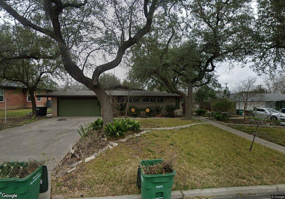
503 Burnside Dr San Antonio, TX 78209
Oak Park-Northwood NeighborhoodEstimated Value: $460,032 - $535,000
3
Beds
2
Baths
2,173
Sq Ft
$231/Sq Ft
Est. Value
About This Home
This home is located at 503 Burnside Dr, San Antonio, TX 78209 and is currently estimated at $501,258, approximately $230 per square foot. 503 Burnside Dr is a home located in Bexar County with nearby schools including Northwood Elementary School, Garner Middle School, and MacArthur High School.
Ownership History
Date
Name
Owned For
Owner Type
Purchase Details
Closed on
Feb 21, 2013
Sold by
Heard Robert W and Heard Carol L
Bought by
Dupre Kristina Kathleen
Current Estimated Value
Home Financials for this Owner
Home Financials are based on the most recent Mortgage that was taken out on this home.
Original Mortgage
$103,000
Outstanding Balance
$20,366
Interest Rate
3.43%
Mortgage Type
Purchase Money Mortgage
Estimated Equity
$480,892
Purchase Details
Closed on
May 16, 2005
Sold by
Zapata Eino
Bought by
Heard Robert W and Heard Carol L
Home Financials for this Owner
Home Financials are based on the most recent Mortgage that was taken out on this home.
Original Mortgage
$148,000
Interest Rate
4.75%
Mortgage Type
Fannie Mae Freddie Mac
Purchase Details
Closed on
Jan 20, 2005
Sold by
Onken Alice E
Bought by
Zapata Eino
Create a Home Valuation Report for This Property
The Home Valuation Report is an in-depth analysis detailing your home's value as well as a comparison with similar homes in the area
Home Values in the Area
Average Home Value in this Area
Purchase History
| Date | Buyer | Sale Price | Title Company |
|---|---|---|---|
| Dupre Kristina Kathleen | -- | Stc | |
| Heard Robert W | -- | Mission Title Lp | |
| Zapata Eino | -- | Chicago Title |
Source: Public Records
Mortgage History
| Date | Status | Borrower | Loan Amount |
|---|---|---|---|
| Open | Dupre Kristina Kathleen | $103,000 | |
| Previous Owner | Heard Robert W | $148,000 |
Source: Public Records
Tax History Compared to Growth
Tax History
| Year | Tax Paid | Tax Assessment Tax Assessment Total Assessment is a certain percentage of the fair market value that is determined by local assessors to be the total taxable value of land and additions on the property. | Land | Improvement |
|---|---|---|---|---|
| 2025 | $8,036 | $438,810 | $166,770 | $272,040 |
| 2024 | $8,036 | $438,810 | $166,770 | $272,040 |
| 2023 | $8,036 | $420,306 | $166,770 | $262,660 |
| 2022 | $9,428 | $382,096 | $145,090 | $265,130 |
| 2021 | $8,874 | $347,360 | $126,110 | $221,250 |
| 2020 | $8,646 | $333,390 | $112,200 | $221,190 |
| 2019 | $8,414 | $315,930 | $112,200 | $203,730 |
| 2018 | $7,743 | $290,000 | $89,760 | $200,240 |
| 2017 | $8,444 | $313,331 | $89,760 | $226,110 |
| 2016 | $7,676 | $284,846 | $53,130 | $237,900 |
| 2015 | $6,288 | $258,951 | $53,130 | $230,170 |
| 2014 | $6,288 | $235,410 | $0 | $0 |
Source: Public Records
Map
Nearby Homes
- 510 Burnside Dr
- 530 Burnside Dr
- 510 Woodcrest Dr
- 419 Woodcrest Dr
- 2603 Brookhurst Dr
- 351 Northridge Dr
- 318 Northridge Dr
- 215 Oakleaf Dr
- 315 Tophill Rd
- 446 Forrest Hill Dr
- 134 Rockhill Dr
- 623 E Nottingham Dr
- 2434 Toftrees Dr
- 210 Laramie Dr
- 631 Robinhood Place
- 7606 N Vandiver Rd
- 205 Larkwood Dr
- 127 Larkwood Dr
- 215 Tophill Rd
- 7238 Seidel Rd
- 507 Burnside Dr
- 455 Burnside Dr
- 270 Forrest Hill Dr
- 511 Burnside Dr
- 451 Burnside Dr
- 506 Burnside Dr
- 502 Burnside Dr
- 447 Burnside Dr
- 515 Burnside Dr
- 450 Burnside Dr
- 514 Burnside Dr
- 1715 Kenilworth Blvd
- 271 Forrest Hill Dr
- 507 Oakleaf Dr
- 443 Burnside Dr
- 515 Oakleaf Dr
- 279 Forrest Hill Dr
- 503 Oakleaf Dr
- 519 Oakleaf Dr
- 518 Burnside Dr