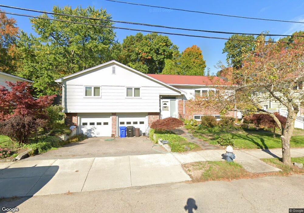
503 Clinton Rd Chestnut Hill, MA 02467
Chestnut Hill NeighborhoodEstimated Value: $1,657,754 - $2,066,000
3
Beds
3
Baths
1,718
Sq Ft
$1,108/Sq Ft
Est. Value
About This Home
This home is located at 503 Clinton Rd, Chestnut Hill, MA 02467 and is currently estimated at $1,903,939, approximately $1,108 per square foot. 503 Clinton Rd is a home located in Norfolk County with nearby schools including Heath Elementary School, Brimmer & May School, and Torah Academy.
Ownership History
Date
Name
Owned For
Owner Type
Purchase Details
Closed on
Jan 23, 1998
Sold by
Glazer Exr Dale
Bought by
Parry David L and Parry Holly
Current Estimated Value
Home Financials for this Owner
Home Financials are based on the most recent Mortgage that was taken out on this home.
Original Mortgage
$216,000
Outstanding Balance
$37,388
Interest Rate
7.11%
Mortgage Type
Purchase Money Mortgage
Estimated Equity
$1,866,551
Create a Home Valuation Report for This Property
The Home Valuation Report is an in-depth analysis detailing your home's value as well as a comparison with similar homes in the area
Home Values in the Area
Average Home Value in this Area
Purchase History
| Date | Buyer | Sale Price | Title Company |
|---|---|---|---|
| Parry David L | $365,000 | -- |
Source: Public Records
Mortgage History
| Date | Status | Borrower | Loan Amount |
|---|---|---|---|
| Open | Parry David L | $216,000 |
Source: Public Records
Tax History Compared to Growth
Tax History
| Year | Tax Paid | Tax Assessment Tax Assessment Total Assessment is a certain percentage of the fair market value that is determined by local assessors to be the total taxable value of land and additions on the property. | Land | Improvement |
|---|---|---|---|---|
| 2025 | $16,055 | $1,626,600 | $1,276,500 | $350,100 |
| 2024 | $15,267 | $1,562,600 | $1,227,400 | $335,200 |
| 2023 | $13,548 | $1,358,900 | $1,007,900 | $351,000 |
| 2022 | $13,188 | $1,294,200 | $959,900 | $334,300 |
| 2021 | $12,195 | $1,244,400 | $923,000 | $321,400 |
| 2020 | $10,915 | $1,155,000 | $839,000 | $316,000 |
| 2019 | $10,307 | $1,100,000 | $799,100 | $300,900 |
| 2018 | $10,131 | $1,070,900 | $758,000 | $312,900 |
| 2017 | $9,982 | $1,010,300 | $715,100 | $295,200 |
| 2016 | $9,839 | $944,200 | $668,300 | $275,900 |
| 2015 | $9,423 | $882,300 | $624,500 | $257,800 |
| 2014 | $9,213 | $808,900 | $574,400 | $234,500 |
Source: Public Records
Map
Nearby Homes
- 142 Crafts Rd
- 2400 Beacon St Unit 112
- 174 Middlesex Rd
- 6 Sutherland Rd Unit 41
- 44 Orkney Rd Unit 3
- 30 Ackers Ave
- 9 Willard Rd
- 41 Orkney Rd
- 540 Chestnut Hill Ave
- 31 Orkney Rd Unit 54
- 19-21 Orkney Rd
- 17 Strathmore Rd Unit 2
- 26 Chiswick Rd Unit 6
- 114 Strathmore Rd Unit 102
- 1880 Beacon St Unit 6
- 88 Strathmore Rd Unit 7
- 8 Strathmore Rd Unit G
- 76 Norfolk Rd
- 97 Strathmore Rd Unit 4
- 65 Strathmore Rd Unit 49
- 509 Clinton Rd
- 497 Clinton Rd
- 515 Clinton Rd
- 491 Clinton Rd
- 2430 Beacon St Unit 202
- 2430 Beacon St Unit 201
- 2430 Beacon St Unit 105
- 2430 Beacon St Unit 104
- 2430 Beacon St Unit 103
- 2430 Beacon St Unit 102
- 2430 Beacon St Unit 101
- 2430 Beacon St Unit Whitehal205
- 2430 Beacon St Unit Leavitt
- 2430 Beacon St Unit WM,106
- 2430 Beacon St Unit 409,WM
- 2430 Beacon St Unit 212,WM
- 2430 Beacon St Unit 412,WM
- 2430 Beacon St Unit 315,WtrMrk
- 2430 Beacon St Unit 312,WM
- 2430 Beacon St Unit PH 1,WtMrk