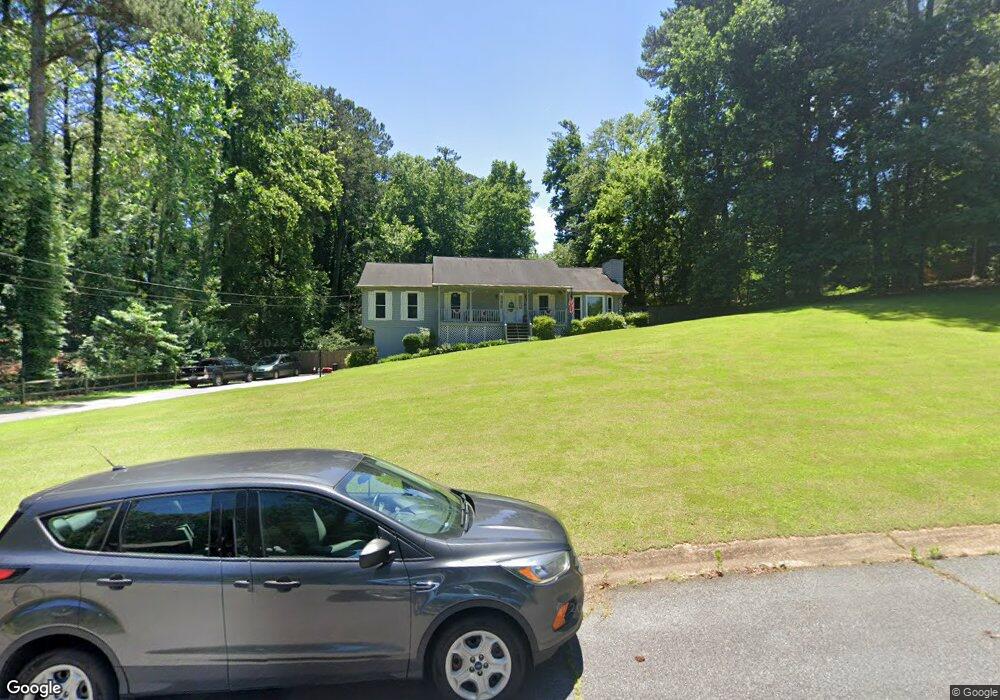
503 Deerbrook Cir Woodstock, GA 30188
Estimated Value: $407,000
3
Beds
2
Baths
1,682
Sq Ft
$242/Sq Ft
Est. Value
About This Home
This home is located at 503 Deerbrook Cir, Woodstock, GA 30188 and is currently estimated at $407,000, approximately $241 per square foot. 503 Deerbrook Cir is a home located in Cherokee County with nearby schools including Little River Elementary, Mill Creek Middle School, and River Ridge High School.
Ownership History
Date
Name
Owned For
Owner Type
Purchase Details
Closed on
Mar 24, 1993
Sold by
Brant William I and Brant Sherian L
Bought by
Yost Thomas J and Yost Christine J
Current Estimated Value
Home Financials for this Owner
Home Financials are based on the most recent Mortgage that was taken out on this home.
Original Mortgage
$107,024
Interest Rate
7.8%
Mortgage Type
FHA
Create a Home Valuation Report for This Property
The Home Valuation Report is an in-depth analysis detailing your home's value as well as a comparison with similar homes in the area
Home Values in the Area
Average Home Value in this Area
Purchase History
| Date | Buyer | Sale Price | Title Company |
|---|---|---|---|
| Yost Thomas J | $108,900 | -- |
Source: Public Records
Mortgage History
| Date | Status | Borrower | Loan Amount |
|---|---|---|---|
| Closed | Yost Thomas J | $107,024 |
Source: Public Records
Tax History Compared to Growth
Tax History
| Year | Tax Paid | Tax Assessment Tax Assessment Total Assessment is a certain percentage of the fair market value that is determined by local assessors to be the total taxable value of land and additions on the property. | Land | Improvement |
|---|---|---|---|---|
| 2025 | $3,297 | $144,516 | $34,000 | $110,516 |
| 2024 | $3,180 | $139,356 | $34,000 | $105,356 |
| 2023 | $3,100 | $133,796 | $28,000 | $105,796 |
| 2022 | $2,389 | $100,436 | $21,200 | $79,236 |
| 2021 | $2,376 | $91,276 | $20,000 | $71,276 |
| 2020 | $2,309 | $88,316 | $15,200 | $73,116 |
| 2019 | $2,037 | $76,600 | $15,200 | $61,400 |
| 2018 | $1,871 | $69,040 | $15,200 | $53,840 |
| 2017 | $1,785 | $161,900 | $12,800 | $51,960 |
| 2016 | $1,728 | $154,200 | $12,800 | $48,880 |
| 2015 | $1,593 | $141,200 | $10,000 | $46,480 |
| 2014 | $1,312 | $117,100 | $10,000 | $36,840 |
Source: Public Records
Map
Nearby Homes
- 116 Neetle Close Dr
- 205 Deerchase Dr
- 230 Apple Branch Dr
- 144 Towey Trail
- 809 Araya Ct
- 140 Apple Valley Dr
- 133 Finsbury Ln
- 154 Towey Trail
- 237 Kigian Trail
- 202 Kigian Trail
- 522 Watercress Dr
- 120 Cornerstone Place
- 236 Persimmon Dr
- 321 Burdock Trace
- 212 Regent Square
- 195 Weatherstone Dr
- 240 Village Square Dr
- 129 Regent Place
- 110 Normandy Dr
- 205 Balaban Cir
- 0 Deerbrook Cir Unit 8455435
- 0 Deerbrook Cir
- 219 Deerchase Dr
- 217 Deerchase Dr
- 505 Deerbrook Cir
- 167 Stone Manor Ct
- 165 Stone Manor Ct
- 161 Stone Manor Ct
- 215 Deerchase Dr
- 221 Deerchase Dr
- 0 Deerchase Dr Unit 7194296
- 159 Stone Manor Ct
- 157 Stone Manor Ct
- 157 Stone Manor Ct
- 213 Deerchase Dr
- 155 Stone Manor Ct
- 155 Stone Manor Ct
- 506 Deerbrook Cir
- 504 Deerbrook Cir
- 223 Deerchase Dr