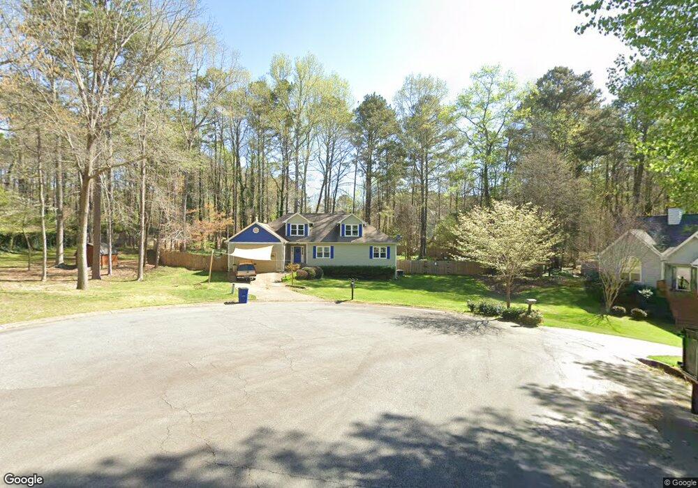
503 Dockside Ct Unit 2 Woodstock, GA 30189
Sutallee NeighborhoodEstimated Value: $396,532 - $421,000
3
Beds
2
Baths
1,967
Sq Ft
$210/Sq Ft
Est. Value
About This Home
This home is located at 503 Dockside Ct Unit 2, Woodstock, GA 30189 and is currently estimated at $413,883, approximately $210 per square foot. 503 Dockside Ct Unit 2 is a home located in Cherokee County with nearby schools including Boston Elementary School, E. T. Booth Middle School, and Etowah High School.
Ownership History
Date
Name
Owned For
Owner Type
Purchase Details
Closed on
Jan 5, 1999
Sold by
Mccurry Chris
Bought by
Nance Cheryl Lee
Current Estimated Value
Home Financials for this Owner
Home Financials are based on the most recent Mortgage that was taken out on this home.
Original Mortgage
$122,500
Interest Rate
6.77%
Mortgage Type
New Conventional
Purchase Details
Closed on
Dec 31, 1998
Sold by
Brandt Joseph J
Bought by
Mccurry Chris
Home Financials for this Owner
Home Financials are based on the most recent Mortgage that was taken out on this home.
Original Mortgage
$122,500
Interest Rate
6.77%
Mortgage Type
New Conventional
Create a Home Valuation Report for This Property
The Home Valuation Report is an in-depth analysis detailing your home's value as well as a comparison with similar homes in the area
Home Values in the Area
Average Home Value in this Area
Purchase History
Date | Buyer | Sale Price | Title Company |
---|---|---|---|
Nance Cheryl Lee | $129,000 | -- | |
Mccurry Chris | $117,600 | -- |
Source: Public Records
Mortgage History
Date | Status | Borrower | Loan Amount |
---|---|---|---|
Open | Nance Cheryl Lee | $42,500 | |
Open | Nance Cheryl Lee | $104,225 | |
Closed | Nance Cheryl L | $117,700 | |
Closed | Nance Cheryl Lee | $122,500 |
Source: Public Records
Tax History Compared to Growth
Tax History
Year | Tax Paid | Tax Assessment Tax Assessment Total Assessment is a certain percentage of the fair market value that is determined by local assessors to be the total taxable value of land and additions on the property. | Land | Improvement |
---|---|---|---|---|
2024 | $784 | $152,012 | $28,000 | $124,012 |
2023 | $642 | $151,132 | $28,000 | $123,132 |
2022 | $781 | $138,812 | $28,000 | $110,812 |
2021 | $716 | $103,128 | $23,520 | $79,608 |
2020 | $2,434 | $92,204 | $20,800 | $71,404 |
2019 | $2,150 | $79,960 | $18,600 | $61,360 |
2018 | $2,071 | $76,120 | $16,800 | $59,320 |
2017 | $1,964 | $177,100 | $16,000 | $54,840 |
2016 | $1,928 | $171,300 | $16,000 | $52,520 |
2015 | $1,822 | $160,700 | $16,000 | $48,280 |
2014 | $1,697 | $149,800 | $16,000 | $43,920 |
Source: Public Records
Map
Nearby Homes
- 308 Mainsail Ln
- 2037 Castlemaine Cir
- 408 Walnut Dr
- 0 Black Oak Trail Unit 10267626
- 0 Black Oak Trail Unit 7303191
- 291 N Briar Ridge
- 304 N Briar Ridge Unit 1
- 934 Pine Cir
- 424 Lake Point Dr
- 923 Pine Cir
- 1039 Ashfern Walk
- 264 Ascott Ln
- 230 Ascott Ln
- 404 Pine Grove Way
- 803 Willow Oak Dr
- 1019 Braelin Ct
- 112 Countryside Ct
- 609 Redwood Dr
- 128 Golden Hills Dr
- 503 Dockside Ct Unit 2
- 605 Dockside Ct
- 504 Dockside Ct
- 410 Dockside Cove
- 412 Dockside Cove Unit 2
- 302 Mainsail Ln
- 306 Mainsail Ln Unit 2
- 408 Dockside Cove
- 408 Dockside Cove
- 414 Dockside Cove Unit 2/65
- 406 Dockside Cove
- 304 Mainsail Ln
- 305 Mainsail Ln
- 0 Dockside Cove Unit 7446740
- 0 Dockside Cove Unit 7224363
- 0 Dockside Cove Unit 7109571
- 0 Dockside Cove Unit 3251273
- 0 Dockside Cove Unit 8416431
- 0 Dockside Cove Unit 8296205
- 0 Dockside Cove Unit 7637867