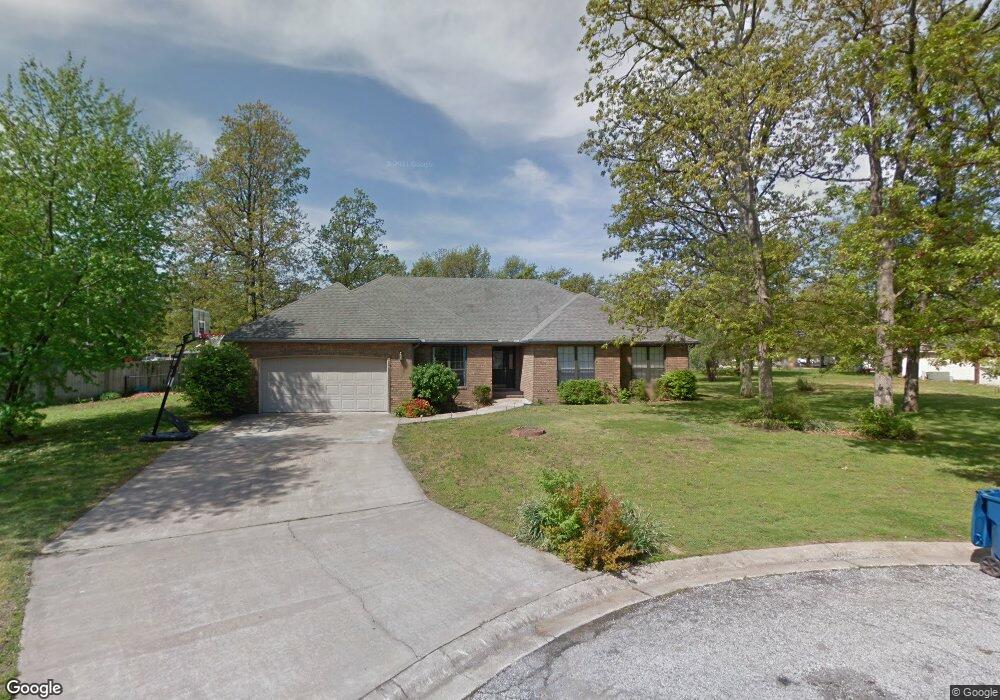
503 Eagle Cir Carl Junction, MO 64834
Briarbrook NeighborhoodEstimated Value: $277,482 - $334,000
3
Beds
2
Baths
2,166
Sq Ft
$140/Sq Ft
Est. Value
About This Home
This home is located at 503 Eagle Cir, Carl Junction, MO 64834 and is currently estimated at $302,621, approximately $139 per square foot. 503 Eagle Cir is a home located in Jasper County with nearby schools including Carl Junction Primary School (K-1), Carl Junction Intermediate School, and Carl Junction Primary School (2-3).
Ownership History
Date
Name
Owned For
Owner Type
Purchase Details
Closed on
May 8, 2019
Sold by
Jones Grant L and Jones Taylor A
Bought by
Snodgrass Alice
Current Estimated Value
Home Financials for this Owner
Home Financials are based on the most recent Mortgage that was taken out on this home.
Original Mortgage
$179,900
Outstanding Balance
$156,521
Interest Rate
4.1%
Mortgage Type
New Conventional
Estimated Equity
$146,100
Purchase Details
Closed on
Apr 18, 2016
Bought by
Jones Grant L
Home Financials for this Owner
Home Financials are based on the most recent Mortgage that was taken out on this home.
Original Mortgage
$139,650
Interest Rate
3.58%
Purchase Details
Closed on
Dec 16, 2005
Sold by
Dunn Michael P and Dunn Joy E
Bought by
Hurley Patricia A
Home Financials for this Owner
Home Financials are based on the most recent Mortgage that was taken out on this home.
Original Mortgage
$127,200
Interest Rate
6.3%
Mortgage Type
Fannie Mae Freddie Mac
Create a Home Valuation Report for This Property
The Home Valuation Report is an in-depth analysis detailing your home's value as well as a comparison with similar homes in the area
Home Values in the Area
Average Home Value in this Area
Purchase History
| Date | Buyer | Sale Price | Title Company |
|---|---|---|---|
| Snodgrass Alice | -- | -- | |
| Jones Grant L | -- | -- | |
| Hurley Patricia A | -- | -- |
Source: Public Records
Mortgage History
| Date | Status | Borrower | Loan Amount |
|---|---|---|---|
| Open | Snodgrass Alice | $179,900 | |
| Previous Owner | Jones Grant L | $139,650 | |
| Previous Owner | Jones Grant L | -- | |
| Previous Owner | Hurley Patricia A | $127,200 |
Source: Public Records
Tax History
| Year | Tax Paid | Tax Assessment Tax Assessment Total Assessment is a certain percentage of the fair market value that is determined by local assessors to be the total taxable value of land and additions on the property. | Land | Improvement |
|---|---|---|---|---|
| 2025 | $1,736 | $30,380 | $3,230 | $27,150 |
| 2024 | $1,742 | $27,380 | $3,230 | $24,150 |
| 2023 | $1,742 | $27,380 | $3,230 | $24,150 |
| 2022 | $1,835 | $28,840 | $3,230 | $25,610 |
| 2021 | $1,589 | $28,840 | $3,230 | $25,610 |
| 2020 | $1,453 | $26,040 | $3,230 | $22,810 |
| 2019 | $1,382 | $26,040 | $3,230 | $22,810 |
| 2018 | $1,352 | $25,630 | $0 | $0 |
| 2017 | $1,355 | $25,630 | $0 | $0 |
| 2016 | $1,454 | $27,720 | $0 | $0 |
| 2015 | $1,425 | $27,720 | $0 | $0 |
| 2014 | $1,425 | $27,720 | $0 | $0 |
Source: Public Records
Map
Nearby Homes
- 710 Briarbrook Dr
- 107 Foursome Ln
- 128 Par Ln
- 6548 Mo-171
- 328 Briarbrook Dr
- XXX Lone Elm
- 106 Victoria Ln
- 306 Lakeview Ln
- 232 Hickory Place
- 706 W Briarbrook Ln
- 126 N Windwood
- 121 Forest Dr
- 807 Copper Oaks Dr
- 913 W Briarbrook Ln
- 909 Silver Oaks Dr
- 9130 Missouri 171
- 201 Tee Ln
- 708 Danica Jo Ln
- 901 Black Thorn Dr
- 907 Silver Oaks Dr
- 505 Eagle Cir
- 405 Birdie Cir
- 501 Eagle Cir
- 33 Tanglewood Dr
- 31 Tanglewood Dr
- 407 Birdie Cir
- 507 Eagle Cir
- 35 Tanglewood Dr
- 603 Bunker Ln
- 402 Birdie Cir
- 701 Bunker Ln
- 403 Birdie Cir
- 500 Eagle Cir
- 29 Tanglewood Dr
- 601 Bunker Ln
- 37 Tanglewood Dr
- 401 Birdie Cir
- 406 Birdie Cir
- 24 Tanglewood Dr
- 506 Eagle Cir
Your Personal Tour Guide
Ask me questions while you tour the home.