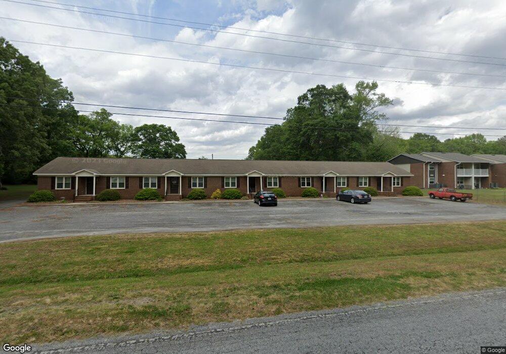
503 Fire Tower Rd La Grange, NC 28551
Estimated Value: $268,000 - $554,000
Studio
--
Bath
5,280
Sq Ft
$75/Sq Ft
Est. Value
About This Home
This home is located at 503 Fire Tower Rd, La Grange, NC 28551 and is currently estimated at $396,248, approximately $75 per square foot. 503 Fire Tower Rd is a home located in Lenoir County with nearby schools including La Grange Elementary School, E.B. Frink Middle School, and North Lenoir High School.
Ownership History
Date
Name
Owned For
Owner Type
Purchase Details
Closed on
Dec 14, 2016
Bought by
Davis James Israel
Current Estimated Value
Home Financials for this Owner
Home Financials are based on the most recent Mortgage that was taken out on this home.
Original Mortgage
$125,000
Outstanding Balance
$102,789
Interest Rate
4.13%
Estimated Equity
$293,459
Create a Home Valuation Report for This Property
The Home Valuation Report is an in-depth analysis detailing your home's value as well as a comparison with similar homes in the area
Home Values in the Area
Average Home Value in this Area
Purchase History
| Date | Buyer | Sale Price | Title Company |
|---|---|---|---|
| Davis James Israel | -- | -- |
Source: Public Records
Mortgage History
| Date | Status | Borrower | Loan Amount |
|---|---|---|---|
| Open | Davis James Israel | $125,000 | |
| Closed | Davis James Israel | -- |
Source: Public Records
Tax History
| Year | Tax Paid | Tax Assessment Tax Assessment Total Assessment is a certain percentage of the fair market value that is determined by local assessors to be the total taxable value of land and additions on the property. | Land | Improvement |
|---|---|---|---|---|
| 2025 | $3,093 | $308,259 | $36,068 | $272,191 |
| 2024 | $2,682 | $194,739 | $20,000 | $174,739 |
| 2023 | $2,682 | $194,739 | $20,000 | $174,739 |
| 2022 | $2,682 | $194,739 | $20,000 | $174,739 |
| 2021 | $2,682 | $194,739 | $20,000 | $174,739 |
| 2020 | $2,682 | $194,739 | $20,000 | $174,739 |
| 2019 | $2,682 | $194,739 | $20,000 | $174,739 |
| 2018 | $2,652 | $194,739 | $20,000 | $174,739 |
| 2017 | $2,662 | $194,739 | $20,000 | $174,739 |
| 2014 | $2,469 | $192,129 | $14,448 | $177,681 |
| 2013 | -- | $192,129 | $14,448 | $177,681 |
| 2011 | -- | $192,129 | $14,448 | $177,681 |
Source: Public Records
Map
Nearby Homes
- 805 Madison Ann Dr
- 605 Firetower Rd
- 107 Claude St
- 102 Claude St
- 106 Claude St
- Hayden Plan at Blair Ridge
- Freeport Plan at Blair Ridge
- KYLE - EXPRESS Plan at Blair Ridge
- Cali Plan at Blair Ridge
- Belhaven Plan at Blair Ridge
- 202 Wood St
- 206 Wood St
- 104 Claude St
- 202 Spence St
- 108 Claude St
- Plan 1602-2 at Blair Ridge
- Plan 2030 at Blair Ridge
- Plan 1902 at Blair Ridge
- Plan 1727 at Blair Ridge
- Plan 2100 at Blair Ridge
- 501 Fire Tower Rd
- 501 Firetower Rd
- 504 Fire Tower Rd
- 0 Firetower Rd
- 409 Fire Tower Rd
- 502 Fire Tower Rd
- 410 Fire Tower Rd
- 407 Firetower Rd
- 407 Fire Tower Rd
- 802 Madison Ann Dr Unit Lot 49
- 802 Madison Ann Dr
- 706 Madison Ann Dr Unit Lot 48
- 706 Madison Ann Dr
- 804 Madison Ann Dr
- 408 Fire Tower Rd
- 407 Spence St
- 403 Fire Tower Rd
- 806 Madison Ann Dr
- 704 Madison Ann Dr
- 515 Fire Tower Rd
Your Personal Tour Guide
Ask me questions while you tour the home.