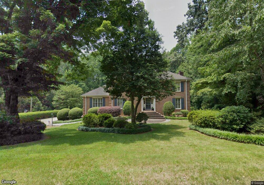
503 Garrison Dr Kings Mountain, NC 28086
Estimated Value: $389,000 - $620,000
--
Bed
--
Bath
3,774
Sq Ft
$138/Sq Ft
Est. Value
About This Home
This home is located at 503 Garrison Dr, Kings Mountain, NC 28086 and is currently estimated at $519,562, approximately $137 per square foot. 503 Garrison Dr is a home located in Cleveland County with nearby schools including North Elementary School, Kings Mountain Intermediate School, and Kings Mountain Middle.
Ownership History
Date
Name
Owned For
Owner Type
Purchase Details
Closed on
Mar 17, 2021
Sold by
Propst Allan M and Propst Patricia H
Bought by
Boyd Laura Propst and Boyd Eric Glenn
Current Estimated Value
Home Financials for this Owner
Home Financials are based on the most recent Mortgage that was taken out on this home.
Original Mortgage
$160,000
Outstanding Balance
$117,407
Interest Rate
2.2%
Mortgage Type
Seller Take Back
Estimated Equity
$402,155
Create a Home Valuation Report for This Property
The Home Valuation Report is an in-depth analysis detailing your home's value as well as a comparison with similar homes in the area
Home Values in the Area
Average Home Value in this Area
Purchase History
| Date | Buyer | Sale Price | Title Company |
|---|---|---|---|
| Boyd Laura Propst | $360,000 | None Available |
Source: Public Records
Mortgage History
| Date | Status | Borrower | Loan Amount |
|---|---|---|---|
| Open | Boyd Laura Propst | $160,000 |
Source: Public Records
Tax History Compared to Growth
Tax History
| Year | Tax Paid | Tax Assessment Tax Assessment Total Assessment is a certain percentage of the fair market value that is determined by local assessors to be the total taxable value of land and additions on the property. | Land | Improvement |
|---|---|---|---|---|
| 2025 | $5,209 | $508,186 | $21,000 | $487,186 |
| 2024 | $3,704 | $315,088 | $16,800 | $298,288 |
| 2023 | $3,685 | $315,088 | $16,800 | $298,288 |
| 2022 | $3,528 | $315,088 | $16,800 | $298,288 |
| 2021 | $3,568 | $315,088 | $16,800 | $298,288 |
| 2020 | $2,884 | $247,732 | $13,843 | $233,889 |
| 2019 | $2,871 | $247,732 | $13,843 | $233,889 |
| 2018 | $2,898 | $247,732 | $13,843 | $233,889 |
| 2017 | $2,885 | $247,732 | $13,843 | $233,889 |
| 2016 | $2,899 | $247,732 | $13,843 | $233,889 |
| 2015 | $3,053 | $268,097 | $13,440 | $254,657 |
| 2014 | $3,055 | $268,097 | $13,440 | $254,657 |
Source: Public Records
Map
Nearby Homes
- 1417 Merrimont Ave
- 521 Coman Ln
- 117 Parker Claire Ln
- 111 Parker Claire Ln
- 213 Parker Claire Ln
- 1427 Merrimont Ave
- 208 Victoria Cir
- 155 Patterson Rd
- 1301 Shelby Rd
- 167 Patterson Rd
- 1500 Shelby Rd
- 104 Edison St
- 442 Phifer Rd
- 1610 Shelby Rd
- 417 Phifer Rd
- 524 Waco Rd
- 522 Waco Rd
- 811 W Gold St Unit 26
- 430 Fulton Dr
- 300 N Watterson St
- 505 Garrison Dr
- 501 Garrison Dr
- 1206 Townsend Terrace
- 1221 Wales Rd
- 1222 Wales Rd
- 407 Garrison Dr
- 1204 Townsend Terrace
- 1308 Wales Rd
- 1305 Wales Rd
- 406 Garrison Dr
- 1218 Wales Rd
- 1202 Townsend Terrace
- 1414 Merrimont Ave
- N/A Wales Rd
- 1201 Townsend Terrace
- 404 Garrison Dr
- 1213 Wales Rd
- 405 Garrison Dr
- 1416 Merrimont Ave
- 1410 Merrimont Ave