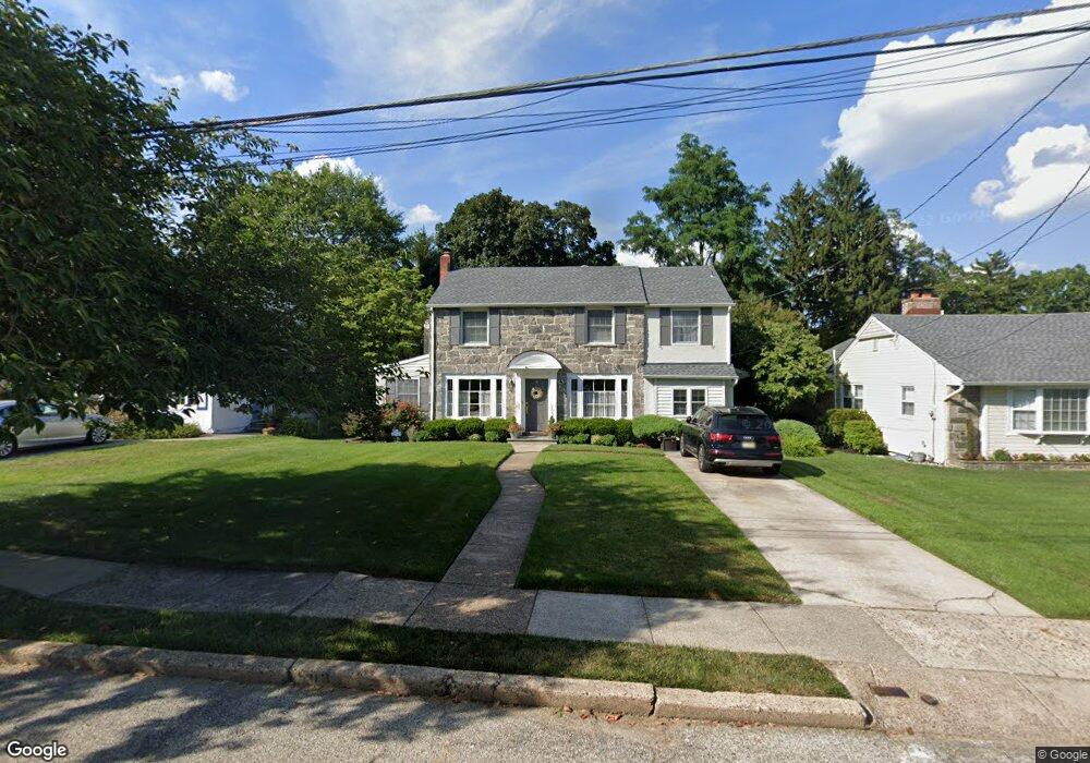
503 Homestead Ave Haddonfield, NJ 08033
Haddon Township NeighborhoodEstimated Value: $674,000 - $785,000
--
Bed
--
Bath
2,667
Sq Ft
$276/Sq Ft
Est. Value
About This Home
This home is located at 503 Homestead Ave, Haddonfield, NJ 08033 and is currently estimated at $736,305, approximately $276 per square foot. 503 Homestead Ave is a home located in Camden County with nearby schools including William G. Rohrer Middle School, Haddon Township High School, and Brookfield Elementary School.
Ownership History
Date
Name
Owned For
Owner Type
Purchase Details
Closed on
Jul 16, 1996
Sold by
Wilson Shirley
Bought by
Gory Gee and Hart Wendy
Current Estimated Value
Home Financials for this Owner
Home Financials are based on the most recent Mortgage that was taken out on this home.
Original Mortgage
$65,000
Outstanding Balance
$4,699
Interest Rate
8.24%
Estimated Equity
$731,606
Create a Home Valuation Report for This Property
The Home Valuation Report is an in-depth analysis detailing your home's value as well as a comparison with similar homes in the area
Home Values in the Area
Average Home Value in this Area
Purchase History
| Date | Buyer | Sale Price | Title Company |
|---|---|---|---|
| Gory Gee | $180,000 | -- |
Source: Public Records
Mortgage History
| Date | Status | Borrower | Loan Amount |
|---|---|---|---|
| Open | Gory Gee | $65,000 |
Source: Public Records
Tax History Compared to Growth
Tax History
| Year | Tax Paid | Tax Assessment Tax Assessment Total Assessment is a certain percentage of the fair market value that is determined by local assessors to be the total taxable value of land and additions on the property. | Land | Improvement |
|---|---|---|---|---|
| 2025 | $14,782 | $620,300 | $161,800 | $458,500 |
| 2024 | $14,342 | $354,900 | $97,400 | $257,500 |
| 2023 | $14,342 | $354,900 | $97,400 | $257,500 |
| 2022 | $14,079 | $354,900 | $97,400 | $257,500 |
| 2021 | $14,185 | $354,900 | $97,400 | $257,500 |
| 2020 | $14,026 | $354,900 | $97,400 | $257,500 |
| 2019 | $13,518 | $354,900 | $97,400 | $257,500 |
| 2018 | $13,433 | $354,900 | $97,400 | $257,500 |
| 2017 | $13,202 | $354,900 | $97,400 | $257,500 |
| 2016 | $12,954 | $354,900 | $97,400 | $257,500 |
| 2015 | $12,532 | $354,900 | $97,400 | $257,500 |
| 2014 | $12,315 | $354,900 | $97,400 | $257,500 |
Source: Public Records
Map
Nearby Homes
- 656 W Crystal Lake Ave
- 38 Birchall Dr
- 210 Carlisle Rd
- 634 W Redman Ave
- 162 Princeton Rd
- 233 E Kings Hwy
- 219 Lafayette Rd
- 2 Loucroft Ave
- 208 E Pine St
- 108 Avondale Ave
- 315 Peyton Ave
- 249 S Davis Ave
- 341 Station Ave
- 428 Mansfield Ave
- 501 Rhoads Ave
- 47 E Kings Hwy
- 229 S Lecato Ave
- 103 White Horse Pike
- 63 Truman Ave
- 109 White Horse Pike
- 501 Homestead Ave
- 505 Homestead Ave
- 507 Homestead Ave
- 607 W Crystal Lake Ave
- 611 W Crystal Lake Ave
- 804 W Redman Ave
- 615 W Crystal Lake Ave
- 808 W Redman Ave
- 504 Homestead Ave
- 502 Homestead Ave
- 506 Homestead Ave
- 810 W Redman Ave
- 603 W Crystal Lake Ave
- 653 W Crystal Lake Ave
- 509 Homestead Ave
- 508 Homestead Ave
- 812 W Redman Ave
- 510 Homestead Ave
- 259 Bewley Rd
- 650 W Crystal Lake Ave