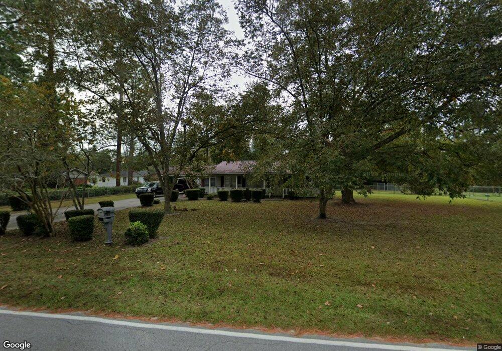
503 Linwood Dr Waycross, GA 31501
Estimated Value: $154,760 - $211,000
3
Beds
2
Baths
1,694
Sq Ft
$111/Sq Ft
Est. Value
About This Home
This home is located at 503 Linwood Dr, Waycross, GA 31501 and is currently estimated at $187,440, approximately $110 per square foot. 503 Linwood Dr is a home located in Ware County with nearby schools including Center Elementary School, Waycross Middle School, and Ware County High School.
Ownership History
Date
Name
Owned For
Owner Type
Purchase Details
Closed on
Mar 20, 2019
Sold by
Crews Charlie H
Bought by
Crews Crews Harold Stuart Harold Stuart and Crews Meeks Amanda Renee
Current Estimated Value
Purchase Details
Closed on
May 3, 2012
Sold by
White Gary
Bought by
Crews Charlie H and Crews Linda F
Purchase Details
Closed on
Jan 27, 2011
Sold by
Us Bank National Association
Bought by
White Gary
Purchase Details
Closed on
Sep 7, 2010
Sold by
Yvonne Melissa and Batten Anthony Daniel
Bought by
Us Bank National Association
Purchase Details
Closed on
May 11, 2001
Sold by
Whitted Carolyn S
Bought by
Winchester Sherman and Winchester Irene
Purchase Details
Closed on
Aug 17, 1988
Bought by
Whitted Carolyn S
Create a Home Valuation Report for This Property
The Home Valuation Report is an in-depth analysis detailing your home's value as well as a comparison with similar homes in the area
Home Values in the Area
Average Home Value in this Area
Purchase History
| Date | Buyer | Sale Price | Title Company |
|---|---|---|---|
| Crews Crews Harold Stuart Harold Stuart | -- | -- | |
| Crews Charlie H | $47,000 | -- | |
| White Gary | $52,500 | -- | |
| Us Bank National Association | $56,989 | -- | |
| Winchester Sherman | $65,000 | -- | |
| Whitted Carolyn S | -- | -- |
Source: Public Records
Tax History Compared to Growth
Tax History
| Year | Tax Paid | Tax Assessment Tax Assessment Total Assessment is a certain percentage of the fair market value that is determined by local assessors to be the total taxable value of land and additions on the property. | Land | Improvement |
|---|---|---|---|---|
| 2024 | $1,421 | $61,632 | $4,050 | $57,582 |
| 2023 | $1,586 | $45,336 | $3,144 | $42,192 |
| 2022 | $1,309 | $45,336 | $3,144 | $42,192 |
| 2021 | $872 | $32,725 | $3,144 | $29,581 |
| 2020 | $1,006 | $31,724 | $3,144 | $28,580 |
| 2019 | $809 | $25,012 | $3,144 | $21,868 |
| 2018 | $785 | $24,047 | $3,144 | $20,903 |
| 2017 | $784 | $24,047 | $3,144 | $20,903 |
| 2016 | $784 | $24,047 | $3,144 | $20,903 |
| 2015 | $791 | $24,046 | $3,144 | $20,903 |
| 2014 | $790 | $24,047 | $3,144 | $20,903 |
| 2013 | -- | $24,046 | $3,144 | $20,902 |
Source: Public Records
Map
Nearby Homes
- 404 Community Dr
- 601 Community Dr
- 2099 Ridge Rd
- 2706 Alice St
- 607 Linden Dr
- 2123 Sunnyside Dr
- 2509 Tebeau St
- 2312 Spurgeon St
- 1013 E Waring St
- 2108 Screven Ave
- 2202 Pioneer St
- 2120 Tebeau St
- 904 Golfview Dr
- 128 Satilla Bluffs Dr
- 515 Summit St
- 00 Pineview Dr
- 0 Pineview Dr
- 1206 Morningside Dr
- 107 Plantation Pines Dr
- 101 Plantation Pines Dr
- 2003 Russell Rd
- 507 Linwood Dr
- 508 Kenwood Dr
- 2110 Russell Rd
- 2001 Russell Rd
- 2101 Russell Rd
- 510 Kenwood Dr
- 511 Linwood Dr
- 0 Russell Rd
- 511 Kenwood Dr
- 1905 Russell Rd
- 507 Sonidale Dr
- Lot 13 Sonidale Dr
- 513 Kenwood Dr
- 0 Kenwood Dr
- 516 Linwood Dr Unit Dr.
- 516 Linwood Dr
- 512 Kenwood Dr
- 515 Linwood Dr
- 527 Kenwood Dr