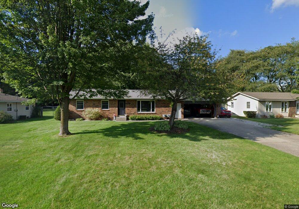
503 Myra Ln Holland, MI 49424
Estimated Value: $302,063 - $354,000
--
Bed
1
Bath
1,272
Sq Ft
$255/Sq Ft
Est. Value
About This Home
This home is located at 503 Myra Ln, Holland, MI 49424 and is currently estimated at $323,766, approximately $254 per square foot. 503 Myra Ln is a home located in Ottawa County with nearby schools including Woodside Elementary School, Macatawa Bay Middle School, and West Ottawa High School.
Ownership History
Date
Name
Owned For
Owner Type
Purchase Details
Closed on
Jun 17, 2009
Sold by
Hanko Mitchell
Bought by
Hanko Laura and Hanko Mitchell
Current Estimated Value
Purchase Details
Closed on
Jul 23, 2004
Sold by
Hamstra Mark and Hamstra Tracy
Bought by
Hanko Mitchell W
Home Financials for this Owner
Home Financials are based on the most recent Mortgage that was taken out on this home.
Original Mortgage
$135,000
Outstanding Balance
$68,237
Interest Rate
6.4%
Mortgage Type
Purchase Money Mortgage
Estimated Equity
$255,529
Create a Home Valuation Report for This Property
The Home Valuation Report is an in-depth analysis detailing your home's value as well as a comparison with similar homes in the area
Home Values in the Area
Average Home Value in this Area
Purchase History
| Date | Buyer | Sale Price | Title Company |
|---|---|---|---|
| Hanko Laura | -- | None Available | |
| Hanko Mitchell W | $150,000 | Chicago Title |
Source: Public Records
Mortgage History
| Date | Status | Borrower | Loan Amount |
|---|---|---|---|
| Open | Hanko Mitchell W | $135,000 |
Source: Public Records
Tax History Compared to Growth
Tax History
| Year | Tax Paid | Tax Assessment Tax Assessment Total Assessment is a certain percentage of the fair market value that is determined by local assessors to be the total taxable value of land and additions on the property. | Land | Improvement |
|---|---|---|---|---|
| 2025 | $2,325 | $134,900 | $0 | $0 |
| 2024 | $1,762 | $130,700 | $0 | $0 |
| 2023 | $1,700 | $105,600 | $0 | $0 |
| 2022 | $2,183 | $99,100 | $0 | $0 |
| 2021 | $2,122 | $91,000 | $0 | $0 |
| 2020 | $2,048 | $84,400 | $0 | $0 |
| 2019 | $2,015 | $65,200 | $0 | $0 |
| 2018 | $1,870 | $79,200 | $14,000 | $65,200 |
| 2017 | $1,841 | $74,800 | $0 | $0 |
| 2016 | $1,831 | $70,100 | $0 | $0 |
| 2015 | $1,753 | $65,500 | $0 | $0 |
| 2014 | $1,753 | $59,800 | $0 | $0 |
Source: Public Records
Map
Nearby Homes
- 785 Mary Ave
- 790 Mayfield Ave
- 781 Shadybrook Dr
- 14145 Carol St
- 961 Shadybrook Dr
- 888 S Kingwood Ct
- 14298 Carol St
- 490 James St
- 14159 Pheasant Run
- 14061 Pheasant Run
- 2604 William Ave
- 582 Hayes St
- 450 N Division Ave
- 2918 Foxboro Ln
- V/L Valley View Ave
- 125 Liberty St
- 1020 Katra Ln Unit 52
- 479 Cherry Ln
- 459 Cherry Ln Unit 45
- 320 Aniline Ave N Unit 10