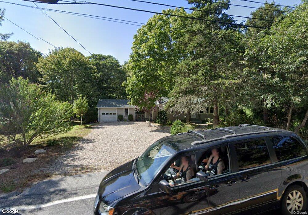
503 N Dennis Rd Yarmouth Port, MA 02675
Yarmouth Port NeighborhoodEstimated Value: $588,000 - $685,000
3
Beds
2
Baths
1,501
Sq Ft
$419/Sq Ft
Est. Value
About This Home
This home is located at 503 N Dennis Rd, Yarmouth Port, MA 02675 and is currently estimated at $628,960, approximately $419 per square foot. 503 N Dennis Rd is a home located in Barnstable County with nearby schools including Dennis-Yarmouth Regional High School and St. Pius X. School.
Ownership History
Date
Name
Owned For
Owner Type
Purchase Details
Closed on
Dec 13, 2018
Sold by
Hayes Christian E and Hayes Amy M
Bought by
Hayes Christian E
Current Estimated Value
Purchase Details
Closed on
Nov 28, 1997
Sold by
Keysar Kevin J and Keysar Elizabeth J
Bought by
Hayes Christian E and Hayes Amy M
Home Financials for this Owner
Home Financials are based on the most recent Mortgage that was taken out on this home.
Original Mortgage
$113,050
Interest Rate
7.26%
Mortgage Type
Purchase Money Mortgage
Purchase Details
Closed on
Jun 10, 1994
Sold by
Colkatine Rt and Williamson
Bought by
Keysar Kevin J and Keysar Elizabeth J
Create a Home Valuation Report for This Property
The Home Valuation Report is an in-depth analysis detailing your home's value as well as a comparison with similar homes in the area
Home Values in the Area
Average Home Value in this Area
Purchase History
| Date | Buyer | Sale Price | Title Company |
|---|---|---|---|
| Hayes Christian E | -- | -- | |
| Hayes Christian E | $119,000 | -- | |
| Keysar Kevin J | $110,000 | -- |
Source: Public Records
Mortgage History
| Date | Status | Borrower | Loan Amount |
|---|---|---|---|
| Previous Owner | Keysar Kevin J | $50,000 | |
| Previous Owner | Keysar Kevin J | $123,300 | |
| Previous Owner | Keysar Kevin J | $123,300 | |
| Previous Owner | Keysar Kevin J | $113,050 |
Source: Public Records
Tax History Compared to Growth
Tax History
| Year | Tax Paid | Tax Assessment Tax Assessment Total Assessment is a certain percentage of the fair market value that is determined by local assessors to be the total taxable value of land and additions on the property. | Land | Improvement |
|---|---|---|---|---|
| 2025 | $3,332 | $470,600 | $162,400 | $308,200 |
| 2024 | $3,308 | $448,300 | $171,600 | $276,700 |
| 2023 | $3,420 | $421,700 | $153,300 | $268,400 |
| 2022 | $3,132 | $341,200 | $138,200 | $203,000 |
| 2021 | $3,099 | $324,200 | $138,200 | $186,000 |
| 2020 | $3,034 | $303,400 | $139,600 | $163,800 |
| 2019 | $2,866 | $283,800 | $139,600 | $144,200 |
| 2018 | $2,654 | $257,900 | $113,700 | $144,200 |
| 2017 | $2,584 | $257,900 | $113,700 | $144,200 |
| 2016 | $2,471 | $247,600 | $103,400 | $144,200 |
| 2015 | $2,357 | $234,800 | $103,400 | $131,400 |
Source: Public Records
Map
Nearby Homes
- 13 Covey Dr
- 6 Nimble Hill Dr
- 59 Main St Unit 19-2
- 59 Route 6a Unit 29-4
- 111 Merchant Ave
- 4 Ebb Rd
- 44 Stratford Ln
- 51 Bray Farm Rd N
- 153 Bayridge Dr
- 268 Main St
- 11 Uncle Stanleys Way
- 64 Kates Path
- 34 Kates Path
- 34 Kates Path Unit 34
- 43 Canterbury Rd
- 86 Pompano Rd
- 15 Captain Jud Rd
- 17 Kates Path Unit A
- 228 Kates Path
- 507 N Dennis Rd
- 497 N Dennis Rd
- 515 N Dennis Rd
- 491 N Dennis Rd
- 510 N Dennis Rd
- 485 N Dennis Rd
- 9 S Yarmouth Rd
- 490 N Dennis Rd
- 59 Covey Dr
- 8 S Yarmouth Rd
- 11 S Yarmouth Rd
- 2 S Yarmouth Rd
- 479 N Dennis Rd
- 170 Setucket Rd
- 14 S Yarmouth Rd
- 31 Plymouth Rd
- 8 Boulder Cir
- 2 Boulder Cir
- 33 Plymouth Rd
- 174 Setucket Rd