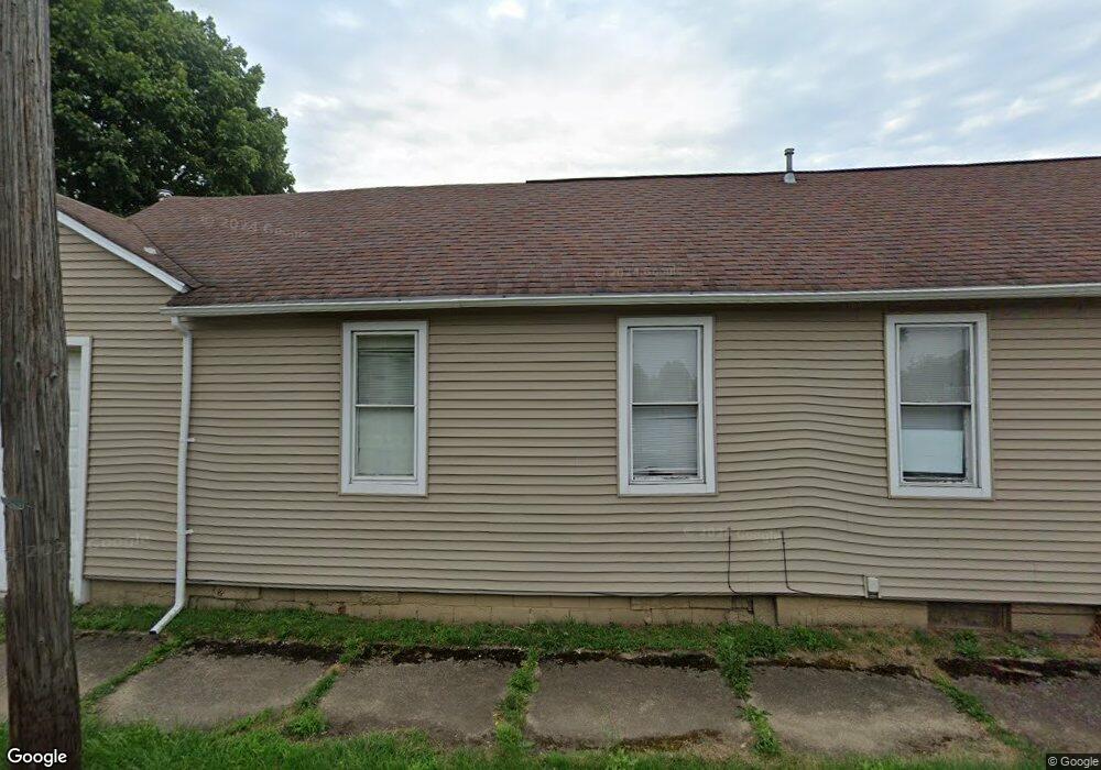
503 N Park Ave Alliance, OH 44601
Estimated Value: $86,000 - $107,000
2
Beds
2
Baths
1,056
Sq Ft
$91/Sq Ft
Est. Value
About This Home
This home is located at 503 N Park Ave, Alliance, OH 44601 and is currently estimated at $96,000, approximately $90 per square foot. 503 N Park Ave is a home located in Stark County with nearby schools including Alliance Early Learning School, Alliance Intermediate School at Northside, and Alliance Middle School.
Ownership History
Date
Name
Owned For
Owner Type
Purchase Details
Closed on
Nov 8, 2022
Sold by
Talll Rentals I Llc
Bought by
Spumante Properties Llc
Current Estimated Value
Home Financials for this Owner
Home Financials are based on the most recent Mortgage that was taken out on this home.
Original Mortgage
$225,000
Outstanding Balance
$218,187
Interest Rate
7.08%
Mortgage Type
New Conventional
Estimated Equity
-$122,187
Purchase Details
Closed on
Jul 30, 2020
Sold by
Johnson Larry F and Johnson Julia
Bought by
Talll Rentals Ii Llc
Purchase Details
Closed on
Jul 26, 2002
Sold by
Brady Donald P and Brady Beulah M
Bought by
Johnson Larry F and Johnson Julia
Create a Home Valuation Report for This Property
The Home Valuation Report is an in-depth analysis detailing your home's value as well as a comparison with similar homes in the area
Home Values in the Area
Average Home Value in this Area
Purchase History
| Date | Buyer | Sale Price | Title Company |
|---|---|---|---|
| Spumante Properties Llc | $215,000 | Heritage Union Title | |
| Talll Rentals Ii Llc | $57,000 | Heritage Union Title Co Ltd | |
| Johnson Larry F | $3,000 | -- |
Source: Public Records
Mortgage History
| Date | Status | Borrower | Loan Amount |
|---|---|---|---|
| Open | Spumante Properties Llc | $225,000 |
Source: Public Records
Tax History Compared to Growth
Tax History
| Year | Tax Paid | Tax Assessment Tax Assessment Total Assessment is a certain percentage of the fair market value that is determined by local assessors to be the total taxable value of land and additions on the property. | Land | Improvement |
|---|---|---|---|---|
| 2025 | -- | $14,530 | $4,730 | $9,800 |
| 2024 | -- | $14,530 | $4,730 | $9,800 |
| 2023 | $555 | $13,480 | $2,380 | $11,100 |
| 2022 | $554 | $13,370 | $2,380 | $10,990 |
| 2021 | $556 | $13,370 | $2,380 | $10,990 |
| 2020 | $400 | $9,000 | $1,720 | $7,280 |
| 2019 | $395 | $10,260 | $1,720 | $8,540 |
| 2018 | $452 | $10,260 | $1,720 | $8,540 |
| 2017 | $418 | $9,320 | $1,440 | $7,880 |
| 2016 | $422 | $9,320 | $1,440 | $7,880 |
| 2015 | $425 | $9,320 | $1,440 | $7,880 |
| 2014 | $301 | $6,270 | $1,540 | $4,730 |
| 2013 | $150 | $6,270 | $1,540 | $4,730 |
Source: Public Records
Map
Nearby Homes
- 710 N Freedom Ave
- 124 E Wayne St
- 361 E Main St
- 163 W Market St
- 652 N Webb Ave
- 132 S Haines Ave
- 356 E Broadway St
- 329 1/2 W Main St
- 511 W Ely St
- 142 S Seneca Ave
- 345 W Market St
- 263 Franklin Ave
- 427 S Union Ave
- 11344 Walnut Ave NE
- V/L S Fredeom Ave
- 432 S Linden Ave
- 11310 Webb Ave NE
- 1214 Jersey St
- 452 E Summit St
- 140 W Summit St
- 521 1st St
- 517 N Park Ave
- 508 1st St
- 553 Hester Ave
- 506 N Park Ave
- 549 Hester Ave
- 716 N Freedom Ave
- 537 1st St
- 704 N Freedom Ave
- 520 N Park Ave
- 541 Hester Ave
- 512 N Park Ave
- 658 N Freedom Ave
- 40 E Washington St
- 531 Hester Ave
- 536 N Park Ave
- 646 N Freedom Ave
- 646 N Freedom Ave Unit 646 N. Freedom
- 634 N Freedom Ave
- 546 N Park Ave