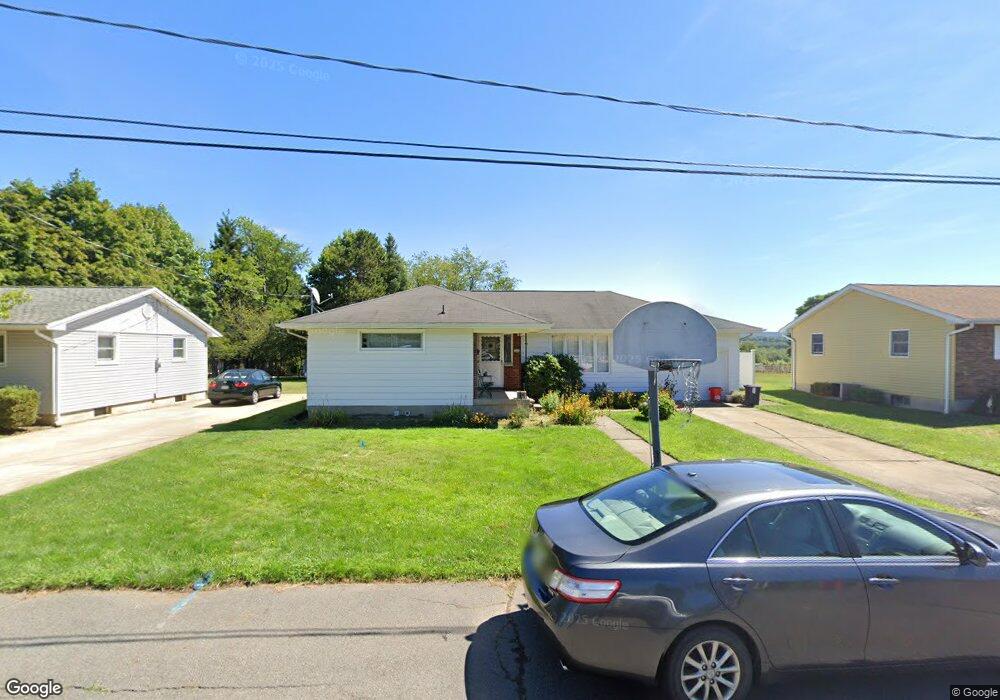
503 Powell St Taylor, PA 18517
Estimated Value: $83,305 - $283,000
--
Bed
--
Bath
--
Sq Ft
0.25
Acres
About This Home
This home is located at 503 Powell St, Taylor, PA 18517 and is currently estimated at $226,576. 503 Powell St is a home located in Lackawanna County with nearby schools including Willard Middle School, Riverside Junior/Senior High School, and Triboro Christian Academy.
Ownership History
Date
Name
Owned For
Owner Type
Purchase Details
Closed on
Jun 27, 2012
Sold by
Warrick Dorothy and Warrick Robert
Bought by
Hartland Rosanne M and Wilson William F
Current Estimated Value
Home Financials for this Owner
Home Financials are based on the most recent Mortgage that was taken out on this home.
Original Mortgage
$113,500
Outstanding Balance
$78,754
Interest Rate
3.78%
Mortgage Type
New Conventional
Estimated Equity
$147,822
Purchase Details
Closed on
Feb 18, 2012
Sold by
Warrick Dorothy and Kozloski John V
Bought by
Warrick Dorothy and Warrick Robert
Create a Home Valuation Report for This Property
The Home Valuation Report is an in-depth analysis detailing your home's value as well as a comparison with similar homes in the area
Home Values in the Area
Average Home Value in this Area
Purchase History
| Date | Buyer | Sale Price | Title Company |
|---|---|---|---|
| Hartland Rosanne M | $135,000 | None Available | |
| Warrick Dorothy | -- | None Available |
Source: Public Records
Mortgage History
| Date | Status | Borrower | Loan Amount |
|---|---|---|---|
| Open | Hartland Rosanne M | $113,500 |
Source: Public Records
Tax History Compared to Growth
Tax History
| Year | Tax Paid | Tax Assessment Tax Assessment Total Assessment is a certain percentage of the fair market value that is determined by local assessors to be the total taxable value of land and additions on the property. | Land | Improvement |
|---|---|---|---|---|
| 2025 | $4,097 | $17,000 | $0 | $17,000 |
| 2024 | $3,654 | $17,000 | $0 | $17,000 |
| 2023 | $3,654 | $17,000 | $0 | $17,000 |
| 2022 | $3,654 | $17,000 | $0 | $17,000 |
| 2021 | $3,654 | $17,000 | $0 | $17,000 |
| 2020 | $3,582 | $17,000 | $0 | $17,000 |
| 2019 | $3,413 | $17,000 | $0 | $17,000 |
| 2018 | $3,353 | $17,000 | $0 | $17,000 |
| 2017 | $3,256 | $17,000 | $0 | $17,000 |
| 2016 | $1,782 | $17,000 | $0 | $0 |
| 2015 | -- | $17,000 | $0 | $0 |
| 2014 | -- | $17,000 | $0 | $0 |
Source: Public Records
Map
Nearby Homes
- 0 Union St Unit GSBSC251501
- 701-703 Union St
- Lot 02 Sibley Ave
- Parcel B Davis Ct
- 112 E Taylor St
- 115 W High St
- 136 E Grove St
- 0 Cooper St Unit GSBSC255606
- Lot 02 Casey Ave
- 133 Corcoran St
- 170 2nd St
- 307 Charles St
- 710 Maple St
- 0 Oak St Unit GSBSC255768
- 736 Oak St
- 800 W Oak St
- 717 Beech St
- 232 Oak St
- 612 Oak St
- 103 Davis St
- 501 Powell St
- 507 Powell St
- 803 W Atherton St
- 801 W Atherton St
- 508 Powell St
- 504 Powell St
- 500 Jefferson St Unit BLK
- 500 Jefferson St
- 502 Jefferson St
- 512 Powell St
- 502 Powell St
- 509 Powell St
- 516 Powell St
- 500 Powell St
- 520 Powell St
- 802 W Atherton St
- 804 W Atherton St
- 425 Powell St
- 426 Powell St
- 0 W Atherton St Unit GSB043652