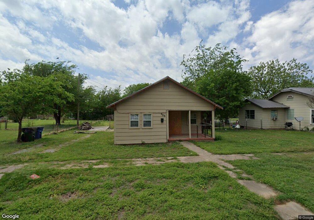
503 S 12th St Duncan, OK 73533
Estimated Value: $50,000 - $67,000
2
Beds
1
Bath
780
Sq Ft
$75/Sq Ft
Est. Value
About This Home
This home is located at 503 S 12th St, Duncan, OK 73533 and is currently estimated at $58,172, approximately $74 per square foot. 503 S 12th St is a home located in Stephens County with nearby schools including Emerson Elementary School, Duncan Middle School, and Duncan High School.
Ownership History
Date
Name
Owned For
Owner Type
Purchase Details
Closed on
Sep 2, 2010
Sold by
Stapp Billy G and Stapp Donna R
Bought by
Sanchez Pedro and Sanchez Estella
Current Estimated Value
Purchase Details
Closed on
Jun 10, 2004
Sold by
Jefferies Chris and Jefferies Etty
Purchase Details
Closed on
Mar 16, 2004
Sold by
Sheriff'S Deed
Purchase Details
Closed on
Oct 8, 1999
Sold by
Jeffries Chris L and Jeffries Betty
Purchase Details
Closed on
Jul 4, 1995
Sold by
Renfro Paul A and Renfro Sheila
Purchase Details
Closed on
Mar 29, 1994
Sold by
Blankenship David
Purchase Details
Closed on
Oct 13, 1992
Sold by
First Bank & Trust
Create a Home Valuation Report for This Property
The Home Valuation Report is an in-depth analysis detailing your home's value as well as a comparison with similar homes in the area
Home Values in the Area
Average Home Value in this Area
Purchase History
| Date | Buyer | Sale Price | Title Company |
|---|---|---|---|
| Sanchez Pedro | $21,500 | None Available | |
| -- | -- | -- | |
| -- | -- | -- | |
| -- | $25,000 | -- | |
| -- | -- | -- | |
| -- | $5,500 | -- | |
| -- | $7,000 | -- |
Source: Public Records
Tax History Compared to Growth
Tax History
| Year | Tax Paid | Tax Assessment Tax Assessment Total Assessment is a certain percentage of the fair market value that is determined by local assessors to be the total taxable value of land and additions on the property. | Land | Improvement |
|---|---|---|---|---|
| 2025 | $170 | $2,018 | $481 | $1,537 |
| 2024 | $173 | $2,030 | $481 | $1,549 |
| 2023 | $173 | $1,934 | $481 | $1,453 |
| 2022 | $180 | $2,223 | $481 | $1,742 |
| 2021 | $180 | $2,117 | $481 | $1,636 |
| 2020 | $166 | $1,921 | $481 | $1,440 |
| 2019 | $169 | $1,950 | $481 | $1,469 |
| 2018 | $173 | $1,945 | $481 | $1,464 |
| 2017 | $93 | $2,079 | $481 | $1,598 |
| 2016 | $120 | $2,410 | $477 | $1,933 |
| 2015 | $118 | $2,340 | $458 | $1,882 |
| 2014 | $118 | $2,272 | $440 | $1,832 |
Source: Public Records
Map
Nearby Homes
- 507 S 13th St
- 711 711 S 12th
- 1309 W Pecan Ave
- 1109 W Stephens Ave
- 273787 E 1720 Rd
- 1240 S 9th St
- 0 W Stephens Ave
- 451 S 11th St
- 1009 W Duncan Ave
- 1007 S 8th St
- 708 W Pecan Ave
- 0 W Mulberry Ave
- 713 713 W Elm Ave
- 1114 1114 S 10th St
- 27 N 14th St
- 1203 W Walnut Ave
- 123 N Highway 81
- 2 5th St Unit Dr
- 174831 N 2844 Rd
- 1105 W Beech Ave
- 501 S 12th St
- 507 S 12th St
- 1212 W Mulberry Ave
- 1214 W Mulberry Ave
- 513 S 12th St
- 506 S 12th St
- 417 S 12th St
- 1209 W Mulberry Ave
- 1205 W Sycamore Ave
- 512 S 12th St
- 504 S 13th St
- 506 S 13th St
- 1112 W Mulberry Ave
- 1207 W Sycamore Ave
- 1203 W Sycamore Ave
- 1211 W Mulberry Ave
- 1209 W Sycamore Ave
- 1201 W Sycamore Ave
- 508 S 13th St
- 1213 W Mulberry Ave