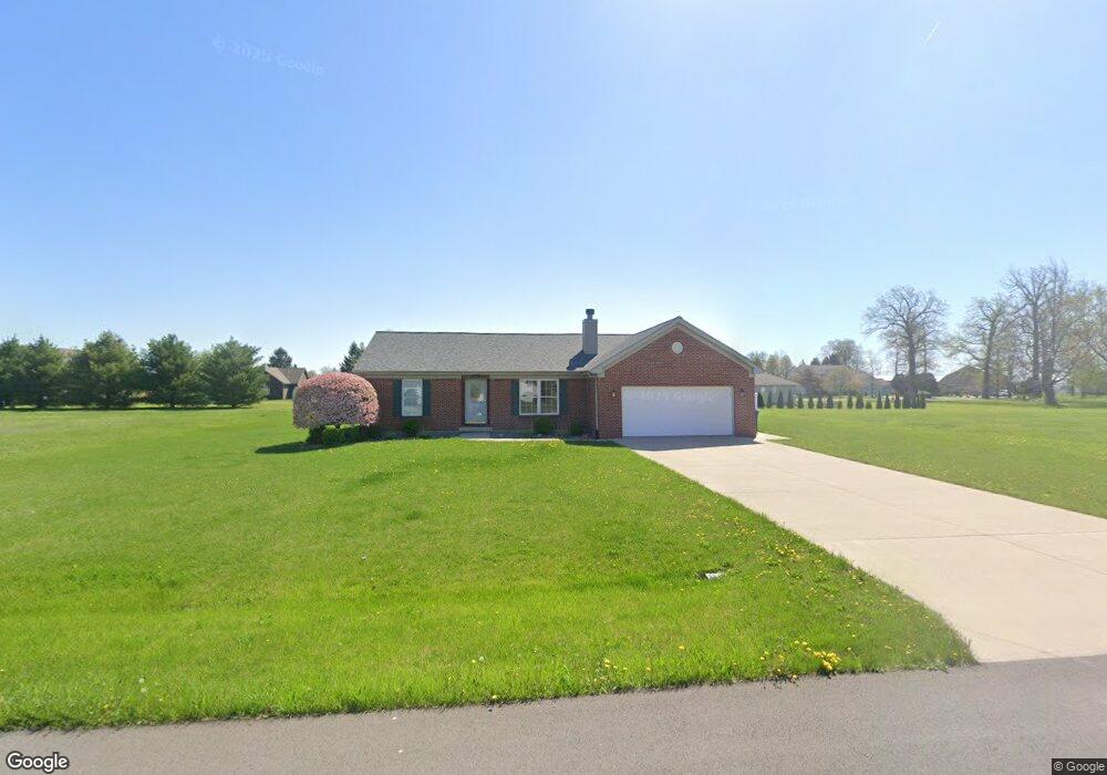
503 S Maple St Sweetser, IN 46987
Estimated Value: $250,000 - $277,000
3
Beds
2
Baths
1,537
Sq Ft
$170/Sq Ft
Est. Value
About This Home
This home is located at 503 S Maple St, Sweetser, IN 46987 and is currently estimated at $261,873, approximately $170 per square foot. 503 S Maple St is a home with nearby schools including Converse Elementary School, Sweetser Elementary School, and Oak Hill Junior High School.
Ownership History
Date
Name
Owned For
Owner Type
Purchase Details
Closed on
Nov 19, 2024
Sold by
Cain Nicholas B
Bought by
Taylor Lindsey M
Current Estimated Value
Home Financials for this Owner
Home Financials are based on the most recent Mortgage that was taken out on this home.
Original Mortgage
$197,600
Outstanding Balance
$186,541
Interest Rate
5.41%
Mortgage Type
New Conventional
Estimated Equity
$75,332
Create a Home Valuation Report for This Property
The Home Valuation Report is an in-depth analysis detailing your home's value as well as a comparison with similar homes in the area
Purchase History
| Date | Buyer | Sale Price | Title Company |
|---|---|---|---|
| Taylor Lindsey M | -- | None Listed On Document | |
| Taylor Lindsey M | $247,000 | None Listed On Document |
Source: Public Records
Mortgage History
| Date | Status | Borrower | Loan Amount |
|---|---|---|---|
| Open | Taylor Lindsey M | $197,600 | |
| Closed | Taylor Lindsey M | $197,600 |
Source: Public Records
Tax History
| Year | Tax Paid | Tax Assessment Tax Assessment Total Assessment is a certain percentage of the fair market value that is determined by local assessors to be the total taxable value of land and additions on the property. | Land | Improvement |
|---|---|---|---|---|
| 2025 | $1,269 | $196,900 | $26,500 | $170,400 |
| 2024 | $1,269 | $165,900 | $26,500 | $139,400 |
| 2023 | $1,164 | $157,800 | $26,500 | $131,300 |
| 2022 | $1,422 | $151,400 | $21,900 | $129,500 |
| 2021 | $1,220 | $136,700 | $21,900 | $114,800 |
| 2020 | $1,073 | $130,700 | $20,700 | $110,000 |
| 2019 | $1,046 | $132,000 | $20,700 | $111,300 |
| 2018 | $900 | $124,500 | $17,200 | $107,300 |
| 2017 | $751 | $119,600 | $17,200 | $102,400 |
| 2016 | $736 | $120,700 | $17,200 | $103,500 |
| 2014 | $746 | $126,600 | $17,200 | $109,400 |
| 2013 | $746 | $123,200 | $17,200 | $106,000 |
Source: Public Records
Map
Nearby Homes
- 203 Eagle Dr
- 119 W Greenburg St
- 502 Allen Dr
- 514 Allen Dr
- 509 Nancy Dr
- 5292 W Delphi Pike
- 716 Allen Dr
- 715 Laura Ln
- 5317 Bechtel Ct
- 1252 S 600 W
- 506 N Miller Ave
- 500 N Hendricks Ave
- 314 N Hendricks Ave
- 2111 W Euclid Ave
- 2005 W Therlow Dr
- 303 S Lenfesty Ave
- 2107 W 8th St
- 2008 W Wilno Dr
- 1807 W Wenlock Dr
- 0 W Kem Rd Unit 202548894
Your Personal Tour Guide
Ask me questions while you tour the home.