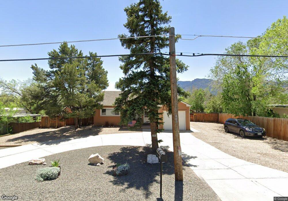
503 W Brookside St Colorado Springs, CO 80905
Ivywild NeighborhoodEstimated Value: $382,000 - $423,000
2
Beds
2
Baths
1,084
Sq Ft
$372/Sq Ft
Est. Value
About This Home
This home is located at 503 W Brookside St, Colorado Springs, CO 80905 and is currently estimated at $403,181, approximately $371 per square foot. 503 W Brookside St is a home located in El Paso County with nearby schools including Adams Elementary School, North Middle School, and William J. Palmer High School.
Ownership History
Date
Name
Owned For
Owner Type
Purchase Details
Closed on
Jun 28, 2021
Sold by
Mcmullen James L
Bought by
Abke Brenda S
Current Estimated Value
Purchase Details
Closed on
Apr 13, 2012
Sold by
Mcmullen James L and Mcmullen Peggy N
Bought by
Mcmullen James L
Purchase Details
Closed on
Apr 29, 2005
Sold by
Carver Gail L and Beaver Gail L
Bought by
Mcmullen James L and Mcmullen Peggy N
Home Financials for this Owner
Home Financials are based on the most recent Mortgage that was taken out on this home.
Original Mortgage
$144,000
Interest Rate
5.93%
Mortgage Type
Fannie Mae Freddie Mac
Purchase Details
Closed on
Apr 27, 1992
Bought by
Mcmullen James L
Purchase Details
Closed on
Jul 1, 1984
Bought by
Mcmullen James L
Create a Home Valuation Report for This Property
The Home Valuation Report is an in-depth analysis detailing your home's value as well as a comparison with similar homes in the area
Home Values in the Area
Average Home Value in this Area
Purchase History
| Date | Buyer | Sale Price | Title Company |
|---|---|---|---|
| Abke Brenda S | $420,000 | Unified Title Co | |
| Mcmullen James L | -- | None Available | |
| Mcmullen James L | $180,000 | Unified Title Company | |
| Mcmullen James L | $59,000 | -- | |
| Mcmullen James L | -- | -- |
Source: Public Records
Mortgage History
| Date | Status | Borrower | Loan Amount |
|---|---|---|---|
| Previous Owner | Mcmullen James L | $144,000 |
Source: Public Records
Tax History Compared to Growth
Tax History
| Year | Tax Paid | Tax Assessment Tax Assessment Total Assessment is a certain percentage of the fair market value that is determined by local assessors to be the total taxable value of land and additions on the property. | Land | Improvement |
|---|---|---|---|---|
| 2025 | $1,332 | $29,470 | -- | -- |
| 2024 | $1,332 | $28,370 | $4,620 | $23,750 |
| 2022 | $1,144 | $20,440 | $3,820 | $16,620 |
| 2021 | $1,241 | $21,030 | $3,930 | $17,100 |
| 2020 | $1,164 | $17,150 | $3,290 | $13,860 |
| 2019 | $1,158 | $17,150 | $3,290 | $13,860 |
| 2018 | $1,082 | $14,740 | $2,740 | $12,000 |
| 2017 | $1,024 | $14,740 | $2,740 | $12,000 |
| 2016 | $804 | $13,870 | $2,790 | $11,080 |
| 2015 | $801 | $13,870 | $2,790 | $11,080 |
| 2014 | $788 | $13,090 | $2,630 | $10,460 |
Source: Public Records
Map
Nearby Homes
- 326 W Ramona Ave
- 1611 Lorraine St
- 229-231 Crestone Ave
- 219 W Ramona Ave
- 308 Laclede Ave
- 313 Laclede Ave
- 403 Laclede Ave
- 312 Cheyenne Blvd
- 416 Cheyenne Blvd
- 1824 Lorraine St
- 1510 S Cascade Ave
- 777 Saturn Dr Unit 200
- 777 Saturn Dr Unit 312
- 777 Saturn Dr Unit 409
- 777 Saturn Dr Unit 301
- 924 Tabor Place
- 900 Saturn Dr Unit 302
- 900 Saturn Dr Unit 706
- 900 Saturn Dr Unit 805
- 900 Saturn Dr Unit 110
- 505 W Brookside St
- 1402 Lorraine St
- 516 Yucca Dr
- 500 W Brookside St
- 518 Yucca Dr
- 502 Yucca Dr
- 515 W Brookside St
- 502 W Brookside St
- 520 Yucca Dr
- 503 Hilltop Dr
- 400 W Brookside St
- 323 W Brookside St
- 519 W Brookside St
- 515 Yucca Dr
- 524 Yucca Dr
- 1431 Lorraine St
- 1502 Lorraine St
- 517 Yucca Dr
- 504 Hilltop Dr
- 501 Foothills Rd