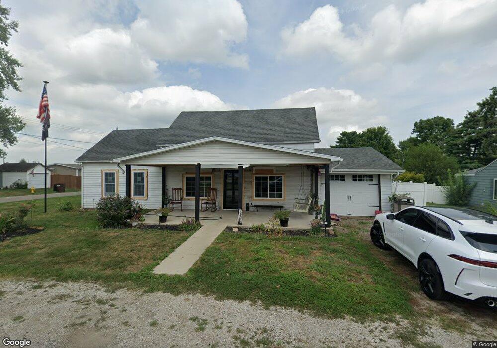
5030 E Main St South Bloomfield, OH 43103
Estimated Value: $186,000 - $242,000
2
Beds
1
Bath
1,228
Sq Ft
$173/Sq Ft
Est. Value
About This Home
This home is located at 5030 E Main St, South Bloomfield, OH 43103 and is currently estimated at $212,172, approximately $172 per square foot. 5030 E Main St is a home located in Pickaway County.
Ownership History
Date
Name
Owned For
Owner Type
Purchase Details
Closed on
May 29, 2022
Sold by
Webster Virginia R
Bought by
Phelps Kayla Ann Brady
Current Estimated Value
Purchase Details
Closed on
Nov 10, 2005
Sold by
Lawrence Marvin B and Lawrence Linda D
Bought by
Webster Virginia R
Home Financials for this Owner
Home Financials are based on the most recent Mortgage that was taken out on this home.
Original Mortgage
$60,000
Interest Rate
6.75%
Mortgage Type
Purchase Money Mortgage
Purchase Details
Closed on
Dec 1, 1985
Create a Home Valuation Report for This Property
The Home Valuation Report is an in-depth analysis detailing your home's value as well as a comparison with similar homes in the area
Home Values in the Area
Average Home Value in this Area
Purchase History
| Date | Buyer | Sale Price | Title Company |
|---|---|---|---|
| Phelps Kayla Ann Brady | -- | Sherman Kendra S | |
| Webster Virginia R | $50,000 | Chicago Title | |
| -- | $23,500 | -- |
Source: Public Records
Mortgage History
| Date | Status | Borrower | Loan Amount |
|---|---|---|---|
| Previous Owner | Webster Virginia R | $60,000 |
Source: Public Records
Tax History Compared to Growth
Tax History
| Year | Tax Paid | Tax Assessment Tax Assessment Total Assessment is a certain percentage of the fair market value that is determined by local assessors to be the total taxable value of land and additions on the property. | Land | Improvement |
|---|---|---|---|---|
| 2024 | -- | $41,550 | $9,540 | $32,010 |
| 2023 | $1,594 | $41,550 | $9,540 | $32,010 |
| 2022 | $1,296 | $31,130 | $7,950 | $23,180 |
| 2021 | $1,227 | $31,130 | $7,950 | $23,180 |
| 2020 | $1,231 | $31,130 | $7,950 | $23,180 |
| 2019 | $532 | $26,240 | $7,950 | $18,290 |
| 2018 | $1,083 | $26,240 | $7,950 | $18,290 |
| 2017 | $1,140 | $26,240 | $7,950 | $18,290 |
| 2016 | $1,056 | $24,210 | $7,850 | $16,360 |
| 2015 | $528 | $24,210 | $7,850 | $16,360 |
| 2014 | $658 | $24,210 | $7,850 | $16,360 |
| 2013 | $1,094 | $24,210 | $7,850 | $16,360 |
Source: Public Records
Map
Nearby Homes
- 0 U S 23
- 5050 S Walnut St
- 5049 Lee Rd
- 5069 Ashville Rd
- The Daffodil Plan at Riverbend at Scioto Landing
- The Daisy Plan at Riverbend at Scioto Landing
- The Avalon Plan at Riverbend at Scioto Landing
- The Aster Plan at Riverbend at Scioto Landing
- 51 Henderson Ln
- 14337 Us Highway 23
- 14337 Us Highway 23
- 127 Boutot St
- Longwood Plan at Walker Pointe
- Birmingham Plan at Walker Pointe
- Sanibel Plan at Walker Pointe
- Carlisle Plan at Walker Pointe
- Somerset Plan at Walker Pointe
- Chattanooga Plan at Walker Pointe
- Rockford Plan at Walker Pointe
- Hoover Plan at Walker Pointe
- 0 Concord St
- 5040 E Main St
- 5020 E Main St
- 5019 E Main St
- 5012 N Concord St
- 5050 E Main St
- 5029 E Main St
- 5016 E Main St
- 5017 E Main St
- 5010 S Concord St
- 5015 N Concord St
- 5033 E Main St
- 5011 E Main St
- 5057 E North St
- 5056 E Main St
- 5059 E North St
- 5016 S Concord St
- 5010 N Walnut St
- 5043 E Main St
- 5025 N Concord St