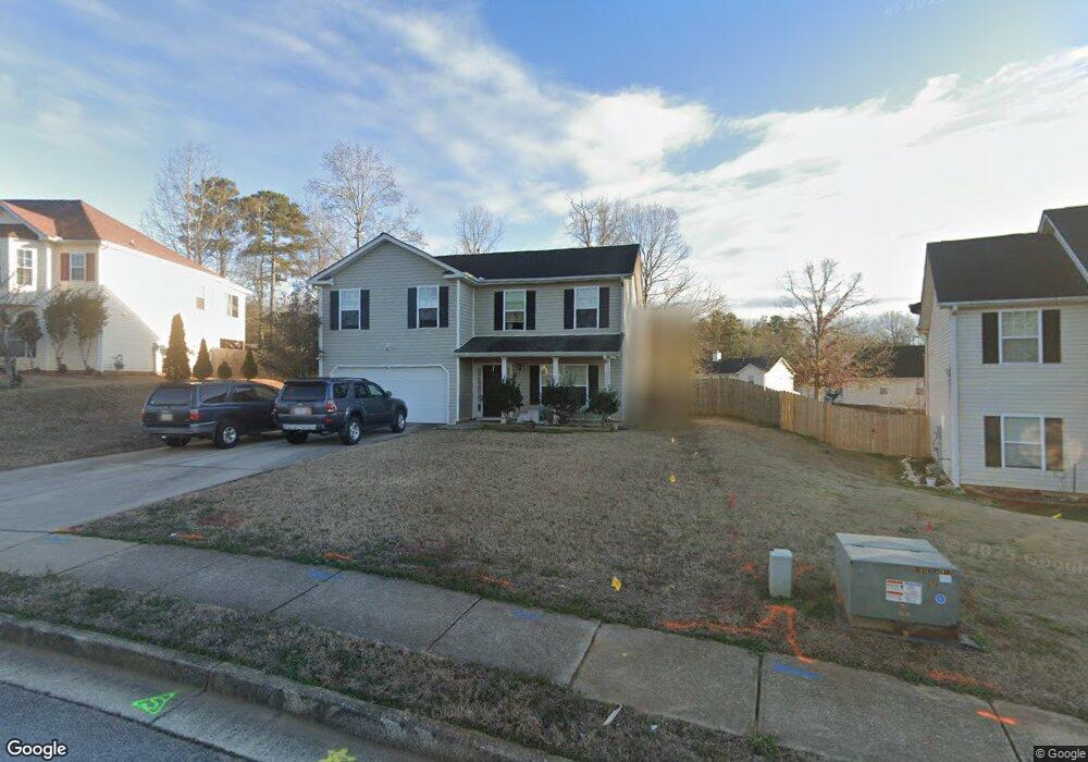
5030 Roxton Ln Unit 2 Douglasville, GA 30135
Bill Arp NeighborhoodEstimated Value: $284,000 - $361,000
3
Beds
3
Baths
1,634
Sq Ft
$189/Sq Ft
Est. Value
About This Home
This home is located at 5030 Roxton Ln Unit 2, Douglasville, GA 30135 and is currently estimated at $308,609, approximately $188 per square foot. 5030 Roxton Ln Unit 2 is a home located in Douglas County with nearby schools including Bill Arp Elementary School, Yeager Middle School, and Alexander High School.
Ownership History
Date
Name
Owned For
Owner Type
Purchase Details
Closed on
Jun 26, 2006
Sold by
Burleson Lisa
Bought by
Kraman Sarah
Current Estimated Value
Home Financials for this Owner
Home Financials are based on the most recent Mortgage that was taken out on this home.
Original Mortgage
$29,180
Outstanding Balance
$17,228
Interest Rate
6.55%
Mortgage Type
Stand Alone Refi Refinance Of Original Loan
Estimated Equity
$291,381
Purchase Details
Closed on
May 17, 2004
Sold by
Kirkwood Homes Inc
Bought by
Dearmond Lisa
Home Financials for this Owner
Home Financials are based on the most recent Mortgage that was taken out on this home.
Original Mortgage
$130,311
Interest Rate
5.98%
Mortgage Type
VA
Create a Home Valuation Report for This Property
The Home Valuation Report is an in-depth analysis detailing your home's value as well as a comparison with similar homes in the area
Home Values in the Area
Average Home Value in this Area
Purchase History
| Date | Buyer | Sale Price | Title Company |
|---|---|---|---|
| Kraman Sarah | $145,900 | -- | |
| Dearmond Lisa | $131,400 | -- |
Source: Public Records
Mortgage History
| Date | Status | Borrower | Loan Amount |
|---|---|---|---|
| Open | Kraman Sarah | $29,180 | |
| Previous Owner | Dearmond Lisa | $130,311 |
Source: Public Records
Tax History Compared to Growth
Tax History
| Year | Tax Paid | Tax Assessment Tax Assessment Total Assessment is a certain percentage of the fair market value that is determined by local assessors to be the total taxable value of land and additions on the property. | Land | Improvement |
|---|---|---|---|---|
| 2024 | $2,654 | $108,920 | $28,000 | $80,920 |
| 2023 | $2,654 | $104,280 | $26,880 | $77,400 |
| 2022 | $2,229 | $83,280 | $15,240 | $68,040 |
| 2021 | $1,798 | $61,560 | $13,840 | $47,720 |
| 2020 | $1,831 | $61,560 | $13,840 | $47,720 |
| 2019 | $1,688 | $59,640 | $13,840 | $45,800 |
| 2018 | $1,571 | $53,720 | $12,720 | $41,000 |
| 2017 | $1,461 | $49,360 | $12,880 | $36,480 |
| 2016 | $1,302 | $43,680 | $11,880 | $31,800 |
| 2015 | $992 | $42,400 | $11,880 | $30,520 |
| 2014 | $992 | $32,880 | $9,920 | $22,960 |
| 2013 | -- | $29,080 | $8,800 | $20,280 |
Source: Public Records
Map
Nearby Homes
- 6160 Queensdale Dr
- 6258 N Summers Cir
- 6236 Shallow Creek Ln
- 4776 Harrod Ct
- 6145 Knights Ln
- 6063 Fielder Way
- 6290 Shallowford Way
- 6025 Crowley Dr
- 6126 Knights Ln
- 6005 Crowley Dr
- 5968 Hilltop Dr
- 5225 Kings Hwy
- 4731 Kings Hwy
- 6374 Dorsett Shoals Rd
- 5890 Crowley Dr
- 6266 Dorsett Shoals Rd Unit 139
- 6441 Michell Way
- 6181 Shallow Wood Ln
- 5040 Roxton Ln
- 5020 Roxton Ln
- 5059 Luxford Dr
- 5049 Luxford Dr
- 5049 Luxford Dr
- 5049 Luxford Dr Unit 4
- 5049 Luxford Dr Unit 5049
- 5025 Roxton Ln
- 6145 Queensdale Dr
- 5009 Luxford Dr Unit 4
- 5009 Luxford Dr
- 6135 Queensdale Dr
- 0 Roxton Ln Unit 8387224
- 0 Roxton Ln Unit 8280327
- 0 Roxton Ln Unit 8367776
- 0 Roxton Ln Unit 8061854
- 0 Roxton Ln Unit 8955624
- 0 Roxton Ln Unit 8948157
- 0 Roxton Ln Unit 8781382
- 0 Roxton Ln Unit 8795102