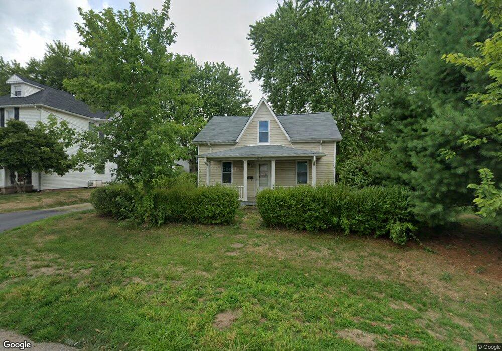
5031 2nd St W South Bloomfield, OH 43103
Estimated Value: $180,000 - $233,000
3
Beds
1
Bath
1,260
Sq Ft
$158/Sq Ft
Est. Value
About This Home
This home is located at 5031 2nd St W, South Bloomfield, OH 43103 and is currently estimated at $199,460, approximately $158 per square foot. 5031 2nd St W is a home located in Pickaway County.
Ownership History
Date
Name
Owned For
Owner Type
Purchase Details
Closed on
Feb 4, 2016
Sold by
Us Bank National Association
Bought by
Caldwell Billy
Current Estimated Value
Purchase Details
Closed on
Jul 13, 2015
Sold by
Gohring Darren R and Case #2014Ci0002
Bought by
Us Bank National Association
Purchase Details
Closed on
Mar 24, 2015
Sold by
Gohring Darren R and Case #2014Ci0002
Bought by
Us Bank National Association
Purchase Details
Closed on
Nov 20, 2006
Sold by
Hilton Charles and Hilton Loretta
Bought by
Gohring Darren R
Home Financials for this Owner
Home Financials are based on the most recent Mortgage that was taken out on this home.
Original Mortgage
$61,600
Interest Rate
7.95%
Mortgage Type
Purchase Money Mortgage
Purchase Details
Closed on
Jan 8, 2001
Sold by
Debus Jacquelyn A
Bought by
Hilton Charles and Hilton Loretta
Create a Home Valuation Report for This Property
The Home Valuation Report is an in-depth analysis detailing your home's value as well as a comparison with similar homes in the area
Home Values in the Area
Average Home Value in this Area
Purchase History
| Date | Buyer | Sale Price | Title Company |
|---|---|---|---|
| Caldwell Billy | $15,500 | Timios Inc | |
| Us Bank National Association | $112,960 | Attorney | |
| Us Bank National Association | $112,960 | None Available | |
| Gohring Darren R | $77,000 | Chicago Title | |
| Hilton Charles | $4,000 | -- |
Source: Public Records
Mortgage History
| Date | Status | Borrower | Loan Amount |
|---|---|---|---|
| Previous Owner | Gohring Darren R | $61,600 | |
| Closed | Hilton Charles | -- |
Source: Public Records
Tax History Compared to Growth
Tax History
| Year | Tax Paid | Tax Assessment Tax Assessment Total Assessment is a certain percentage of the fair market value that is determined by local assessors to be the total taxable value of land and additions on the property. | Land | Improvement |
|---|---|---|---|---|
| 2024 | -- | $43,800 | $9,540 | $34,260 |
| 2023 | $0 | $43,800 | $9,540 | $34,260 |
| 2022 | $1,391 | $32,630 | $7,950 | $24,680 |
| 2021 | $1,320 | $32,630 | $7,950 | $24,680 |
| 2020 | $1,324 | $32,630 | $7,950 | $24,680 |
| 2019 | $571 | $27,410 | $7,950 | $19,460 |
| 2018 | $1,160 | $27,410 | $7,950 | $19,460 |
| 2017 | $1,190 | $27,410 | $7,950 | $19,460 |
| 2016 | $1,101 | $25,240 | $7,850 | $17,390 |
| 2015 | $536 | $25,240 | $7,850 | $17,390 |
| 2014 | $2,369 | $25,240 | $7,850 | $17,390 |
| 2013 | $1,111 | $25,240 | $7,850 | $17,390 |
Source: Public Records
Map
Nearby Homes
- 5050 S Walnut St
- 0 U S 23
- The Daffodil Plan at Riverbend at Scioto Landing
- The Daisy Plan at Riverbend at Scioto Landing
- The Avalon Plan at Riverbend at Scioto Landing
- The Aster Plan at Riverbend at Scioto Landing
- 51 Henderson Ln
- 5069 Ashville Rd
- 127 Boutot St
- 5049 Lee Rd
- 58 Cedar Cove
- Longwood Plan at Walker Pointe
- Birmingham Plan at Walker Pointe
- Sanibel Plan at Walker Pointe
- Carlisle Plan at Walker Pointe
- Somerset Plan at Walker Pointe
- Chattanooga Plan at Walker Pointe
- Rockford Plan at Walker Pointe
- Hoover Plan at Walker Pointe
- Sedona Plan at Walker Pointe
- 5039 2nd St W
- 5027 2nd St W
- 5028 2nd St W
- 5075 Union St
- 5030 2nd St W
- 5073 Union St
- 5023 Union St
- 5011 West St
- 5049 W Main St
- 5015 West St
- 5051 W Main St
- 3001 Union St
- 5016 S Union St S
- 5013 S Union St S
- 5031 W Main St
- 23 Danielson Cir
- 23 Danielson Cir Unit 45
- 5008 2nd St W
- 21 Danielson Cir
- 5019 West St