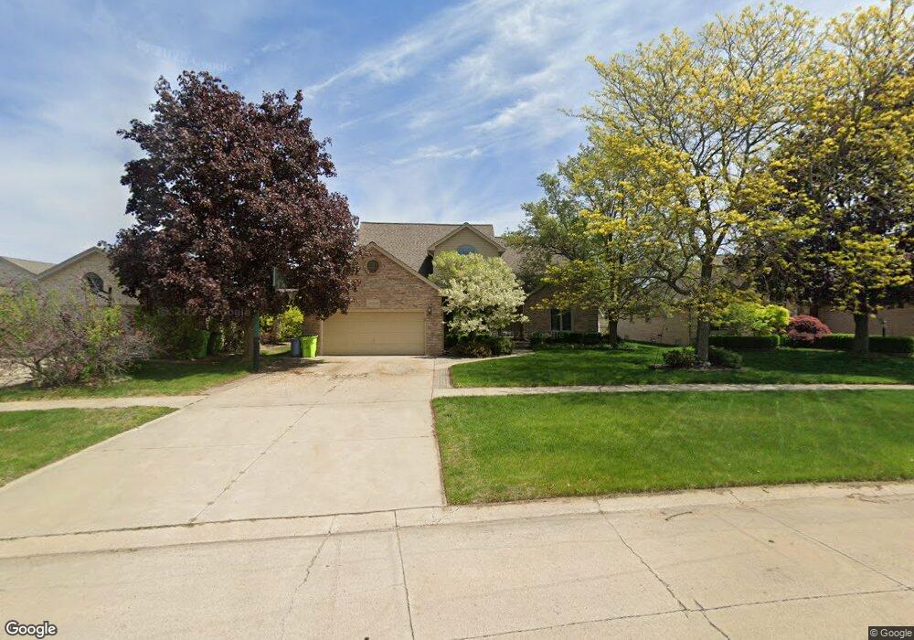
50318 Middle River Dr Macomb, MI 48044
Estimated Value: $452,136 - $488,000
Studio
2
Baths
2,328
Sq Ft
$202/Sq Ft
Est. Value
About This Home
This home is located at 50318 Middle River Dr, Macomb, MI 48044 and is currently estimated at $470,784, approximately $202 per square foot. 50318 Middle River Dr is a home located in Macomb County with nearby schools including Sequoyah Elementary School, Iroquois Middle School, and Dakota High School.
Ownership History
Date
Name
Owned For
Owner Type
Purchase Details
Closed on
Apr 19, 2001
Sold by
Lanning Bruce F
Bought by
Perzanowski Frank R
Current Estimated Value
Home Financials for this Owner
Home Financials are based on the most recent Mortgage that was taken out on this home.
Original Mortgage
$104,000
Interest Rate
7.18%
Mortgage Type
Purchase Money Mortgage
Purchase Details
Closed on
Jun 28, 1996
Sold by
Constructn Elmgrove
Bought by
Lanning B and Lanning A
Create a Home Valuation Report for This Property
The Home Valuation Report is an in-depth analysis detailing your home's value as well as a comparison with similar homes in the area
Home Values in the Area
Average Home Value in this Area
Purchase History
| Date | Buyer | Sale Price | Title Company |
|---|---|---|---|
| Perzanowski Frank R | $261,000 | -- | |
| Lanning B | $204,000 | -- |
Source: Public Records
Mortgage History
| Date | Status | Borrower | Loan Amount |
|---|---|---|---|
| Previous Owner | Perzanowski Frank R | $104,000 |
Source: Public Records
Tax History
| Year | Tax Paid | Tax Assessment Tax Assessment Total Assessment is a certain percentage of the fair market value that is determined by local assessors to be the total taxable value of land and additions on the property. | Land | Improvement |
|---|---|---|---|---|
| 2025 | $3,442 | $202,800 | $0 | $0 |
| 2024 | $33 | $196,300 | $0 | $0 |
| 2023 | $3,174 | $178,900 | $0 | $0 |
| 2022 | $3,943 | $157,500 | $0 | $0 |
| 2021 | $3,837 | $148,400 | $0 | $0 |
| 2020 | $2,912 | $146,100 | $0 | $0 |
| 2019 | $4,475 | $138,600 | $0 | $0 |
| 2018 | $3,458 | $134,000 | $0 | $0 |
| 2017 | $3,403 | $126,240 | $32,500 | $93,740 |
| 2016 | $3,228 | $126,250 | $0 | $0 |
| 2015 | $3,185 | $119,880 | $0 | $0 |
| 2014 | $3,185 | $106,800 | $21,500 | $85,300 |
| 2011 | $578 | $103,940 | $18,500 | $85,440 |
Source: Public Records
Map
Nearby Homes
- 18973 Calypso Dr
- 49683 Yale Dr
- 50912 Alden Dr
- 50600 Koss Dr
- 50533 Crusader Dr
- 50617 Crusader Dr
- 50649 Crusader Dr
- 50585 Crusader Dr
- 50681 Crusader Dr
- 19201 Grisham Dr
- 50632 Crusader Dr
- 50664 Crusader Dr
- 50696 Crusader Dr
- 19852 Keats Ct
- 49954 Willowood Dr
- 50682 Beckett Ct
- 50314 Paradise Ct
- 20473 W Kilburn Dr
- 20409 W Kilburn Dr
- 20352 Banbury Ct
- 50286 Middle River Dr
- 50344 Middle River Dr
- 50325 Hillside Dr
- 50353 Hillside Dr
- 50250 Middle River Dr
- 50297 Hillside Dr
- 50370 Middle River Dr
- 50381 Hillside Dr
- 50269 Hillside Dr
- 19243 Sandpiper Dr
- 50222 Middle River Dr
- 50402 Middle River Dr
- 50409 Hillside Dr
- 50261 Middle River Dr
- 50231 Hillside Dr
- 19226 Calypso Dr
- 50194 Middle River Dr
- 50438 Middle River Dr
- 19221 Sandpiper Dr
- 50237 Middle River Dr