Estimated Value: $292,000 - $410,000
--
Bed
1
Bath
2,363
Sq Ft
$144/Sq Ft
Est. Value
About This Home
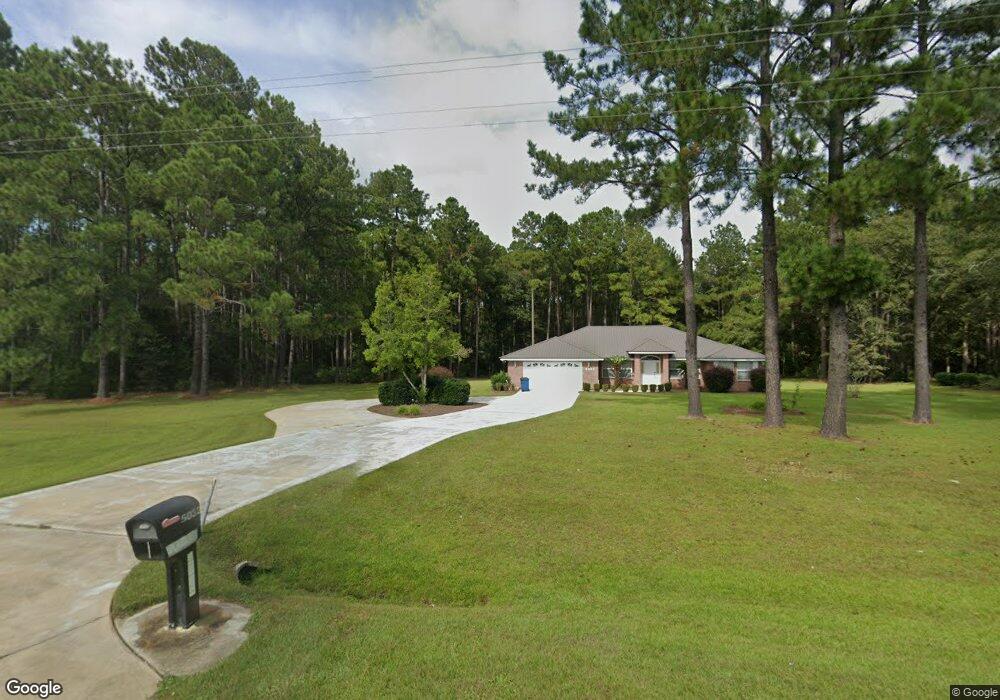
This home is located at 5032 Lanes Bridge Rd, Jesup, GA 31545 and is currently estimated at $339,511, approximately $143 per square foot. 5032 Lanes Bridge Rd is a home located in Wayne County with nearby schools including Bacon Elementary School, Martha Puckett Middle School, and Wayne County High School.
Ownership History
Date
Name
Owned For
Owner Type
Purchase Details
Closed on
Oct 28, 2021
Sold by
Hagains Windell Brian
Bought by
Fielding Seretta L
Current Estimated Value
Purchase Details
Closed on
Jun 27, 2008
Sold by
Yoder Ben
Bought by
Hagains Windell Brian and Hagains Maria P
Purchase Details
Closed on
Feb 12, 2007
Sold by
Odum Karla Morris
Bought by
Yoder Ben and Yoder Clarita
Purchase Details
Closed on
Aug 1, 2004
Purchase Details
Closed on
Mar 1, 1996
Bought by
Schweikart Grace M
Purchase Details
Closed on
Nov 1, 1990
Purchase Details
Closed on
Aug 1, 1980
Create a Home Valuation Report for This Property
The Home Valuation Report is an in-depth analysis detailing your home's value as well as a comparison with similar homes in the area
Home Values in the Area
Average Home Value in this Area
Purchase History
| Date | Buyer | Sale Price | Title Company |
|---|---|---|---|
| Fielding Seretta L | $216,000 | -- | |
| Hagains Windell Brian | $39,000 | -- | |
| Yoder Ben | $32,000 | -- | |
| -- | $22,000 | -- | |
| Schweikart Grace M | -- | -- | |
| -- | -- | -- | |
| -- | -- | -- | |
| -- | -- | -- |
Source: Public Records
Tax History Compared to Growth
Tax History
| Year | Tax Paid | Tax Assessment Tax Assessment Total Assessment is a certain percentage of the fair market value that is determined by local assessors to be the total taxable value of land and additions on the property. | Land | Improvement |
|---|---|---|---|---|
| 2024 | $2,473 | $93,352 | $24,070 | $69,282 |
| 2023 | $2,741 | $93,352 | $24,070 | $69,282 |
| 2022 | $1,579 | $110,838 | $24,460 | $86,378 |
| 2021 | $1,721 | $110,838 | $24,460 | $86,378 |
| 2020 | $1,744 | $108,081 | $21,703 | $86,378 |
| 2019 | $1,848 | $108,081 | $21,703 | $86,378 |
| 2018 | $2,434 | $72,754 | $12,813 | $59,941 |
| 2017 | $1,332 | $58,246 | $12,813 | $45,433 |
| 2016 | $383 | $12,813 | $12,813 | $0 |
| 2014 | -- | $12,813 | $12,813 | $0 |
| 2013 | -- | $12,813 | $12,813 | $0 |
Source: Public Records
Map
Nearby Homes
- 876 Hires Rd
- 6555 Lanes Bridge Rd
- 556 Caleb Cir
- 131 Mill Creek Ln
- 143 Caleb Cir
- Lot 1,2,3 Rayonier Rd
- 1 Palm Island Cir
- 0 Palm Island Cir
- 0 Oglethorpe Rd
- 96 Palm Tree Place
- 75 Woodlawn Dr
- 0 Red Oak Dr Unit 160341
- 0 Red Oak Dr Unit SA331365
- 186 Community Cir
- 98 Saint Simons St
- 95 Mayflower Rd
- 200 W Melody Dr
- 125 Pleasant Way
- 290 Yellow Pine Rd
- 47 Yellow Pine Rd
- 4995 Lanes Bridge Rd
- 4855 Lanes Bridge Rd
- 4911 Lanes Bridge Rd
- 4921 Lanes Bridge Rd
- 586 Caleb Cir
- 546 Caleb Cir
- 524 Caleb Cir
- 568 Caleb Cir
- 737 Ritch Church Rd
- 180 Brannen Bay Rd
- 5301 Lanes Bridge Rd
- 4777 Lanes Bridge Rd
- 365 Peach Rd
- 93 Brannen Bay Rd
- 121 Brannen Bay Rd
- 245 Peach Rd
- 4590 Lanes Bridge Rd
- 594 Hires Rd
- 696 Hires Rd
- 0 Hires Rd Unit 154557