Estimated Value: $320,000 - $372,000
3
Beds
3
Baths
2,151
Sq Ft
$161/Sq Ft
Est. Value
About This Home
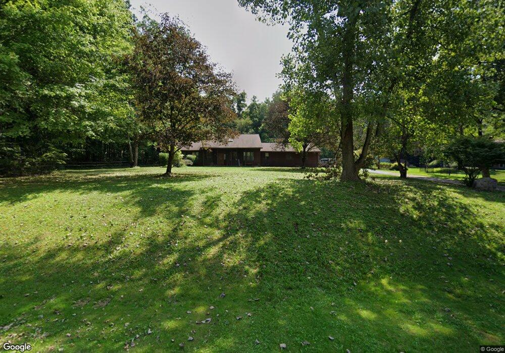
This home is located at 5032 Sherman Wood Dr, Kent, OH 44240 and is currently estimated at $346,565, approximately $161 per square foot. 5032 Sherman Wood Dr is a home located in Portage County with nearby schools including Brimfield Elementary School, Field Middle School, and Field High School.
Ownership History
Date
Name
Owned For
Owner Type
Purchase Details
Closed on
Jun 20, 2024
Sold by
Alldredge John L and Alldredge Jocelyn
Bought by
Alldredge Timothy Scott
Current Estimated Value
Home Financials for this Owner
Home Financials are based on the most recent Mortgage that was taken out on this home.
Original Mortgage
$175,000
Outstanding Balance
$172,797
Interest Rate
7.09%
Mortgage Type
New Conventional
Estimated Equity
$173,768
Purchase Details
Closed on
Jul 16, 2018
Sold by
Estate Of Norma J Alldredge
Bought by
Alldredge John L
Purchase Details
Closed on
Mar 1, 2018
Sold by
Alldredge Jack L
Bought by
Alldredge Norma J and Alldredge Norma
Purchase Details
Closed on
Jun 9, 1987
Bought by
Alldredge Jack L and Alldredge Norma
Create a Home Valuation Report for This Property
The Home Valuation Report is an in-depth analysis detailing your home's value as well as a comparison with similar homes in the area
Home Values in the Area
Average Home Value in this Area
Purchase History
| Date | Buyer | Sale Price | Title Company |
|---|---|---|---|
| Alldredge Timothy Scott | $220,000 | None Listed On Document | |
| Alldredge John L | -- | Accommodation | |
| Alldredge Norma J | -- | -- | |
| Alldredge Jack L | $15,000 | -- |
Source: Public Records
Mortgage History
| Date | Status | Borrower | Loan Amount |
|---|---|---|---|
| Open | Alldredge Timothy Scott | $175,000 |
Source: Public Records
Tax History Compared to Growth
Tax History
| Year | Tax Paid | Tax Assessment Tax Assessment Total Assessment is a certain percentage of the fair market value that is determined by local assessors to be the total taxable value of land and additions on the property. | Land | Improvement |
|---|---|---|---|---|
| 2024 | $5,261 | $109,380 | $18,200 | $91,180 |
| 2023 | $5,268 | $88,240 | $11,380 | $76,860 |
| 2022 | $5,283 | $88,240 | $11,380 | $76,860 |
| 2021 | $5,166 | $88,240 | $11,380 | $76,860 |
| 2020 | $4,473 | $68,750 | $11,380 | $57,370 |
| 2019 | $4,411 | $68,750 | $11,380 | $57,370 |
| 2018 | $2,839 | $61,820 | $11,380 | $50,440 |
| 2017 | $2,839 | $61,820 | $11,380 | $50,440 |
| 2016 | $2,832 | $61,820 | $11,380 | $50,440 |
| 2015 | $2,740 | $61,820 | $11,380 | $50,440 |
| 2014 | $2,644 | $61,820 | $11,380 | $50,440 |
| 2013 | $2,583 | $61,820 | $11,380 | $50,440 |
Source: Public Records
Map
Nearby Homes
- 4837 King Meadow Trail
- 1755 Honeychuck Ln
- 4891 Edson Rd
- Poplar Plan at Woodland Reserve
- Nassau Cove Plan at Woodland Reserve
- 0 Meloy Rd Unit 5162435
- V/L Sherman Rd
- 4682 State Route 43
- 1354 Brimfield Dr
- 1024E Cedar Ridge Dr
- 1024A Cedar Ridge Dr
- 5123 Troyer Dr
- 1224 Cedar Ridge Rd
- 1236 Cedar Ridge Rd
- 2092 Sugar Maple Dr
- 2105 Sugar Maple Dr
- 1523 Whitehall Blvd
- 720 Ivan Dr
- 1587 Chadwick Rd
- 1426 Loop Rd Unit 1426
- 5016 Sherman Wood Dr
- 5044 Sherman Wood Dr
- 5031 Sherman Wood Dr
- 5000 Sherman Wood Dr
- 5061 Sherman Wood Dr
- 4919 Chestnut Dr
- 5064 Sherman Wood Dr
- 4934 Chestnut Dr
- 4901 Chestnut Dr
- 5076 Sherman Wood Dr
- 4910 Chestnut Dr
- 4984 Sherman Wood Dr
- 5091 Sherman Wood Dr
- 4999 Sherman Wood Dr
- 4958 Sherman Wood Dr
- 5096 Sherman Wood Dr
- 4897 Chestnut Dr
- 5103 Sherman Wood Dr
- 4896 Chestnut Dr
- 4900 Chestnut Dr